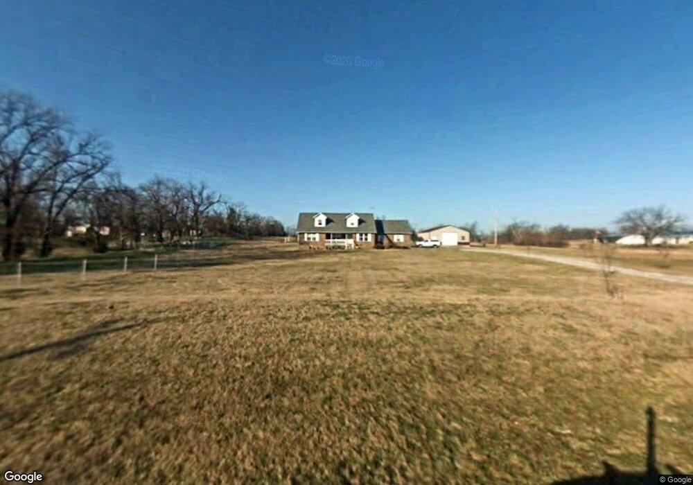
11251 Cripps Rd Gentry, AR 72734
Estimated Value: $508,960 - $842,000
3
Beds
3
Baths
2,320
Sq Ft
$271/Sq Ft
Est. Value
About This Home
This home is located at 11251 Cripps Rd, Gentry, AR 72734 and is currently estimated at $629,740, approximately $271 per square foot. 11251 Cripps Rd is a home located in Benton County with nearby schools including Gentry Intermediate School, Gentry Primary School, and Gentry Middle School.
Ownership History
Date
Name
Owned For
Owner Type
Purchase Details
Closed on
Apr 28, 2006
Sold by
Largent Harlan V and Largent Helen J
Bought by
Stevens Darrell C and Stevens Pam J
Current Estimated Value
Home Financials for this Owner
Home Financials are based on the most recent Mortgage that was taken out on this home.
Original Mortgage
$203,250
Outstanding Balance
$116,154
Interest Rate
6.36%
Mortgage Type
Purchase Money Mortgage
Estimated Equity
$513,586
Purchase Details
Closed on
Feb 19, 2003
Bought by
Largent
Purchase Details
Closed on
Aug 1, 2001
Bought by
Wofford 5Ac
Purchase Details
Closed on
Nov 9, 1998
Bought by
Kaufmann 5Ac
Create a Home Valuation Report for This Property
The Home Valuation Report is an in-depth analysis detailing your home's value as well as a comparison with similar homes in the area
Purchase History
| Date | Buyer | Sale Price | Title Company |
|---|---|---|---|
| Stevens Darrell C | $322,000 | Waco Title Company | |
| Largent | $175,000 | -- | |
| Wofford 5Ac | $136,000 | -- | |
| Kaufmann 5Ac | $22,000 | -- |
Source: Public Records
Mortgage History
| Date | Status | Borrower | Loan Amount |
|---|---|---|---|
| Open | Stevens Darrell C | $203,250 |
Source: Public Records
Tax History
| Year | Tax Paid | Tax Assessment Tax Assessment Total Assessment is a certain percentage of the fair market value that is determined by local assessors to be the total taxable value of land and additions on the property. | Land | Improvement |
|---|---|---|---|---|
| 2025 | $2,046 | $100,685 | $23,000 | $77,685 |
| 2024 | $1,999 | $100,685 | $23,000 | $77,685 |
| 2023 | $1,999 | $60,300 | $11,700 | $48,600 |
| 2022 | $1,751 | $60,300 | $11,700 | $48,600 |
| 2021 | $1,746 | $60,300 | $11,700 | $48,600 |
| 2020 | $1,747 | $46,180 | $7,000 | $39,180 |
| 2019 | $1,649 | $44,320 | $7,000 | $37,320 |
| 2018 | $1,674 | $44,320 | $7,000 | $37,320 |
| 2017 | $1,674 | $44,320 | $7,000 | $37,320 |
| 2016 | $1,674 | $44,320 | $7,000 | $37,320 |
| 2015 | $1,814 | $36,280 | $6,000 | $30,280 |
| 2014 | $1,464 | $36,280 | $6,000 | $30,280 |
Source: Public Records
Map
Nearby Homes
- 11419 Cripps Rd
- 0000 Cripps Rd
- TBD Swepco Lake Rd
- 12007 Swepco Lake Rd
- 0 W Hwy 12 Unit 1333344
- 22844 Floyd Moore Rd
- 0 Swepco Lake Rd Unit 1327398
- 0 Swepco Lake Rd Unit 1327399
- 0 Swepco Lake Rd Unit 1327400
- TBD N Bloomfield Rd
- 22772 Worthington Rd
- 21609 Gann Rd
- 22.56 Acres Floyd Moore Rd
- TBD west Floyd Moore Rd
- . Floyd Moore Rd
- 23963 Floyd Moore Rd
- 21854 Floyd Moore Rd
- 0 Ruby Hall Rd Unit 25-289
- 0 Ruby Hall Rd Unit 1336365
- 11013 Wpa Rd
- 22841 W Highway 12
- 11343 Cripps Rd
- 22856 W Highway 12
- 22929 W Highway 12
- 22931 W Highway 12
- 22782 W Highway 12
- 22726 W Highway 12
- 22979 W Highway 12
- 22979 Arkansas 12
- 22692 W Highway 12
- 22970 W Highway 12
- TBD Highway 12
- 22946 W Highway 12
- 23037 W Highway 12
- 0 Hwy 12 Unit 361187
- 0 Hwy 12 Unit 409304
- 0 Hwy 12 Unit 419499
- 0 Hwy 12 Unit 419549
- 0 Hwy 12 Unit 406312
- 0 Hwy 12 Unit 406313
Your Personal Tour Guide
Ask me questions while you tour the home.