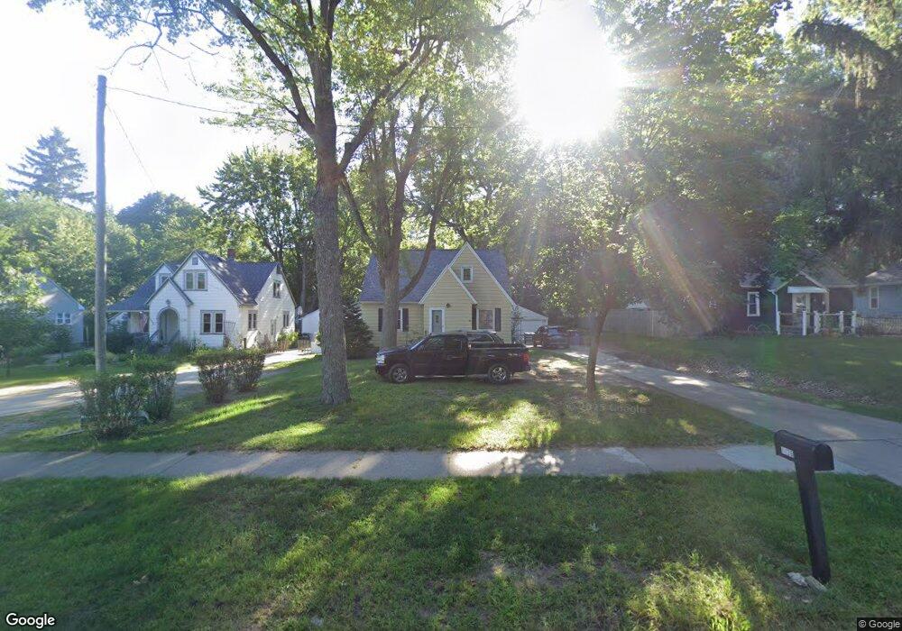
1126 Ball Ave NE Grand Rapids, MI 49505
North East Citizens Action NeighborhoodEstimated Value: $245,000 - $310,000
--
Bed
--
Bath
1,105
Sq Ft
$250/Sq Ft
Est. Value
About This Home
This home is located at 1126 Ball Ave NE, Grand Rapids, MI 49505 and is currently estimated at $276,279, approximately $250 per square foot. 1126 Ball Ave NE is a home located in Kent County with nearby schools including Kent Hills School, Riverside Middle School, and Union High School.
Ownership History
Date
Name
Owned For
Owner Type
Purchase Details
Closed on
Sep 13, 2002
Sold by
Wickerham Floyd and Wickerham Susan A
Bought by
Wood William H and Wood Amy E
Current Estimated Value
Home Financials for this Owner
Home Financials are based on the most recent Mortgage that was taken out on this home.
Original Mortgage
$113,200
Outstanding Balance
$47,564
Interest Rate
6.32%
Mortgage Type
FHA
Estimated Equity
$228,716
Purchase Details
Closed on
Apr 17, 2000
Sold by
Kmpr Ts and Kmpr Wckerham F
Bought by
Wckerham Wckerham F and Wckerham S
Purchase Details
Closed on
Mar 14, 1998
Sold by
Kmpr Mcnty
Bought by
Wood William H Iii Amy E
Purchase Details
Closed on
Jan 4, 1990
Sold by
Kamper Kamper T T and Kamper T
Bought by
Wood William H Iii Amy E
Create a Home Valuation Report for This Property
The Home Valuation Report is an in-depth analysis detailing your home's value as well as a comparison with similar homes in the area
Home Values in the Area
Average Home Value in this Area
Purchase History
| Date | Buyer | Sale Price | Title Company |
|---|---|---|---|
| Wood William H | $115,000 | -- | |
| Wckerham Wckerham F | $85,000 | -- | |
| Wood William H Iii Amy E | -- | -- | |
| Wood William H Iii Amy E | -- | -- |
Source: Public Records
Mortgage History
| Date | Status | Borrower | Loan Amount |
|---|---|---|---|
| Open | Wood William H | $113,200 |
Source: Public Records
Tax History Compared to Growth
Tax History
| Year | Tax Paid | Tax Assessment Tax Assessment Total Assessment is a certain percentage of the fair market value that is determined by local assessors to be the total taxable value of land and additions on the property. | Land | Improvement |
|---|---|---|---|---|
| 2025 | $1,597 | $129,600 | $0 | $0 |
| 2024 | $1,597 | $119,700 | $0 | $0 |
| 2023 | $1,621 | $98,400 | $0 | $0 |
| 2022 | $1,539 | $80,100 | $0 | $0 |
| 2021 | $1,504 | $79,400 | $0 | $0 |
| 2020 | $1,438 | $72,000 | $0 | $0 |
| 2019 | $1,506 | $63,100 | $0 | $0 |
| 2018 | $1,455 | $58,400 | $0 | $0 |
| 2017 | $1,416 | $47,400 | $0 | $0 |
| 2016 | $1,433 | $44,700 | $0 | $0 |
| 2015 | $1,333 | $44,700 | $0 | $0 |
| 2013 | -- | $39,200 | $0 | $0 |
Source: Public Records
Map
Nearby Homes
- 1250 Mayfield Ave NE
- 1659 Mason St NE
- 1539 Mason St NE
- 1535 Mason St NE
- 1238 Carlton Ave NE
- 1332 Leonard St NE
- 1455 Ball Ave NE
- 1452 Carlton Ave NE
- 1518 Mayfield Ave NE
- 1209 Mason St NE
- 2098 Cranbrook Dr NE Unit 51
- 1100 Coldbrook St NE
- 1524 Sweet St NE
- 1339 Fuller Ave NE
- 1060 Leonard St NE
- 1119 Spencer St NE
- 1436 Manton St NE
- 1228 Spring Ave NE
- 1420 Worcester Dr NE
- 1150 Diamond Ave NE
- 1122 Ball Ave NE
- 1130 Ball Ave NE
- 1120 Ball Ave NE
- 1136 Ball Ave NE
- 1066 Ball Ave NE
- 1138 Ball Ave NE
- 1150 Ball Ave NE
- 1610 Leonard St NE
- 1610 Leonard St NE Unit 18-22
- 1630 Leonard St NE
- 1618 Leonard St NE
- 1600 Leonard St NE
- 1622 Leonard St NW
- 1622 Leonard St NW
- 1133 Ball Ave NE
- 1855 Leonard St NE
- 0 Leonard St NE Unit APP 4 3244320
- 0 Leonard St NE Unit APP 4
- 1708 Leonard St NE
- 1553 Leonard St NE