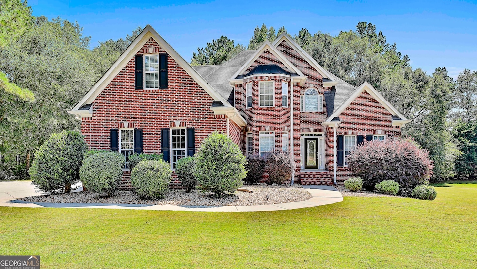
1126 Charleston Ridge McDonough, GA 30252
Estimated payment $3,846/month
Highlights
- Second Kitchen
- Deck
- Traditional Architecture
- Union Grove High School Rated A
- Vaulted Ceiling
- Wood Flooring
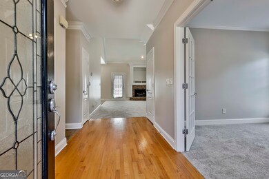
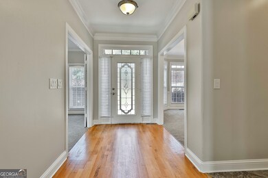
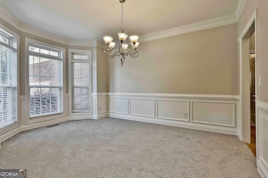
About This Home
Welcome to this beautiful 7-bedroom, 4 full bath, and 2 half bath home, perfectly situated on a level 1-acre lot in the sought-after Union Grove school district. With a thoughtful layout and plenty of space, this property offers flexibility for a variety of living arrangements. The main level features a large eat-in kitchen with plenty of counter space, a separate dining room, a spacious living room with a fireplace, an office, 1.5 baths, a laundry room, and the primary suite. Upstairs, you'll find 3 additional bedrooms, 2 full baths, an office, and a large bonus room. The finished basement adds even more living options, with 2 bedrooms, 1.5 baths, a full kitchen, a full laundry room, a large family room, and a bonus room/office. With its private entrance, patio, and drive-around parking, this space is ideal for extended living, entertaining, or guests. This home combines solid construction, generous living areas, and is located on an established lot. Schedule your tour today and see everything this property has to offer.
Home Details
Home Type
- Single Family
Est. Annual Taxes
- $9,392
Year Built
- Built in 2004
Lot Details
- 1 Acre Lot
- Level Lot
HOA Fees
- $33 Monthly HOA Fees
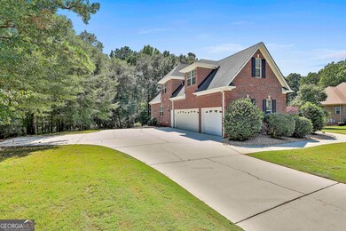
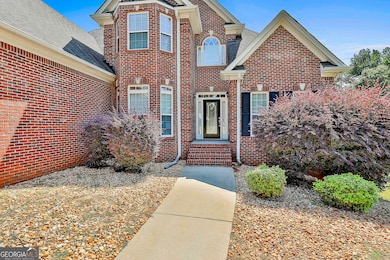
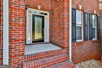
Home Design
- Traditional Architecture
- Composition Roof
- Concrete Siding
- Four Sided Brick Exterior Elevation
Interior Spaces
- 2-Story Property
- Tray Ceiling
- Vaulted Ceiling
- Ceiling Fan
- Gas Log Fireplace
- Entrance Foyer
- Family Room with Fireplace
- Formal Dining Room
- Bonus Room
- Pull Down Stairs to Attic
- Laundry Room
Kitchen
- Second Kitchen
- Breakfast Room
- Convection Oven
- Microwave
- Ice Maker
- Dishwasher
- Stainless Steel Appliances
- Solid Surface Countertops
Flooring
- Wood
- Carpet
- Tile
Bedrooms and Bathrooms
- 7 Bedrooms | 1 Primary Bedroom on Main
- Walk-In Closet
- In-Law or Guest Suite
- Double Vanity
- Whirlpool Bathtub
- Bathtub Includes Tile Surround
- Separate Shower
Finished Basement
- Basement Fills Entire Space Under The House
- Interior and Exterior Basement Entry
- Finished Basement Bathroom
- Natural lighting in basement
Parking
- 3 Car Garage
- Parking Pad
- Side or Rear Entrance to Parking
- Drive Under Main Level
Accessible Home Design
- Accessible Doors
Outdoor Features
- Deck
- Patio
Schools
- Timber Ridge Elementary School
- Union Grove Middle School
- Union Grove High School
Utilities
- Central Heating and Cooling System
- Heating System Uses Natural Gas
- Underground Utilities
- Septic Tank
- Cable TV Available
Community Details
- $200 Initiation Fee
- Association fees include ground maintenance, private roads
- The Preserve Subdivision
Map
Home Values in the Area
Average Home Value in this Area
Tax History
| Year | Tax Paid | Tax Assessment Tax Assessment Total Assessment is a certain percentage of the fair market value that is determined by local assessors to be the total taxable value of land and additions on the property. | Land | Improvement |
|---|---|---|---|---|
| 2025 | $9,761 | $244,120 | $26,000 | $218,120 |
| 2024 | $9,761 | $225,040 | $26,000 | $199,040 |
| 2023 | $8,280 | $212,960 | $24,000 | $188,960 |
| 2022 | $7,714 | $198,200 | $22,000 | $176,200 |
| 2021 | $6,416 | $164,360 | $16,000 | $148,360 |
| 2020 | $5,358 | $136,800 | $11,491 | $125,309 |
| 2019 | $5,049 | $135,800 | $12,000 | $123,800 |
| 2018 | $5,386 | $146,720 | $12,000 | $134,720 |
| 2016 | $5,190 | $142,000 | $12,000 | $130,000 |
| 2015 | $4,920 | $128,880 | $10,000 | $118,880 |
| 2014 | $4,869 | $126,240 | $10,000 | $116,240 |
Property History
| Date | Event | Price | List to Sale | Price per Sq Ft |
|---|---|---|---|---|
| 09/18/2025 09/18/25 | Pending | -- | -- | -- |
| 09/12/2025 09/12/25 | For Sale | $574,900 | -- | $113 / Sq Ft |
Purchase History
| Date | Type | Sale Price | Title Company |
|---|---|---|---|
| Warranty Deed | $342,000 | -- | |
| Quit Claim Deed | -- | -- | |
| Quit Claim Deed | -- | -- | |
| Quit Claim Deed | -- | -- | |
| Deed | $48,500 | -- |
Source: Georgia MLS
MLS Number: 10603630
APN: 137D-01-016-000
Disclaimer: Certain information contained herein is derived from information provided by parties other than Homes.com. All information provided is deemed reliable, but is not guaranteed to be accurate and should be independently verified.
![]() The data relating to real estate for sale on this web site comes in part from the Broker Reciprocity Program of Georgia MLS. Real estate listings held by brokerage firms other than Redfin are marked with the Broker Reciprocity logo and detailed information about them includes the name of the listing brokers. Information deemed reliable but not guaranteed. Copyright 2025 Georgia MLS. All rights reserved.
The data relating to real estate for sale on this web site comes in part from the Broker Reciprocity Program of Georgia MLS. Real estate listings held by brokerage firms other than Redfin are marked with the Broker Reciprocity logo and detailed information about them includes the name of the listing brokers. Information deemed reliable but not guaranteed. Copyright 2025 Georgia MLS. All rights reserved.
- 1202 Persimmon Way
- 1209 Persimmon Way
- 121 Harper Rd
- 111 Harper Rd
- 1333 Nickel Oak Bend
- 2550 Highway 20 E
- 2194 Highway 20 E
- 381 Country Lake Dr
- 2175 Highway 20 E
- 548 Harper Rd
- 2200 E Lake Rd
- 1964 E Lake Rd
- 2772 E Lake Rd
- 293 Country Lake Dr
- 200 Brookview Dr
- 628 Continental Dr
- Meridian II Plan at Trinity Park
