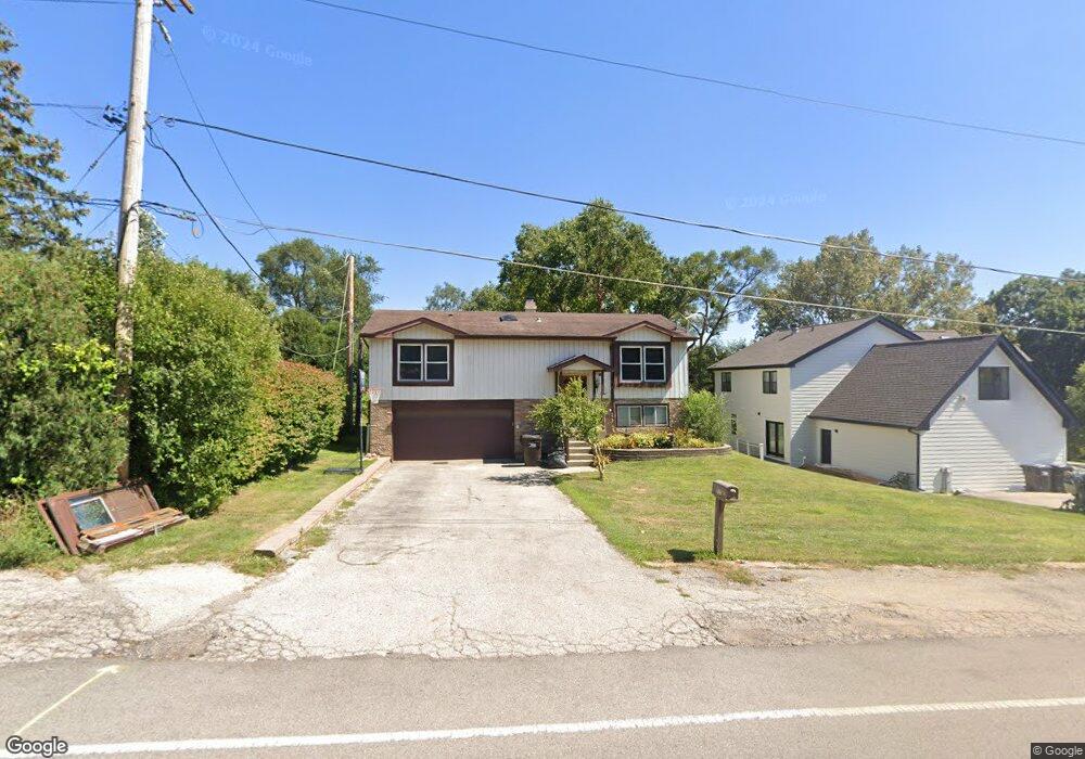
1126 N Garland Rd Wauconda, IL 60084
Estimated Value: $271,855 - $342,000
--
Bed
1
Bath
1,188
Sq Ft
$257/Sq Ft
Est. Value
About This Home
This home is located at 1126 N Garland Rd, Wauconda, IL 60084 and is currently estimated at $305,714, approximately $257 per square foot. 1126 N Garland Rd is a home located in Lake County with nearby schools including Wauconda Grade School, Wauconda Middle School, and Wauconda High School.
Ownership History
Date
Name
Owned For
Owner Type
Purchase Details
Closed on
Dec 18, 1993
Sold by
Stephens David and Stephens Martha
Bought by
Reyes Federico and Reyes Angela
Current Estimated Value
Home Financials for this Owner
Home Financials are based on the most recent Mortgage that was taken out on this home.
Original Mortgage
$57,000
Interest Rate
7.26%
Purchase Details
Closed on
Dec 17, 1993
Sold by
Debolt James H and Debolt Lillian M
Bought by
Stephens David and Stephens Martha
Home Financials for this Owner
Home Financials are based on the most recent Mortgage that was taken out on this home.
Original Mortgage
$57,000
Interest Rate
7.26%
Create a Home Valuation Report for This Property
The Home Valuation Report is an in-depth analysis detailing your home's value as well as a comparison with similar homes in the area
Home Values in the Area
Average Home Value in this Area
Purchase History
| Date | Buyer | Sale Price | Title Company |
|---|---|---|---|
| Reyes Federico | $83,333 | -- | |
| Stephens David | $81,333 | -- |
Source: Public Records
Mortgage History
| Date | Status | Borrower | Loan Amount |
|---|---|---|---|
| Closed | Reyes Federico | $57,000 |
Source: Public Records
Tax History Compared to Growth
Tax History
| Year | Tax Paid | Tax Assessment Tax Assessment Total Assessment is a certain percentage of the fair market value that is determined by local assessors to be the total taxable value of land and additions on the property. | Land | Improvement |
|---|---|---|---|---|
| 2024 | $6,903 | $85,613 | $17,444 | $68,169 |
| 2023 | $6,903 | $78,257 | $15,945 | $62,312 |
| 2022 | $6,461 | $65,208 | $16,138 | $49,070 |
| 2021 | $6,156 | $61,616 | $15,249 | $46,367 |
| 2020 | $5,949 | $58,727 | $14,534 | $44,193 |
| 2019 | $5,277 | $55,502 | $13,736 | $41,766 |
| 2018 | $4,743 | $47,270 | $12,541 | $34,729 |
| 2017 | $4,737 | $46,723 | $12,396 | $34,327 |
| 2016 | $4,433 | $44,246 | $11,739 | $32,507 |
| 2015 | $4,140 | $40,619 | $10,777 | $29,842 |
| 2014 | $5,103 | $45,329 | $12,292 | $33,037 |
| 2012 | $4,987 | $49,703 | $11,760 | $37,943 |
Source: Public Records
Map
Nearby Homes
- 0 Bonner Rd
- 28177 N Garland Rd
- 26049 N Il Route 59
- 28855 N Garland Rd
- 28722 N Madison Ave
- 26241 W Bonner Rd
- 29564 N Garland Rd
- 136 Parkview Dr Unit 5136
- 225 Regency Ct Unit A
- 235 Regency Ct Unit B
- 240 Regency Ct
- 1260 Water Stone Cir
- 701 Lake Shore Dr
- 450 N Main St Unit S307A
- 450 N Main St Unit S208A
- 29295 N Callahan Rd
- 302 Stillwater Ct Unit 1702
- 303 Stillwater Ct Unit 1106
- 309 Stillwater Ct Unit 1101
- 325 Sundown Ct Unit B
- 1134 Northshore Dr
- 1130 N Garland Rd
- 1132 Northshore Dr
- 1130 Northshore Dr
- 54 Bonner Rd
- 514 E Bonner Rd
- 1110 N Garland Rd
- 28464 N Garland Rd
- 1128 Northshore Dr
- 1129 Northshore Dr
- 1125 Northshore Dr
- 1126 Northshore Dr
- 1104 N Garland Rd
- 1123 Northshore Dr
- 1124 Northshore Dr
- 1125 Barbara Ln
- 1100 N Garland Rd
- 1121 Northshore Dr
- 25829 W Bonner Rd
- 1122 Northshore Dr