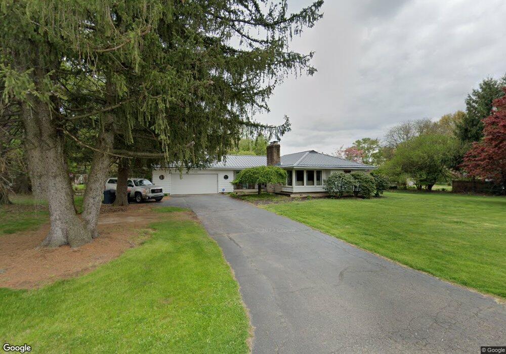
1126 Pierson Blvd Newark, OH 43055
Estimated Value: $252,000 - $289,000
3
Beds
2
Baths
1,354
Sq Ft
$205/Sq Ft
Est. Value
About This Home
This home is located at 1126 Pierson Blvd, Newark, OH 43055 and is currently estimated at $278,190, approximately $205 per square foot. 1126 Pierson Blvd is a home located in Licking County with nearby schools including John Clem Elementary School, Liberty Middle School, and Newark High School.
Ownership History
Date
Name
Owned For
Owner Type
Purchase Details
Closed on
Nov 27, 2002
Sold by
Kishler Kurt F
Bought by
Mccallen Robert and Mccallen Judy
Current Estimated Value
Home Financials for this Owner
Home Financials are based on the most recent Mortgage that was taken out on this home.
Original Mortgage
$138,934
Outstanding Balance
$59,593
Interest Rate
6.22%
Mortgage Type
VA
Estimated Equity
$218,597
Create a Home Valuation Report for This Property
The Home Valuation Report is an in-depth analysis detailing your home's value as well as a comparison with similar homes in the area
Home Values in the Area
Average Home Value in this Area
Purchase History
| Date | Buyer | Sale Price | Title Company |
|---|---|---|---|
| Mccallen Robert | $134,888 | -- |
Source: Public Records
Mortgage History
| Date | Status | Borrower | Loan Amount |
|---|---|---|---|
| Open | Mccallen Robert | $138,934 |
Source: Public Records
Tax History Compared to Growth
Tax History
| Year | Tax Paid | Tax Assessment Tax Assessment Total Assessment is a certain percentage of the fair market value that is determined by local assessors to be the total taxable value of land and additions on the property. | Land | Improvement |
|---|---|---|---|---|
| 2024 | $2,212 | $81,450 | $27,300 | $54,150 |
| 2023 | $2,416 | $81,450 | $27,300 | $54,150 |
| 2022 | $1,839 | $54,600 | $14,700 | $39,900 |
| 2021 | $1,929 | $54,600 | $14,700 | $39,900 |
| 2020 | $1,973 | $54,600 | $14,700 | $39,900 |
| 2019 | $1,638 | $45,400 | $14,700 | $30,700 |
| 2018 | $2,029 | $0 | $0 | $0 |
| 2017 | $2,104 | $0 | $0 | $0 |
| 2016 | $2,217 | $0 | $0 | $0 |
| 2015 | $2,265 | $0 | $0 | $0 |
| 2014 | $2,902 | $0 | $0 | $0 |
| 2013 | $2,210 | $0 | $0 | $0 |
Source: Public Records
Map
Nearby Homes
- 1049 Sunrise Dr
- 440 Reverie Place
- 473 Meadowbrook Dr
- 370 Meadowbrook Dr
- 403 Meadowbrook Dr
- 259 Goosepond Rd Unit C
- 261 Goosepond Rd Unit D
- 584 Moull St Unit A
- 267 Goosepond Rd Unit A
- 227 N Quentin Rd
- 988 Mount Vernon Rd
- 892 Shelbourne Place Unit 892
- 1495 Kenarbre Dr
- 188 Meadow Dr
- 184 Meadow Dr
- 11 Waterworks Rd
- 855 E Village Dr
- 752 Maxola Ave
- 1518 Constitution Ct
- 52 Charles St
- 1126 Pierson Dr
- 1138 Pierson Dr
- 414 Welsh View Dr
- 404 Welsh View Dr
- 424 Welsh View Dr
- 1135 Pierson Dr
- 1125 Cranwood Dr
- 1137 Cranwood Dr
- 394 Welsh View Dr
- 1152 Pierson Dr
- 1112 Pierson Dr
- 1149 Pierson Dr
- 393 Pierson Blvd
- 415 Welsh View Dr
- 1099 Welsh View Dr
- 1060 Cranwood Dr Unit Newark
- 1080 Cranwood Dr
- 1038 Cranwood Dr
- 1060 Cranwood Dr
- 393 Welsh View Dr