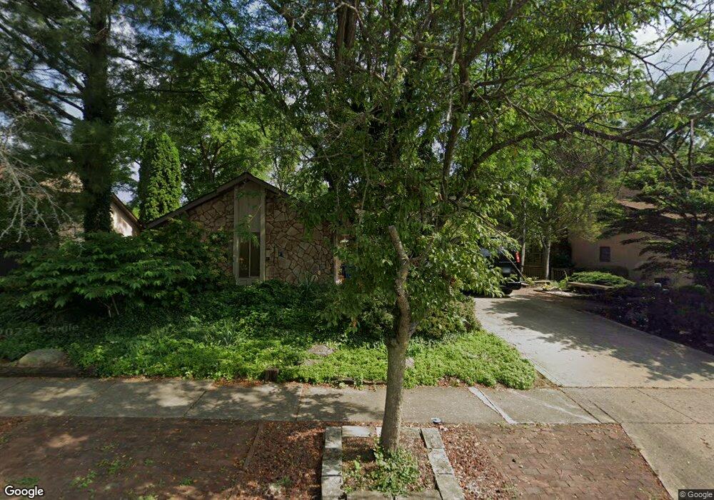
1126 Rockport Ln Columbus, OH 43235
The Gables NeighborhoodEstimated Value: $442,568 - $473,000
3
Beds
3
Baths
2,228
Sq Ft
$205/Sq Ft
Est. Value
About This Home
This home is located at 1126 Rockport Ln, Columbus, OH 43235 and is currently estimated at $457,642, approximately $205 per square foot. 1126 Rockport Ln is a home located in Franklin County with nearby schools including Gables Elementary School, Ridgeview Middle School, and Centennial High School.
Ownership History
Date
Name
Owned For
Owner Type
Purchase Details
Closed on
Jun 23, 1997
Sold by
Williams Rodney L and Williams Belva J
Bought by
Belisle Michael G and Belisle Brenda G
Current Estimated Value
Home Financials for this Owner
Home Financials are based on the most recent Mortgage that was taken out on this home.
Original Mortgage
$139,000
Outstanding Balance
$20,355
Interest Rate
8.25%
Estimated Equity
$437,287
Purchase Details
Closed on
Aug 26, 1992
Purchase Details
Closed on
Jul 1, 1986
Create a Home Valuation Report for This Property
The Home Valuation Report is an in-depth analysis detailing your home's value as well as a comparison with similar homes in the area
Home Values in the Area
Average Home Value in this Area
Purchase History
| Date | Buyer | Sale Price | Title Company |
|---|---|---|---|
| Belisle Michael G | $189,000 | Franklin Abstract | |
| -- | $147,000 | -- | |
| -- | $115,000 | -- |
Source: Public Records
Mortgage History
| Date | Status | Borrower | Loan Amount |
|---|---|---|---|
| Open | Belisle Michael G | $139,000 |
Source: Public Records
Tax History Compared to Growth
Tax History
| Year | Tax Paid | Tax Assessment Tax Assessment Total Assessment is a certain percentage of the fair market value that is determined by local assessors to be the total taxable value of land and additions on the property. | Land | Improvement |
|---|---|---|---|---|
| 2024 | $5,189 | $125,410 | $47,740 | $77,670 |
| 2023 | $5,150 | $125,410 | $47,740 | $77,670 |
| 2022 | $4,831 | $101,890 | $25,970 | $75,920 |
| 2021 | $4,839 | $101,890 | $25,970 | $75,920 |
| 2020 | $4,846 | $101,890 | $25,970 | $75,920 |
| 2019 | $4,417 | $81,560 | $20,760 | $60,800 |
| 2018 | $4,337 | $81,560 | $20,760 | $60,800 |
| 2017 | $4,414 | $81,560 | $20,760 | $60,800 |
| 2016 | $4,700 | $79,700 | $15,930 | $63,770 |
| 2015 | $4,266 | $79,700 | $15,930 | $63,770 |
| 2014 | $4,277 | $79,700 | $15,930 | $63,770 |
| 2013 | $1,996 | $75,880 | $15,155 | $60,725 |
Source: Public Records
Map
Nearby Homes
- 1213 Nantucket Ave
- 1246 Southport Dr
- 5016 Postlewaite Rd Unit 5016
- 928 Linworth Village Dr
- 962 Augusta Glen Dr
- 895 Linworth Village Dr
- 1161 Bethel Rd Unit 103/104
- 5363 Godown Rd
- 1147 Langland Dr
- 1540 Slade Ave Unit 303
- 1505 Eastmeadow Place
- 5773 Middlefield Dr
- 5854 Aqua Bay Dr Unit 5854
- 5881 Rocky Rill Rd
- 5936 Aqua Bay Dr
- 5938 Aqua Bay Dr
- 5111 Portland St
- 1558 Denbigh Dr
- 511 W Kanawha Ave
- 1466 Weybridge Rd
- 1134 Rockport Ln
- 1114 Rockport Ln
- 1142 Rockport Ln
- 1100 Rockport Ln
- 1135 Middleport Dr
- 1123 Middleport Dr
- 1125 Rockport Ln
- 1150 Rockport Ln
- 1145 Middleport Dr
- 1094 Rockport Ln
- 1117 Middleport Dr
- 1111 Rockport Ln
- 1141 Rockport Ln
- 1157 Middleport Dr
- 1097 Rockport Ln
- 1157 Rockport Ln
- 1088 Rockport Ln
- 1126 Nantucket Ave
- 1118 Nantucket Ave
- 1138 Nantucket Ave