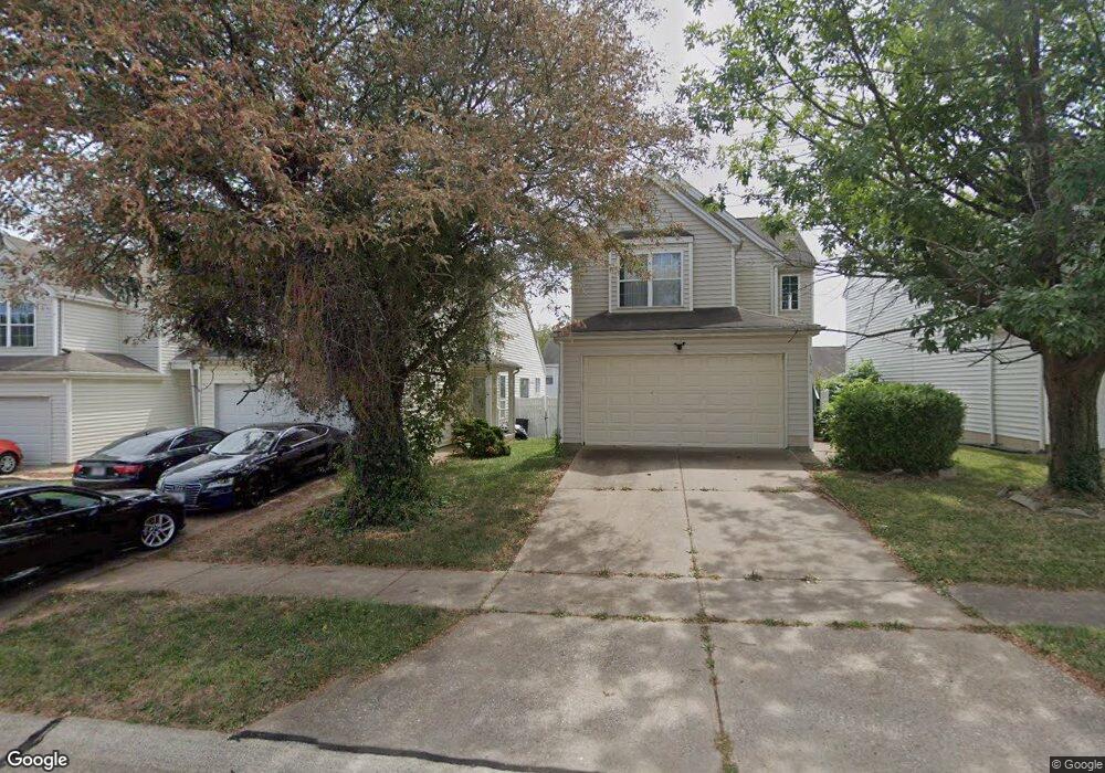
11260 Liberty Landing Dr Florissant, MO 63033
Estimated Value: $193,000 - $232,000
2
Beds
2
Baths
1,580
Sq Ft
$129/Sq Ft
Est. Value
About This Home
This home is located at 11260 Liberty Landing Dr, Florissant, MO 63033 and is currently estimated at $203,832, approximately $129 per square foot. 11260 Liberty Landing Dr is a home located in St. Louis County with nearby schools including Jury Elementary School, Central Middle School, and Hazelwood Central High School.
Ownership History
Date
Name
Owned For
Owner Type
Purchase Details
Closed on
Jun 15, 1998
Sold by
Alligood Leon Y
Bought by
Smith Latonya R
Current Estimated Value
Home Financials for this Owner
Home Financials are based on the most recent Mortgage that was taken out on this home.
Original Mortgage
$84,816
Outstanding Balance
$17,204
Interest Rate
7.21%
Mortgage Type
FHA
Estimated Equity
$186,628
Create a Home Valuation Report for This Property
The Home Valuation Report is an in-depth analysis detailing your home's value as well as a comparison with similar homes in the area
Home Values in the Area
Average Home Value in this Area
Purchase History
| Date | Buyer | Sale Price | Title Company |
|---|---|---|---|
| Smith Latonya R | -- | -- |
Source: Public Records
Mortgage History
| Date | Status | Borrower | Loan Amount |
|---|---|---|---|
| Open | Smith Latonya R | $84,816 |
Source: Public Records
Tax History Compared to Growth
Tax History
| Year | Tax Paid | Tax Assessment Tax Assessment Total Assessment is a certain percentage of the fair market value that is determined by local assessors to be the total taxable value of land and additions on the property. | Land | Improvement |
|---|---|---|---|---|
| 2025 | $2,870 | $34,870 | $1,620 | $33,250 |
| 2024 | $2,870 | $31,520 | $2,260 | $29,260 |
| 2023 | $2,860 | $31,520 | $2,260 | $29,260 |
| 2022 | $2,610 | $25,560 | $2,910 | $22,650 |
| 2021 | $2,471 | $25,560 | $2,910 | $22,650 |
| 2020 | $2,318 | $22,320 | $1,290 | $21,030 |
| 2019 | $2,280 | $22,320 | $1,290 | $21,030 |
| 2018 | $1,942 | $17,540 | $1,290 | $16,250 |
| 2017 | $1,940 | $17,540 | $1,290 | $16,250 |
| 2016 | $1,649 | $14,630 | $1,290 | $13,340 |
| 2015 | $1,611 | $14,630 | $1,290 | $13,340 |
| 2014 | $1,422 | $12,820 | $2,980 | $9,840 |
Source: Public Records
Map
Nearby Homes
- 11129 Old Halls Ferry Rd
- 11565 Mehl Ave
- 11540 Lares Dr
- 4401 Rhine Dr
- 4384 Remus Dr
- 4461 Rhine Dr
- 4471 Rhine Dr
- 4497 Rhine Dr
- 2628 Hadden Dr
- 11008 Saginaw Dr
- 11790 New Halls Ferry Rd
- 1749 Foley Dr
- 11636 MacRinus Dr
- 4950 Patricia Ridge Dr
- 4493 Caracalla Dr
- 11100 Landseer Dr
- 11015 Landseer Dr
- 4354 Metarus Dr
- 2571 Burchard Dr
- 12062 Cato Dr
- 11264 Liberty Landing Dr
- 11252 Liberty Landing Dr
- 11268 Liberty Landing Dr
- 11248 Liberty Landing Dr
- 2861 Liberty Landing Ct
- 2857 Liberty Landing Ct
- 2853 Liberty Landing Ct
- 11272 Liberty Landing Dr
- 2865 Liberty Landing Ct
- 2849 Liberty Landing Ct
- 11220 Liberty Landing Dr
- 2869 Liberty Landing Ct
- 2845 Liberty Landing Ct
- 11261 Liberty Landing Dr
- 11265 Liberty Landing Dr
- 11257 Liberty Landing Dr
- 2817 Liberty Landing Ct
- 11269 Liberty Landing Dr
- 11253 Liberty Landing Dr
- 2871 Liberty Landing Ct