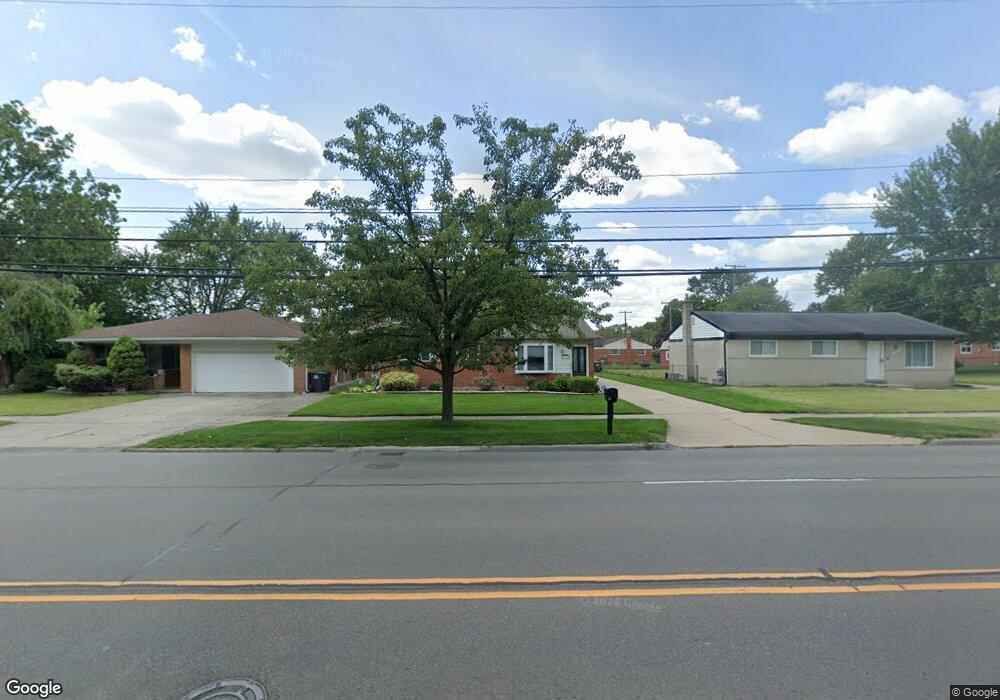
11262 Pardee Rd Taylor, MI 48180
Estimated Value: $199,771 - $259,000
3
Beds
1
Bath
1,138
Sq Ft
$199/Sq Ft
Est. Value
About This Home
This home is located at 11262 Pardee Rd, Taylor, MI 48180 and is currently estimated at $226,943, approximately $199 per square foot. 11262 Pardee Rd is a home located in Wayne County with nearby schools including Bernice Mcdowell Elementary School, Robert J. West Middle School, and Taylor High School.
Ownership History
Date
Name
Owned For
Owner Type
Purchase Details
Closed on
Nov 8, 2018
Sold by
Morris Victoria A and Sprindys Renee C
Bought by
Morris Victoria A and Sprindys Renee C
Current Estimated Value
Purchase Details
Closed on
Oct 10, 2003
Sold by
Morris Victoria A
Bought by
Morris Victoria A
Purchase Details
Closed on
Jun 23, 1994
Sold by
Sergio Latorre
Bought by
Sergio Latorre
Home Financials for this Owner
Home Financials are based on the most recent Mortgage that was taken out on this home.
Original Mortgage
$68,850
Interest Rate
8.38%
Mortgage Type
FHA
Create a Home Valuation Report for This Property
The Home Valuation Report is an in-depth analysis detailing your home's value as well as a comparison with similar homes in the area
Home Values in the Area
Average Home Value in this Area
Purchase History
| Date | Buyer | Sale Price | Title Company |
|---|---|---|---|
| Morris Victoria A | -- | None Available | |
| Morris Victoria A | -- | Multiple | |
| Sergio Latorre | $69,000 | -- |
Source: Public Records
Mortgage History
| Date | Status | Borrower | Loan Amount |
|---|---|---|---|
| Closed | Sergio Latorre | $68,850 |
Source: Public Records
Tax History
| Year | Tax Paid | Tax Assessment Tax Assessment Total Assessment is a certain percentage of the fair market value that is determined by local assessors to be the total taxable value of land and additions on the property. | Land | Improvement |
|---|---|---|---|---|
| 2025 | $2,012 | $93,700 | $0 | $0 |
| 2024 | $1,948 | $91,500 | $0 | $0 |
| 2023 | $2,376 | $81,000 | $0 | $0 |
| 2022 | $1,859 | $68,900 | $0 | $0 |
| 2021 | $2,089 | $65,500 | $0 | $0 |
| 2020 | $2,063 | $62,100 | $0 | $0 |
| 2019 | $206,043 | $53,900 | $0 | $0 |
| 2018 | $1,596 | $43,500 | $0 | $0 |
| 2017 | $940 | $42,600 | $0 | $0 |
| 2016 | $2,014 | $41,500 | $0 | $0 |
| 2015 | $3,607 | $40,900 | $0 | $0 |
| 2013 | $3,590 | $37,300 | $0 | $0 |
| 2012 | $1,568 | $36,300 | $10,900 | $25,400 |
Source: Public Records
Map
Nearby Homes
- 11187 Pardee Rd
- 22675 Goddard Rd
- 22155 Maplelawn Ave
- 11801 Moran St
- 6445 Pardee Rd
- 10769 Birch St
- 11119 Dudley St
- 11078 Pine St
- 11724 Syracuse St
- 11725 Cornell St
- 23722 Brest
- 22243 Kinyon St Unit 3
- 000 Pine Lot A St
- 000 Beechdaly
- 000 Pine Lot B St
- 9942 Lincoln St
- Telegraph Telegraph Rd
- 9883 Roosevelt St
- 9814 Cass Ave
- 12312 Cornell St
- 11276 Pardee Rd Unit Bldg-Unit
- 11276 Pardee Rd
- 11248 Pardee Rd
- 22717 S Keyes St
- 11300 Pardee Rd
- 22709 S Keyes St
- 22725 S Keyes St
- 22635 W Maplelawn Ave
- 22619 W Maplelawn Ave
- 22651 W Maplelawn Ave
- 11316 Pardee Rd
- 11265 Pardee Rd
- 11285 Pardee Rd
- 22667 W Maplelawn Ave
- 22733 W Keyes St
- 11245 Pardee Rd
- 11301 Pardee Rd
- 11330 Pardee Rd
- 22742 W Keyes St
- 22741 W Keyes St
Your Personal Tour Guide
Ask me questions while you tour the home.