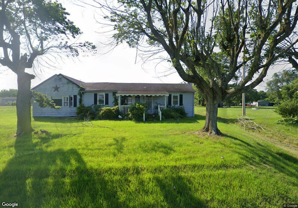
11263 Station Rd Worton, MD 21678
Estimated Value: $123,000 - $252,000
--
Bed
1
Bath
1,280
Sq Ft
$158/Sq Ft
Est. Value
About This Home
This home is located at 11263 Station Rd, Worton, MD 21678 and is currently estimated at $202,274, approximately $158 per square foot. 11263 Station Rd is a home located in Kent County with nearby schools including Center for Innovation, Kent County Middle School, and Kent County High School.
Ownership History
Date
Name
Owned For
Owner Type
Purchase Details
Closed on
Feb 25, 2021
Sold by
Jones Alice B
Bought by
Boyer Nedra N
Current Estimated Value
Purchase Details
Closed on
Apr 20, 2007
Sold by
Boyer Thomas and Boyer Anna,
Bought by
Boyer Thomas and Boyer Anna,
Purchase Details
Closed on
Apr 18, 2007
Sold by
Boyer Thomas and Boyer Anna,
Bought by
Boyer Thomas and Boyer Anna,
Purchase Details
Closed on
Dec 14, 2004
Sold by
Boyer Thomas and Boyer Anna
Bought by
Boyer Thomas and Boyer Anna,
Create a Home Valuation Report for This Property
The Home Valuation Report is an in-depth analysis detailing your home's value as well as a comparison with similar homes in the area
Home Values in the Area
Average Home Value in this Area
Purchase History
| Date | Buyer | Sale Price | Title Company |
|---|---|---|---|
| Boyer Nedra N | $43,000 | Bay East Title | |
| Boyer Thomas | -- | -- | |
| Boyer Thomas | -- | -- | |
| Boyer Thomas | -- | -- |
Source: Public Records
Tax History Compared to Growth
Tax History
| Year | Tax Paid | Tax Assessment Tax Assessment Total Assessment is a certain percentage of the fair market value that is determined by local assessors to be the total taxable value of land and additions on the property. | Land | Improvement |
|---|---|---|---|---|
| 2025 | $1,650 | $140,200 | $0 | $0 |
| 2024 | $1,505 | $127,400 | $0 | $0 |
| 2023 | $1,360 | $114,600 | $54,000 | $60,600 |
| 2022 | $1,337 | $113,567 | $0 | $0 |
| 2021 | $2,770 | $112,533 | $0 | $0 |
| 2020 | $1,324 | $111,500 | $54,000 | $57,500 |
| 2019 | $1,357 | $111,500 | $54,000 | $57,500 |
| 2018 | $2,649 | $111,500 | $54,000 | $57,500 |
| 2017 | $1,344 | $113,200 | $0 | $0 |
| 2016 | -- | $113,200 | $0 | $0 |
| 2015 | $1,287 | $113,200 | $0 | $0 |
| 2014 | $1,287 | $114,600 | $0 | $0 |
Source: Public Records
Map
Nearby Homes
- 11040 Kylie Ln
- 26109 Lambs Meadow Rd
- 25999 Lambs Meadow Rd
- 11944 Augustine Herman Hwy
- 11969 Augustine Herman Hwy
- 0 Old Morgnec Rd Unit MDKE2004974
- 27741 Lambs Meadow Rd
- 0 Medders Rd
- 12765 Still Pond Rd
- 0 Main St
- 26670 Maple Ave
- 0 Lambs Meadow Rd Unit MDKE2005704
- 11150 Old Worton Rd
- 25135 Smithville Rd
- 0 Still Pond Creek Rd Unit MDKE2005888
- 25051 Smithville Rd
- 0 Blackmon Ln
- 25034 Lambs Meadow Rd
- 11054 Austin Ln
- 0 Dutchtown Rd
- 0 Station Branch Rd Unit MDKE110900
- 26954 Branchtown Rd
- 11235 Station Rd
- 26969 Branchtown Rd
- 26979 Branchtown Rd
- 26989 Branchtown Rd
- 26992 Branchtown Rd
- 11225 Station Rd
- 0 Branchtown Rd Unit 1006770352
- 0 Branchtown Rd Unit 1006379178
- 0 Branchtown Rd Unit 1006340550
- 0 Branchtown Rd Unit MDKE2003140
- 0 Branchtown Rd Unit MDKE2002382
- 0 Branchtown Rd Unit MDKE2002404
- 0 Branchtown Rd Unit KE7474530
- 705 Branchtown Rd
- 0 Branchtown Rd Unit 1009206866
- 0 Branchtown Rd Unit 1009143572
- 11325 Station Rd
- 26999 Branchtown Rd