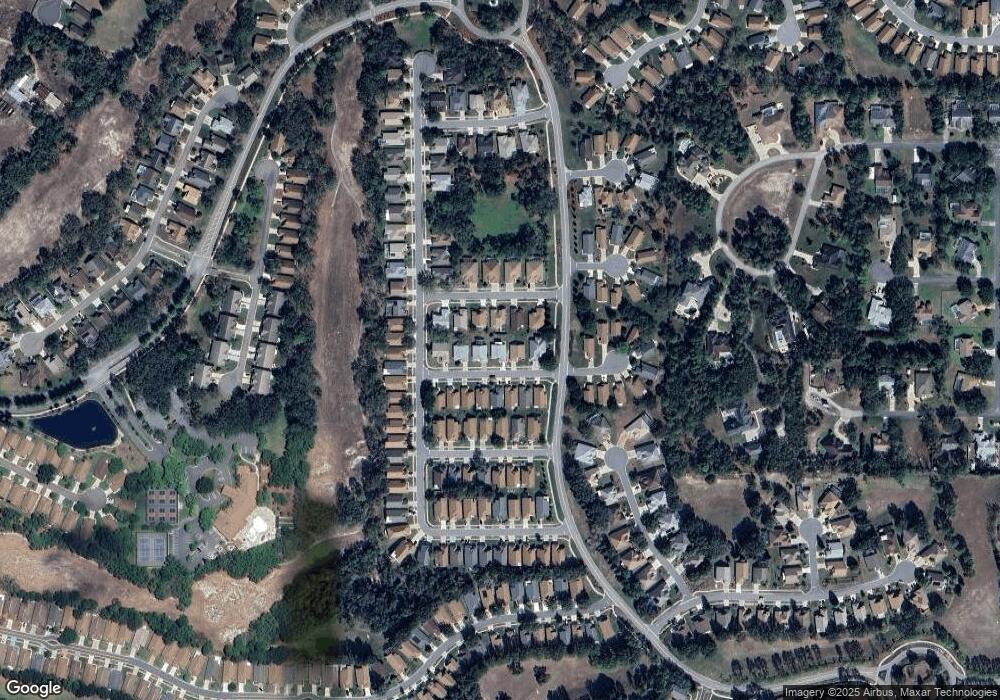
11267 Musgrove Mill Dr Spring Hill, FL 34609
Estimated Value: $278,370 - $305,000
2
Beds
2
Baths
1,629
Sq Ft
$178/Sq Ft
Est. Value
About This Home
This home is located at 11267 Musgrove Mill Dr, Spring Hill, FL 34609 and is currently estimated at $290,093, approximately $178 per square foot. 11267 Musgrove Mill Dr is a home located in Hernando County with nearby schools including Suncoast Elementary School, Powell Middle School, and Frank W. Springstead High School.
Ownership History
Date
Name
Owned For
Owner Type
Purchase Details
Closed on
Feb 25, 2025
Sold by
Petrone James R
Bought by
Petrone James R and Hanson Weiling
Current Estimated Value
Purchase Details
Closed on
Jun 13, 2000
Sold by
Ryland Com Inc
Bought by
Petrone James R and Petrone Victoria
Home Financials for this Owner
Home Financials are based on the most recent Mortgage that was taken out on this home.
Original Mortgage
$80,000
Interest Rate
8.27%
Create a Home Valuation Report for This Property
The Home Valuation Report is an in-depth analysis detailing your home's value as well as a comparison with similar homes in the area
Home Values in the Area
Average Home Value in this Area
Purchase History
| Date | Buyer | Sale Price | Title Company |
|---|---|---|---|
| Petrone James R | $100 | None Listed On Document | |
| Petrone James R | $127,100 | -- |
Source: Public Records
Mortgage History
| Date | Status | Borrower | Loan Amount |
|---|---|---|---|
| Previous Owner | Petrone James R | $80,000 |
Source: Public Records
Tax History Compared to Growth
Tax History
| Year | Tax Paid | Tax Assessment Tax Assessment Total Assessment is a certain percentage of the fair market value that is determined by local assessors to be the total taxable value of land and additions on the property. | Land | Improvement |
|---|---|---|---|---|
| 2024 | $1,385 | $122,562 | -- | -- |
| 2023 | $1,385 | $118,992 | $0 | $0 |
| 2022 | $1,277 | $115,526 | $0 | $0 |
| 2021 | $1,240 | $111,910 | $0 | $0 |
| 2020 | $1,118 | $110,365 | $0 | $0 |
| 2019 | $1,099 | $107,884 | $0 | $0 |
| 2018 | $566 | $105,872 | $0 | $0 |
| 2017 | $829 | $103,694 | $0 | $0 |
| 2016 | $805 | $101,561 | $0 | $0 |
| 2015 | $803 | $100,855 | $0 | $0 |
| 2014 | $785 | $100,055 | $0 | $0 |
Source: Public Records
Map
Nearby Homes
- 11261 McRacken Dr
- 371 Quane Ave
- 367 Quane Ave
- 284 Quane Ave
- 11323 Highlander Ct
- 453 Candlestone Ct
- 402 & 406 Candlestone Ct
- 401 & 405 Candlestone Ct
- 449 Candlestone Ct
- 11330 Leeds Dr
- 464 Mistwood Ct
- 432 Mistwood Ct
- 265 Center Oak Cir
- 11218 Heathrow Ave
- 11185 Heathrow Ave
- 11255 Copley Ct
- 11368 Copley Ct
- 525 Bent Oak Ct
- 416 Mistwood Ct
- 533 Bent Oak Ct
- 11279 Musgrove Mill Dr
- 11263 Musgrove Mill Dr
- 11230 Chickasaw Dr
- 11228 Chickasaw Dr
- 11232 Chickasaw Dr
- 11259 Musgrove Mill Dr
- 11287 Musgrove Mill Dr
- 11276 Musgrove Mill Dr
- 11226 Chickasaw Dr
- 11264 Musgrove Mill Dr
- 11234 Chickasaw Dr
- 11280 Musgrove Mill Dr
- 11260 Musgrove Mill Dr
- 11251 Musgrove Mill Dr
- 11284 Musgrove Mill Dr
- 11256 Musgrove Mill Dr
- 11224 Chickasaw Dr
- 11248 Musgrove Mill Dr
- 11248 Musgrove
- 11273 McRacken Dr
