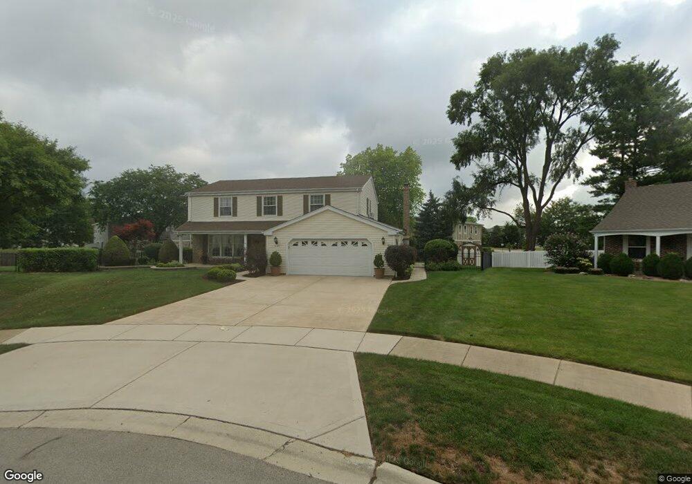
1127 Jamestown Ct Schaumburg, IL 60193
South Schaumburg NeighborhoodEstimated Value: $554,339 - $645,000
4
Beds
3
Baths
2,248
Sq Ft
$268/Sq Ft
Est. Value
About This Home
This home is located at 1127 Jamestown Ct, Schaumburg, IL 60193 and is currently estimated at $602,335, approximately $267 per square foot. 1127 Jamestown Ct is a home located in Cook County with nearby schools including Michael Collins Elementary School, Robert Frost Junior High School, and J B Conant High School.
Ownership History
Date
Name
Owned For
Owner Type
Purchase Details
Closed on
Sep 26, 2018
Sold by
Tippet Victor L and Tippet Joan E
Bought by
Tippet Victor L and Tippet Joan E
Current Estimated Value
Purchase Details
Closed on
Jul 31, 2014
Sold by
Simpson Kathleen A and Simpson Keith S
Bought by
Clark Steve and Clark Steve R
Create a Home Valuation Report for This Property
The Home Valuation Report is an in-depth analysis detailing your home's value as well as a comparison with similar homes in the area
Home Values in the Area
Average Home Value in this Area
Purchase History
| Date | Buyer | Sale Price | Title Company |
|---|---|---|---|
| Tippet Victor L | -- | Attorney | |
| Clark Steve | $364,500 | -- | |
| Clark Steve | $364,500 | -- | |
| Clark Steve | $364,500 | -- |
Source: Public Records
Tax History Compared to Growth
Tax History
| Year | Tax Paid | Tax Assessment Tax Assessment Total Assessment is a certain percentage of the fair market value that is determined by local assessors to be the total taxable value of land and additions on the property. | Land | Improvement |
|---|---|---|---|---|
| 2024 | $9,533 | $40,000 | $8,532 | $31,468 |
| 2023 | $9,193 | $40,000 | $8,532 | $31,468 |
| 2022 | $9,193 | $40,000 | $8,532 | $31,468 |
| 2021 | $8,736 | $34,816 | $4,653 | $30,163 |
| 2020 | $8,707 | $34,816 | $4,653 | $30,163 |
| 2019 | $8,714 | $38,685 | $4,653 | $34,032 |
| 2018 | $8,618 | $34,900 | $4,071 | $30,829 |
| 2017 | $8,514 | $34,900 | $4,071 | $30,829 |
| 2016 | $8,458 | $34,900 | $4,071 | $30,829 |
| 2015 | $8,491 | $32,878 | $3,490 | $29,388 |
| 2014 | $8,425 | $32,878 | $3,490 | $29,388 |
| 2013 | $8,179 | $32,878 | $3,490 | $29,388 |
Source: Public Records
Map
Nearby Homes
- 1078 Newport Harbor Unit 6101
- 1100 Boston Harbor Unit 7004
- 286 Nantucket Harbor Unit 601
- 421 E Wise Rd
- 1205 Laurel Ln
- 620 S Point Dr
- 731 Highpoint Ct
- 1323 S Roselle Rd
- 1420 Indian Hill Dr
- 826 Thornton Ct Unit 2AL
- 13 W Monterey Ave
- 717 Tipperary Ct Unit 1C
- 409 New York Ln
- 733 Limerick Ln Unit 7333D
- 722 Merlin Dr Unit 16
- 517 E Weathersfield Way
- 712 Tipperary Ct Unit 1C
- 711 Tipperary Ct Unit 2D
- 924 Surrey Dr Unit 1A
- 727 Killarney Ct Unit 2D
- 1128 Jamestown Ct
- 1072 Newport Harbor Unit 6002
- 1131 Jamestown Ct
- 1070 Newport Harbor Unit 6001
- 1074 Newport Harbor Unit 6003
- 1082 Newport Harbor Unit 6103
- 1039 Hampton Harbor Unit 9603
- 1072 Hampton Harbor Unit 9404
- 1076 Newport Harbor Unit 6102
- 1080 Newport Harbor Unit 6104
- 1068 Newport Harbor Unit 6004
- 1134 Jamestown Ct
- 1066 Newport Harbor Unit 5903
- 1135 Jamestown Ct
- 1064 Newport Harbor Unit 5902
- 1060 Newport Harbor Unit 5904
- 1062 Newport Harbor Unit 5901
- 1057 Brunswick Harbor Unit 46
- 1053 Brunswick Harbor Unit 46
- 1055 Brunswick Harbor Unit 46