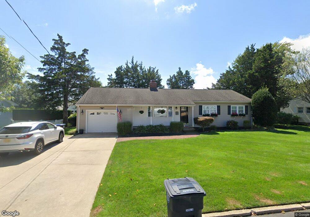
1127 Mohegan Rd Manasquan, NJ 08736
Estimated Value: $886,503 - $996,000
3
Beds
2
Baths
1,385
Sq Ft
$676/Sq Ft
Est. Value
About This Home
This home is located at 1127 Mohegan Rd, Manasquan, NJ 08736 and is currently estimated at $936,626, approximately $676 per square foot. 1127 Mohegan Rd is a home located in Monmouth County with nearby schools including Wall High School and The Brookside School.
Ownership History
Date
Name
Owned For
Owner Type
Purchase Details
Closed on
Oct 30, 2013
Sold by
Stebner Matthew M
Bought by
Kershis John F
Current Estimated Value
Home Financials for this Owner
Home Financials are based on the most recent Mortgage that was taken out on this home.
Original Mortgage
$363,600
Outstanding Balance
$272,613
Interest Rate
4.52%
Mortgage Type
New Conventional
Estimated Equity
$664,013
Purchase Details
Closed on
Apr 29, 2011
Sold by
Dirobbio Marilyn and Rycyk Donna L
Bought by
Stebner Matthew M
Create a Home Valuation Report for This Property
The Home Valuation Report is an in-depth analysis detailing your home's value as well as a comparison with similar homes in the area
Home Values in the Area
Average Home Value in this Area
Purchase History
| Date | Buyer | Sale Price | Title Company |
|---|---|---|---|
| Kershis John F | $477,000 | Agent For Old Republic | |
| Stebner Matthew M | $375,000 | Old Republic National Title |
Source: Public Records
Mortgage History
| Date | Status | Borrower | Loan Amount |
|---|---|---|---|
| Open | Kershis John F | $363,600 |
Source: Public Records
Tax History Compared to Growth
Tax History
| Year | Tax Paid | Tax Assessment Tax Assessment Total Assessment is a certain percentage of the fair market value that is determined by local assessors to be the total taxable value of land and additions on the property. | Land | Improvement |
|---|---|---|---|---|
| 2025 | $8,830 | $418,500 | $250,000 | $168,500 |
| 2024 | $8,567 | $418,500 | $250,000 | $168,500 |
| 2023 | $8,567 | $418,500 | $250,000 | $168,500 |
| 2022 | $8,357 | $418,500 | $250,000 | $168,500 |
| 2021 | $8,357 | $418,500 | $250,000 | $168,500 |
| 2020 | $8,257 | $418,500 | $250,000 | $168,500 |
| 2019 | $8,157 | $418,500 | $250,000 | $168,500 |
| 2018 | $8,085 | $418,500 | $250,000 | $168,500 |
| 2017 | $7,926 | $418,500 | $250,000 | $168,500 |
| 2016 | $7,759 | $418,500 | $250,000 | $168,500 |
| 2015 | $8,888 | $301,300 | $133,900 | $167,400 |
| 2014 | $8,577 | $297,400 | $130,000 | $167,400 |
Source: Public Records
Map
Nearby Homes
- 2404 Lenape Trail
- 1215 Church St
- 203 Lenape Trail
- 1210 Bayberry Rd
- 14 Lebanon Dr
- 34 Gertrude Place
- 1207 Bayberry Rd
- 10 Acpoan Place
- 1347 Winter View Rd
- 2311 Camden Ave
- 3 Central Ave
- 308 South St
- 1209 Lenape Trail
- 2253 Wagner Ln
- 633 Agnes Ave
- 1422 Lakewood Rd
- 619 Park Ave
- 34 Broad St Unit 306
- 610 Agnes Ave
- 1307 W Union Ln Unit A4
- 1131 Mohegan Rd
- 1130 Lakewood Rd
- 1124 Lakewood Rd
- 1126 Mohegan Rd
- 1132 Mohegan Rd
- 1134 Lakewood Rd
- 1119 Mohegan Rd
- 1122 Mohegan Rd
- 1120 Lakewood Rd
- 1135 Mohegan Rd
- 1129 Minnesink Rd
- 1127 Minnesink Rd
- 1136 Mohegan Rd
- 1120 Mohegan Rd
- 1138 Lakewood Rd
- 1133 Minnesink Rd
- 1117 Mohegan Rd
- 1129 Lakewood Rd
- 1127 Lakewood Rd
- 1125 Minnesink Rd