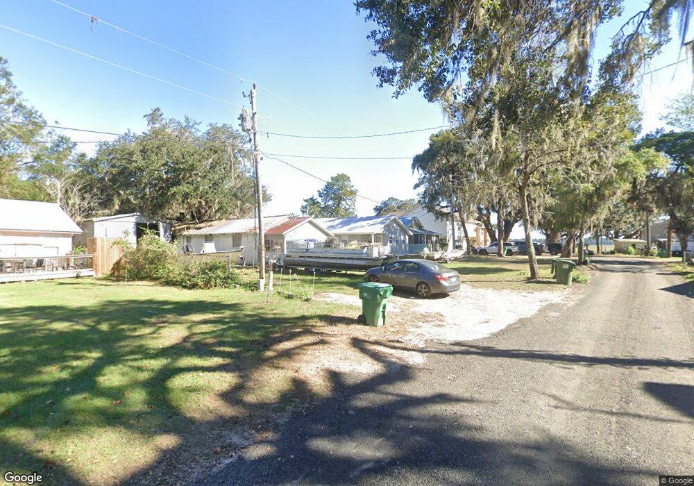
1127 Norman St NE Townsend, GA 31331
Estimated Value: $156,207 - $269,000
2
Beds
1
Bath
948
Sq Ft
$203/Sq Ft
Est. Value
About This Home
This home is located at 1127 Norman St NE, Townsend, GA 31331 and is currently estimated at $192,802, approximately $203 per square foot. 1127 Norman St NE is a home with nearby schools including Todd Grant Elementary School, McIntosh County Middle School, and McIntosh County Academy.
Ownership History
Date
Name
Owned For
Owner Type
Purchase Details
Closed on
May 30, 2019
Sold by
Mason James Andrew
Bought by
Jmj & T Llc
Current Estimated Value
Purchase Details
Closed on
May 27, 2016
Sold by
Hargrove Betty Daves
Bought by
Mason James Andrew
Purchase Details
Closed on
May 9, 2016
Sold by
Hargrove Jesse H
Bought by
Hargrove Betty D
Create a Home Valuation Report for This Property
The Home Valuation Report is an in-depth analysis detailing your home's value as well as a comparison with similar homes in the area
Purchase History
| Date | Buyer | Sale Price | Title Company |
|---|---|---|---|
| Jmj & T Llc | -- | -- | |
| Mason James Andrew | $75,000 | -- | |
| Hargrove Betty D | -- | -- |
Source: Public Records
Tax History
| Year | Tax Paid | Tax Assessment Tax Assessment Total Assessment is a certain percentage of the fair market value that is determined by local assessors to be the total taxable value of land and additions on the property. | Land | Improvement |
|---|---|---|---|---|
| 2024 | $1,316 | $41,960 | $9,720 | $32,240 |
| 2023 | $1,298 | $41,160 | $9,720 | $31,440 |
| 2022 | $1,159 | $34,840 | $9,720 | $25,120 |
| 2021 | $780 | $29,360 | $9,720 | $19,640 |
| 2020 | $952 | $28,400 | $9,720 | $18,680 |
| 2019 | $749 | $28,200 | $9,720 | $18,480 |
| 2018 | $749 | $28,200 | $9,720 | $18,480 |
| 2017 | $862 | $26,720 | $9,720 | $17,000 |
| 2016 | $794 | $24,160 | $8,080 | $16,080 |
| 2015 | $785 | $24,644 | $8,100 | $16,545 |
| 2014 | $786 | $24,645 | $8,100 | $16,545 |
Source: Public Records
Map
Nearby Homes
- 38 Sutherland Bluff Dr NE
- 1043 Fishermans Lodge Rd NE
- 1130 Fishermans Lodge Road North E
- 609 Sutherland Bluff Dr NE
- 1031 Moore Haven Cir NE
- 1076 Blue Marlin Dr NE
- 1112 Moore Haven Circle North E
- 1090 Blue Marlin Dr NE
- Lot 129 Sapelo Park Dr NE
- 1112 Blue Marlin Dr NE
- 0 Sutherland Bluff Dr NE Unit 1660573
- 0 Sutherland Bluff Dr NE Unit 30571
- 39 Sutherland Bluff Dr NE
- 0 Sutherland Bluff Dr NE Unit 10656238
- Lot 1, Phase 6 Sutherland Bluff Dr NE
- 71 Coopers Point Dr NE
- 7272 Shellman Bluff Rd NE Unit 21
- 7272 Shellman Bluff Rd NE Unit 22
- 7272 Shellman Bluff Rd NE Unit 14
- 7272 Shellman Bluff Rd NE Unit 17
- 1111 Norman St NE
- 1133 Norman St NE
- 1099 Norman St NE
- 1134 Smith St NE
- 1112 Norman St NE
- 1134 Norman St NE
- 1151 Norman St NE
- 1114 Smith St NE
- 1140 Norman St NE
- 1096 Norman St NE
- 1105 Well St NE
- 1079 Norman St NE
- 1103 River Rd NE
- 1139 Smith St NE
- 1137 Well St NE
- 1171 Smith Rd SE
- 1084 Smith St NE
- 1068 Norman St NE
- 1106 Shellman Bluff Rd NE
- 1063 Norman St NE
Your Personal Tour Guide
Ask me questions while you tour the home.