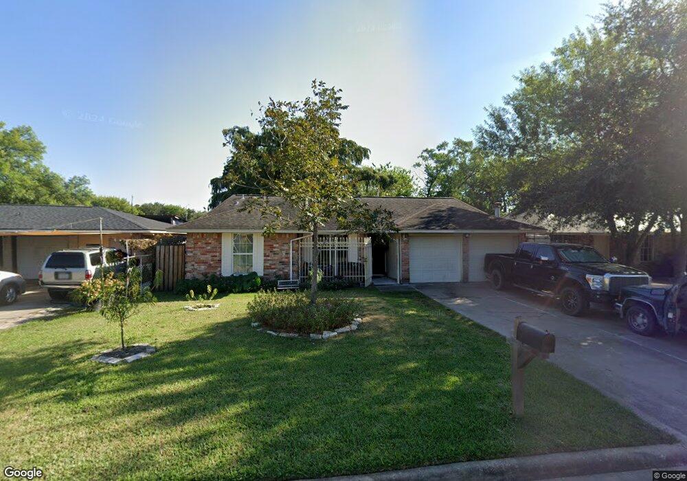
1127 Pilot Point Dr Houston, TX 77038
North Houston NeighborhoodEstimated Value: $179,502 - $214,000
3
Beds
2
Baths
1,037
Sq Ft
$193/Sq Ft
Est. Value
About This Home
This home is located at 1127 Pilot Point Dr, Houston, TX 77038 and is currently estimated at $200,376, approximately $193 per square foot. 1127 Pilot Point Dr is a home located in Harris County with nearby schools including Jerry Keeble Ec/Pre-K, Gray Elementary School, and Aldine Ninth Grade School.
Ownership History
Date
Name
Owned For
Owner Type
Purchase Details
Closed on
Nov 11, 1998
Sold by
Murray Brian K
Bought by
Barriga Mario
Current Estimated Value
Home Financials for this Owner
Home Financials are based on the most recent Mortgage that was taken out on this home.
Original Mortgage
$54,857
Outstanding Balance
$11,837
Interest Rate
6.46%
Mortgage Type
FHA
Estimated Equity
$188,539
Create a Home Valuation Report for This Property
The Home Valuation Report is an in-depth analysis detailing your home's value as well as a comparison with similar homes in the area
Home Values in the Area
Average Home Value in this Area
Purchase History
| Date | Buyer | Sale Price | Title Company |
|---|---|---|---|
| Barriga Mario | -- | First American Title |
Source: Public Records
Mortgage History
| Date | Status | Borrower | Loan Amount |
|---|---|---|---|
| Open | Barriga Mario | $54,857 |
Source: Public Records
Tax History Compared to Growth
Tax History
| Year | Tax Paid | Tax Assessment Tax Assessment Total Assessment is a certain percentage of the fair market value that is determined by local assessors to be the total taxable value of land and additions on the property. | Land | Improvement |
|---|---|---|---|---|
| 2025 | $1,526 | $175,279 | $32,232 | $143,047 |
| 2024 | $1,526 | $175,279 | $32,232 | $143,047 |
| 2023 | $1,526 | $177,964 | $32,232 | $145,732 |
| 2022 | $2,699 | $139,397 | $26,860 | $112,537 |
| 2021 | $2,559 | $119,758 | $26,860 | $92,898 |
| 2020 | $2,477 | $115,506 | $26,860 | $88,646 |
| 2019 | $2,342 | $105,379 | $26,860 | $78,519 |
| 2018 | $791 | $98,251 | $12,324 | $85,927 |
| 2017 | $1,875 | $98,251 | $12,324 | $85,927 |
| 2016 | $1,705 | $80,900 | $12,324 | $68,576 |
| 2015 | $1,105 | $80,900 | $12,324 | $68,576 |
| 2014 | $1,105 | $66,826 | $12,324 | $54,502 |
Source: Public Records
Map
Nearby Homes
- 1138 Cherry Spring Dr
- 1219 Pilot Point Dr
- 1022 Progreso Dr
- 1327 Fallbrook Dr
- 1010 Francitas Dr
- 1006 Fruitvale Dr
- 939 Point Blank Dr
- 00 Fallbrook Dr
- 1506 Wilshire Park Dr
- 1019 Castolan Dr
- 10519 Pleasanton Dr
- 0 W Mt Houston Rd Unit 90464120
- 10134 Lasaber Ct
- 10226 Ella Falls Blvd
- 10558 Pleasanton Dr
- 2115 Havencrest Dr
- 10026 Lasaber Ct
- 2203 Chalet Rd
- 12718 Sai Baba Dr
- Whitetail Plan at Forestwood
- 1131 Pilot Point Dr
- 1123 Pilot Point Dr
- 1126 Progreso Dr
- 1135 Pilot Point Dr
- 1130 Progreso Dr
- 1122 Progreso Dr
- 1119 Pilot Point Dr
- 1134 Progreso Dr
- 1118 Progreso Dr
- 1126 Pilot Point Dr
- 1139 Pilot Point Dr
- 1130 Pilot Point Dr
- 1122 Pilot Point Dr
- 1115 Pilot Point Dr
- 1134 Pilot Point Dr
- 1138 Progreso Dr
- 1118 Pilot Point Dr
- 1114 Progreso Dr
- 1203 Pilot Point Dr
- 1111 Pilot Point Dr