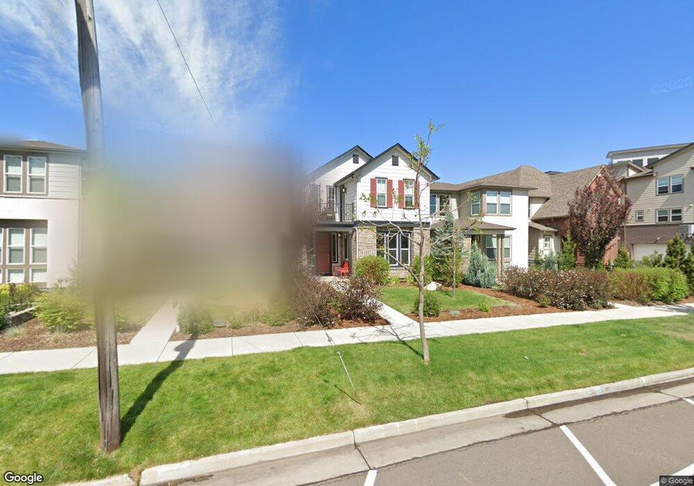
1127 S Logan St Denver, CO 80210
Platt Park NeighborhoodEstimated Value: $922,000 - $1,260,000
3
Beds
3
Baths
2,344
Sq Ft
$478/Sq Ft
Est. Value
About This Home
This home is located at 1127 S Logan St, Denver, CO 80210 and is currently estimated at $1,121,520, approximately $478 per square foot. 1127 S Logan St is a home with nearby schools including McKinley-Thatcher Elementary School, Grant Beacon Middle School, and South High School.
Ownership History
Date
Name
Owned For
Owner Type
Purchase Details
Closed on
Jul 12, 2018
Sold by
Saab Jorgina N
Bought by
Saab Jorgina Najla
Current Estimated Value
Purchase Details
Closed on
Dec 16, 2014
Sold by
Tri Pointe Homes Inc
Bought by
Saab Jorgina N
Home Financials for this Owner
Home Financials are based on the most recent Mortgage that was taken out on this home.
Original Mortgage
$417,000
Outstanding Balance
$320,827
Interest Rate
4.04%
Mortgage Type
New Conventional
Estimated Equity
$800,693
Create a Home Valuation Report for This Property
The Home Valuation Report is an in-depth analysis detailing your home's value as well as a comparison with similar homes in the area
Home Values in the Area
Average Home Value in this Area
Purchase History
| Date | Buyer | Sale Price | Title Company |
|---|---|---|---|
| Saab Jorgina Najla | -- | None Available | |
| Saab Jorgina N | $620,000 | Land Title Guarantee Company |
Source: Public Records
Mortgage History
| Date | Status | Borrower | Loan Amount |
|---|---|---|---|
| Open | Saab Jorgina N | $417,000 |
Source: Public Records
Tax History Compared to Growth
Tax History
| Year | Tax Paid | Tax Assessment Tax Assessment Total Assessment is a certain percentage of the fair market value that is determined by local assessors to be the total taxable value of land and additions on the property. | Land | Improvement |
|---|---|---|---|---|
| 2024 | $5,915 | $74,680 | $20,130 | $54,550 |
| 2023 | $5,787 | $74,680 | $20,130 | $54,550 |
| 2022 | $5,148 | $64,740 | $24,700 | $40,040 |
| 2021 | $4,970 | $66,600 | $25,410 | $41,190 |
| 2020 | $4,863 | $65,540 | $21,790 | $43,750 |
| 2019 | $4,726 | $65,540 | $21,790 | $43,750 |
| 2018 | $3,880 | $50,150 | $8,530 | $41,620 |
| 2017 | $3,868 | $50,150 | $8,530 | $41,620 |
| 2016 | $4,351 | $53,360 | $8,087 | $45,273 |
| 2015 | $4,169 | $53,360 | $8,087 | $45,273 |
Source: Public Records
Map
Nearby Homes
- 1056 S Pennsylvania St
- 1209 S Pennsylvania St
- 1001 S Pennsylvania St Unit 1005
- 969 S Pearl St Unit 204
- 1355 S Pennsylvania St
- 857 S Grant St
- 1023 S Emerson St
- 1313 S Clarkson St Unit 305
- 1313 S Clarkson St Unit 405
- 1313 S Clarkson St Unit 202
- 838 S Sherman St
- 981 S Emerson St
- 1127 S Ogden St
- 1260 S Emerson St
- 130 E Ohio Ave Unit 140
- 1144 S Cherokee St
- 794 S Pearl St
- 1050 S Corona St
- 1518 S Sherman St
- 646 S Lincoln St
- 1129 S Logan St
- 1125 S Logan St
- 1131 S Logan St
- 1121 S Logan St
- 1118 S Grant St
- 1143 S Logan St
- 1143 S Logan St
- 1145 S Logan St
- 390 E Mississippi Ave
- 1122 S Grant St
- 1147 S Logan St
- 1126 S Grant St
- 1112 S Grant St
- 1130 S Grant St
- 1149 S Logan St
- 340 E Mississippi Ave
- 340 E Mississippi Ave Unit 1
- 348 E Mississippi Ave
- 1132 S Grant St
- 1151 S Logan St