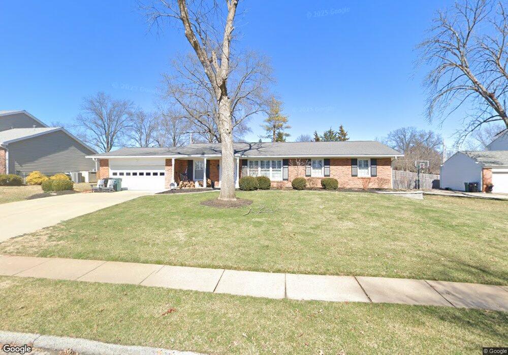
1127 St Croix Kirkwood, MO 63122
Estimated Value: $540,546 - $652,000
3
Beds
2
Baths
1,782
Sq Ft
$330/Sq Ft
Est. Value
About This Home
This home is located at 1127 St Croix, Kirkwood, MO 63122 and is currently estimated at $588,387, approximately $330 per square foot. 1127 St Croix is a home located in St. Louis County with nearby schools including W.W. Keysor Elementary School, North Kirkwood Middle School, and Kirkwood Senior High School.
Ownership History
Date
Name
Owned For
Owner Type
Purchase Details
Closed on
Feb 17, 2009
Sold by
Hizar Thomas W and Hizar Anne P
Bought by
Mill Robert W
Current Estimated Value
Home Financials for this Owner
Home Financials are based on the most recent Mortgage that was taken out on this home.
Original Mortgage
$254,400
Outstanding Balance
$159,170
Interest Rate
4.91%
Mortgage Type
Purchase Money Mortgage
Estimated Equity
$429,217
Purchase Details
Closed on
Aug 18, 2008
Sold by
Brown E R and Brown Elizabeth N
Bought by
Hizar Thomas W and Hizar Anne P
Create a Home Valuation Report for This Property
The Home Valuation Report is an in-depth analysis detailing your home's value as well as a comparison with similar homes in the area
Home Values in the Area
Average Home Value in this Area
Purchase History
| Date | Buyer | Sale Price | Title Company |
|---|---|---|---|
| Mill Robert W | $318,000 | None Available | |
| Hizar Thomas W | $185,000 | None Available |
Source: Public Records
Mortgage History
| Date | Status | Borrower | Loan Amount |
|---|---|---|---|
| Open | Mill Robert W | $254,400 |
Source: Public Records
Tax History Compared to Growth
Tax History
| Year | Tax Paid | Tax Assessment Tax Assessment Total Assessment is a certain percentage of the fair market value that is determined by local assessors to be the total taxable value of land and additions on the property. | Land | Improvement |
|---|---|---|---|---|
| 2025 | $5,166 | $96,580 | $60,880 | $35,700 |
| 2024 | $5,166 | $82,560 | $41,860 | $40,700 |
| 2023 | $5,086 | $82,560 | $41,860 | $40,700 |
| 2022 | $4,943 | $74,860 | $41,860 | $33,000 |
| 2021 | $4,878 | $74,860 | $41,860 | $33,000 |
| 2020 | $4,543 | $67,010 | $33,270 | $33,740 |
| 2019 | $4,559 | $67,010 | $33,270 | $33,740 |
| 2018 | $4,823 | $62,640 | $26,960 | $35,680 |
| 2017 | $4,817 | $62,640 | $26,960 | $35,680 |
| 2016 | $4,323 | $56,620 | $23,140 | $33,480 |
| 2015 | $4,301 | $56,620 | $23,140 | $33,480 |
| 2014 | $4,245 | $54,660 | $16,340 | $38,320 |
Source: Public Records
Map
Nearby Homes
- 1001 Dovergate Dr
- 1422 Northlin Dr
- 919 Nana Ln
- 946 Rochdale Dr
- 11909 Lillian Ave
- 1312 W Essex Ave
- 11913 Lillian Ave
- 1710 Lynkirk Ln
- 12006 Montour Dr
- 546 Dougherty Ferry Rd
- 550 Bedford Oaks Dr
- 11358 Manchester Rd
- 425 Gabriel Dr
- 1003 Ormond Dr
- 603 W Essex Ave
- 531 Goethe Ave
- 537 Goethe Ave
- 841 N Geyer Rd
- 535 Kirkshire Dr
- 456 Wilcox Ave
- 1127 Saint Croix Ct
- 1119 Saint Croix Ct
- 1133 Saint Croix Ct
- 1124 Saint Croix Ct
- 1111 Saint Croix Ct
- 1132 Saint Croix Ct
- 1110 Saint Croix Ct
- 1205 Saint Croix Ct
- 809 Lockett Rd
- 734 Lockett Rd
- 831 Rochdale Dr
- 825 Rochdale Dr
- 807 Lockett Rd
- 839 Rochdale Dr
- 1207 Lin Manor Dr
- 1101 Dougherty Ferry Rd
- 1109 Dougherty Ferry Rd
- 1124 Whitecliff Dr
- 733 Lockett Rd
- 726 Lockett Rd