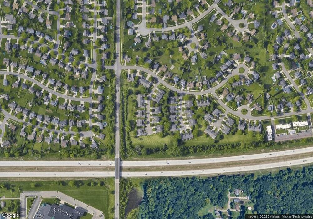
1127 Vail Ct Lansing, MI 48917
Estimated Value: $233,000 - $252,000
3
Beds
2
Baths
1,246
Sq Ft
$193/Sq Ft
Est. Value
About This Home
This home is located at 1127 Vail Ct, Lansing, MI 48917 and is currently estimated at $240,670, approximately $193 per square foot. 1127 Vail Ct is a home located in Eaton County with nearby schools including Waverly Senior High School, Greater Lansing Adventist School, and New Covenant Christian School.
Ownership History
Date
Name
Owned For
Owner Type
Purchase Details
Closed on
Dec 17, 2024
Sold by
Cornelius Thomas S and Cornelius Joann Kay
Bought by
Cornelius Thomas S and Cornelius Joann Kay
Current Estimated Value
Purchase Details
Closed on
Aug 8, 2024
Sold by
Muriel Kay Mckessy Trust and Mckessy Muriel Kay
Bought by
Cornelius Thomas S and Cornelius Joann Kay
Home Financials for this Owner
Home Financials are based on the most recent Mortgage that was taken out on this home.
Original Mortgage
$154,000
Interest Rate
6.89%
Mortgage Type
New Conventional
Purchase Details
Closed on
Apr 9, 2021
Sold by
Mckessy Muriel Kay
Bought by
Muriel Kay Mckessy Trust
Create a Home Valuation Report for This Property
The Home Valuation Report is an in-depth analysis detailing your home's value as well as a comparison with similar homes in the area
Home Values in the Area
Average Home Value in this Area
Purchase History
| Date | Buyer | Sale Price | Title Company |
|---|---|---|---|
| Cornelius Thomas S | -- | None Listed On Document | |
| Cornelius Thomas S | $220,000 | Transnation Title | |
| Muriel Kay Mckessy Trust | -- | None Available | |
| Muriel Kay Mckessy Trust | -- | None Listed On Document |
Source: Public Records
Mortgage History
| Date | Status | Borrower | Loan Amount |
|---|---|---|---|
| Previous Owner | Cornelius Thomas S | $154,000 |
Source: Public Records
Tax History
| Year | Tax Paid | Tax Assessment Tax Assessment Total Assessment is a certain percentage of the fair market value that is determined by local assessors to be the total taxable value of land and additions on the property. | Land | Improvement |
|---|---|---|---|---|
| 2025 | $3,305 | $112,800 | $0 | $0 |
| 2024 | $3,189 | $107,100 | $0 | $0 |
| 2023 | $1,855 | $92,100 | $0 | $0 |
| 2022 | $2,896 | $85,400 | $0 | $0 |
| 2021 | $2,802 | $81,400 | $0 | $0 |
| 2020 | $2,879 | $74,600 | $0 | $0 |
| 2019 | $2,864 | $68,968 | $0 | $0 |
| 2018 | $2,815 | $68,300 | $0 | $0 |
| 2017 | $2,752 | $67,700 | $0 | $0 |
| 2016 | -- | $65,300 | $0 | $0 |
| 2015 | -- | $61,800 | $0 | $0 |
| 2014 | -- | $58,600 | $0 | $0 |
| 2013 | -- | $58,300 | $0 | $0 |
Source: Public Records
Map
Nearby Homes
- 1109 Boulder Ct Unit 46
- 1122 Powderhorn
- 931 Arlington Dr
- 4616 W Saint Joe Hwy
- 5525 W St Joe Hwy Unit A8
- 5535 W Saint Joseph Hwy Unit B3
- 5535 W Saint Joe Hwy Unit B12
- 929 Grenoble Dr Unit B
- 918 Harvest Ln
- 1005 Grenoble Dr Unit F
- 1010 Grenoble Cir
- 2122 NE 14th Place
- 6019 Montevideo Dr Unit D
- 2517 W Michigan Ave
- 125 Richard Ave
- 516 Hume Blvd
- 2419 Park St
- 215 Winifred Ave Unit A & B
- 6025 Madeira Dr Unit 111
- 6036 Madeira Dr Unit 100
- 1127 Vail Ct Unit 15
- 1129 Vail Ct
- 1129 Vail Ct Unit 16
- 1115 Vail Ct Unit 10
- 1131 Vail Ct
- 1111 Vail Ct
- 1126 Vail Ct
- 1130 Vail Ct
- 1133 Vail Ct
- 1133 Vail Ct Unit 18
- 1132 Vail Ct
- 1120 Vail Ct
- 1107 Vail Ct Unit 8
- 1118 Vail Ct
- 1114 Vail Ct Unit 11
- 1134 Vail Ct
- 1141 Vail Ct
- 1141 Vail Ct Unit 19
- 1105 Vail Ct
- 1108 Boulder Ct
