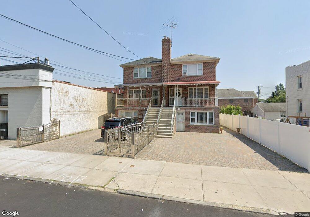
1128 Lydig Ave Bronx, NY 10461
Morris Park NeighborhoodEstimated Value: $864,587 - $1,067,000
Studio
--
Bath
2,520
Sq Ft
$388/Sq Ft
Est. Value
About This Home
This home is located at 1128 Lydig Ave, Bronx, NY 10461 and is currently estimated at $978,647, approximately $388 per square foot. 1128 Lydig Ave is a home located in Bronx County with nearby schools including P.S. 108 Philip J Abinanti, J.H.S. 144 Michelangelo, and Emblaze Academy Charter School.
Ownership History
Date
Name
Owned For
Owner Type
Purchase Details
Closed on
Feb 11, 1998
Sold by
Brescia Joseph M
Bought by
Joseph Ernest and Joseph Venus
Current Estimated Value
Home Financials for this Owner
Home Financials are based on the most recent Mortgage that was taken out on this home.
Original Mortgage
$161,200
Interest Rate
7.09%
Purchase Details
Closed on
Jun 7, 1996
Sold by
Brescia Carla and Brescia Joesph
Bought by
Brescia Joseph
Home Financials for this Owner
Home Financials are based on the most recent Mortgage that was taken out on this home.
Original Mortgage
$160,000
Interest Rate
7.98%
Create a Home Valuation Report for This Property
The Home Valuation Report is an in-depth analysis detailing your home's value as well as a comparison with similar homes in the area
Home Values in the Area
Average Home Value in this Area
Purchase History
| Date | Buyer | Sale Price | Title Company |
|---|---|---|---|
| Joseph Ernest | $201,500 | First American Title Ins Co | |
| Joseph Ernest | $201,500 | First American Title Ins Co | |
| Brescia Joseph | -- | -- | |
| Brescia Joseph M | -- | Commonwealth Land Title Ins | |
| Brescia Joseph M | -- | Commonwealth Land Title Ins |
Source: Public Records
Mortgage History
| Date | Status | Borrower | Loan Amount |
|---|---|---|---|
| Previous Owner | Joseph Ernest | $161,200 | |
| Previous Owner | Brescia Joseph M | $160,000 |
Source: Public Records
Tax History
| Year | Tax Paid | Tax Assessment Tax Assessment Total Assessment is a certain percentage of the fair market value that is determined by local assessors to be the total taxable value of land and additions on the property. | Land | Improvement |
|---|---|---|---|---|
| 2025 | $7,913 | $41,126 | $7,542 | $33,584 |
| 2024 | $7,913 | $39,398 | $7,630 | $31,768 |
| 2023 | $8,001 | $39,398 | $6,559 | $32,839 |
| 2022 | $7,630 | $48,120 | $9,540 | $38,580 |
| 2021 | $7,645 | $41,340 | $9,540 | $31,800 |
| 2020 | $6,549 | $42,720 | $9,540 | $33,180 |
| 2019 | $6,163 | $34,500 | $9,540 | $24,960 |
| 2018 | $6,395 | $32,832 | $7,757 | $25,075 |
| 2017 | $6,193 | $31,849 | $8,540 | $23,309 |
| 2016 | $5,742 | $30,273 | $9,116 | $21,157 |
| 2015 | $3,404 | $28,560 | $10,620 | $17,940 |
| 2014 | $3,404 | $27,360 | $10,620 | $16,740 |
Source: Public Records
Map
Nearby Homes
- 1100 Neill Ave
- 1054 Lydig Ave
- 1942 Haight Ave
- 1059 Neill Ave
- 1194 Lydig Ave
- 1917 Haight Ave
- 1912 Haight Ave
- 1922 Hering Ave
- 1214 Pelham Pkwy S
- 1116 Rhinelander Ave
- 1863 Williamsbridge Rd
- 2019 Colden Ave
- - Lydig Ave
- 2037 Radcliff Ave
- 1850 Hone Ave
- 2129 Muliner Ave
- 1178 Astor Ave
- 1242 Pawnee Place
- 1818 Tomlinson Ave
- 2004 Bogart Ave
- 1126 Lydig Ave
- 1120 Lydig Ave
- 2034 Tomlinson Ave
- 2051 Williamsbridge Rd
- 2045 Williamsbridge Rd
- 2055-2059 Williamsbridge Rd
- 2032 Tomlinson Ave
- 2027 Williamsbridge Rd
- 2049 Williamsbridge Rd
- 2028 Tomlinson Ave
- 2102 Tomlinson Ave
- 2102 Tomlinson Ave Unit B1
- 2021-2025 Williamsbridge Rd
- 1118 Lydig Ave
- 2101 Williamsbridge Rd
- 2022 Tomlinson Ave
- 2106 Tomlinson Ave
- 2108 Tomlinson Ave
- 2015-2019 Williamsbridge Rd
- 1110 Lydig Ave
Your Personal Tour Guide
Ask me questions while you tour the home.