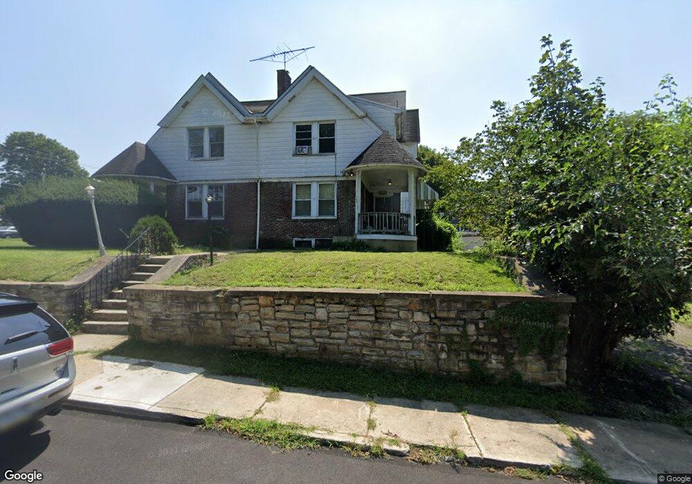
1128 Olive St Coatesville, PA 19320
Estimated Value: $182,000 - $272,000
3
Beds
1
Bath
1,328
Sq Ft
$180/Sq Ft
Est. Value
About This Home
This home is located at 1128 Olive St, Coatesville, PA 19320 and is currently estimated at $239,476, approximately $180 per square foot. 1128 Olive St is a home located in Chester County with nearby schools including Caln Elementary School, Coatesville Intermediate High School, and Coatesville Area Senior High School.
Ownership History
Date
Name
Owned For
Owner Type
Purchase Details
Closed on
Jul 21, 2004
Sold by
Taylor Doreen L and Taylor George T
Bought by
Eubanks Che A and Eubanks Arlene M
Current Estimated Value
Home Financials for this Owner
Home Financials are based on the most recent Mortgage that was taken out on this home.
Original Mortgage
$113,900
Outstanding Balance
$63,378
Interest Rate
8%
Mortgage Type
Purchase Money Mortgage
Estimated Equity
$176,098
Purchase Details
Closed on
Jan 3, 1996
Sold by
Taylor Doreen L
Bought by
Taylor George T and Taylor Doreen L
Purchase Details
Closed on
Jun 30, 1995
Sold by
Hiscock Marie B
Bought by
Taylor Doreen L
Home Financials for this Owner
Home Financials are based on the most recent Mortgage that was taken out on this home.
Original Mortgage
$82,955
Interest Rate
7.7%
Mortgage Type
FHA
Create a Home Valuation Report for This Property
The Home Valuation Report is an in-depth analysis detailing your home's value as well as a comparison with similar homes in the area
Home Values in the Area
Average Home Value in this Area
Purchase History
| Date | Buyer | Sale Price | Title Company |
|---|---|---|---|
| Eubanks Che A | $135,000 | -- | |
| Taylor George T | -- | -- | |
| Taylor Doreen L | $83,000 | -- |
Source: Public Records
Mortgage History
| Date | Status | Borrower | Loan Amount |
|---|---|---|---|
| Open | Eubanks Che A | $113,900 | |
| Previous Owner | Taylor Doreen L | $82,955 |
Source: Public Records
Tax History Compared to Growth
Tax History
| Year | Tax Paid | Tax Assessment Tax Assessment Total Assessment is a certain percentage of the fair market value that is determined by local assessors to be the total taxable value of land and additions on the property. | Land | Improvement |
|---|---|---|---|---|
| 2025 | $4,888 | $81,290 | $20,200 | $61,090 |
| 2024 | $4,888 | $81,290 | $20,200 | $61,090 |
| 2023 | $4,839 | $81,290 | $20,200 | $61,090 |
| 2022 | $4,715 | $81,290 | $20,200 | $61,090 |
| 2021 | $4,594 | $81,290 | $20,200 | $61,090 |
| 2020 | $4,579 | $81,290 | $20,200 | $61,090 |
| 2019 | $4,461 | $81,290 | $20,200 | $61,090 |
| 2018 | $4,312 | $81,290 | $20,200 | $61,090 |
| 2017 | $4,194 | $81,290 | $20,200 | $61,090 |
| 2016 | $3,196 | $81,290 | $20,200 | $61,090 |
| 2015 | $3,196 | $81,290 | $20,200 | $61,090 |
| 2014 | $3,196 | $81,290 | $20,200 | $61,090 |
Source: Public Records
Map
Nearby Homes
- 1263 E Diamond St
- 826 Stirling St
- 824 Stirling St
- 901 Merchant St Unit 60
- 1050 Wayne Ave
- 69 Palmer Ave
- 124 Chester Ave
- 440 Oak St
- 131 Pennsylvania Ave
- 420 Glendale Ave
- 298 N Chester Ave
- 499 Prospect Ave
- 622 Walnut St
- 209 Kendig Ln
- 215 Kennedy Dr
- 213 Kennedy Dr
- 65 Lukens Mill Dr Unit 154
- 111 Lukens Mill Dr Unit 50
- 43 S 5th Ave
- 214 Andrew Rd
- 1130 Olive St
- 1122 Olive St
- 1118 Olive St
- 1116 Olive St
- 1143 Stirling St
- 1141 Stirling St
- 1149 Stirling St
- 1127 Olive St
- 1139 Stirling St
- 1123 Olive St
- 1131 Olive St
- 1137 Stirling St
- 25 S 12th Ave
- 1121 Olive St
- 1114 Olive St
- 1135 Stirling St
- 1133 Stirling St
- 1119 Olive St
- 1201 Stirling St
- 31 S 12th Ave