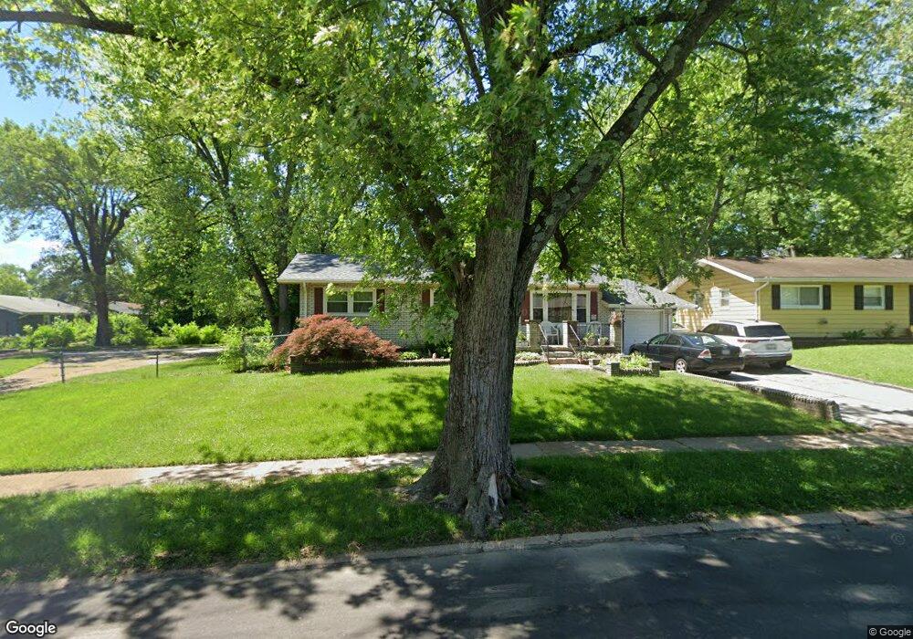
1128 Renshaw Dr Saint Louis, MO 63135
Estimated Value: $118,000 - $136,000
3
Beds
1
Bath
1,216
Sq Ft
$102/Sq Ft
Est. Value
About This Home
This home is located at 1128 Renshaw Dr, Saint Louis, MO 63135 and is currently estimated at $124,575, approximately $102 per square foot. 1128 Renshaw Dr is a home located in St. Louis County with nearby schools including Griffith Elementary School, Ferguson Middle School, and McCluer High School.
Ownership History
Date
Name
Owned For
Owner Type
Purchase Details
Closed on
Jul 16, 1999
Sold by
Williamson Rufus L and Williamson Repunzel J
Bought by
Pendleton Marva M
Current Estimated Value
Home Financials for this Owner
Home Financials are based on the most recent Mortgage that was taken out on this home.
Original Mortgage
$69,900
Outstanding Balance
$19,440
Interest Rate
7.47%
Estimated Equity
$105,135
Create a Home Valuation Report for This Property
The Home Valuation Report is an in-depth analysis detailing your home's value as well as a comparison with similar homes in the area
Home Values in the Area
Average Home Value in this Area
Purchase History
| Date | Buyer | Sale Price | Title Company |
|---|---|---|---|
| Pendleton Marva M | $69,900 | -- |
Source: Public Records
Mortgage History
| Date | Status | Borrower | Loan Amount |
|---|---|---|---|
| Open | Pendleton Marva M | $69,900 |
Source: Public Records
Tax History Compared to Growth
Tax History
| Year | Tax Paid | Tax Assessment Tax Assessment Total Assessment is a certain percentage of the fair market value that is determined by local assessors to be the total taxable value of land and additions on the property. | Land | Improvement |
|---|---|---|---|---|
| 2025 | $1,787 | $27,150 | $3,840 | $23,310 |
| 2024 | $1,787 | $24,680 | $3,440 | $21,240 |
| 2023 | $1,777 | $24,680 | $3,440 | $21,240 |
| 2022 | $1,425 | $17,180 | $4,410 | $12,770 |
| 2021 | $1,379 | $17,180 | $4,410 | $12,770 |
| 2020 | $1,299 | $14,530 | $2,220 | $12,310 |
| 2019 | $1,274 | $14,530 | $2,220 | $12,310 |
| 2018 | $1,185 | $12,030 | $2,720 | $9,310 |
| 2017 | $1,162 | $12,030 | $2,720 | $9,310 |
| 2016 | $1,426 | $14,600 | $2,720 | $11,880 |
| 2015 | $1,436 | $14,600 | $2,720 | $11,880 |
| 2014 | $1,399 | $14,060 | $2,790 | $11,270 |
Source: Public Records
Map
Nearby Homes
- 125 Forestwood Dr
- 1006 Highmont Dr
- 315 S Dellwood Dr
- 1321 Highmont Dr
- 50 Fenwick Dr
- 299 Dashwood Dr
- 49 S Dellwood Ave
- 109 Florwood Ct
- 33 S Schlueter Ave
- 1325 Kappel Dr
- 1347 Kappel Dr
- 1304 Lang Dr
- 324 Gage Dr
- 1330 Chambers Rd
- 141 S Barat Ave
- 135 S Barat Ave
- 9619 Perch Dr
- 29 Godfrey Ln
- 1209 Chambers Rd
- 38 Westdell Dr
- 1124 Renshaw Dr
- 227 Forestwood Dr
- 1129 Highmont Dr
- 1133 Highmont Dr
- 1120 Renshaw Dr
- 239 Forestwood Dr
- 1125 Highmont Dr
- 1137 Highmont Dr
- 1129 Renshaw Dr
- 1121 Highmont Dr
- 243 Forestwood Dr
- 1116 Renshaw Dr
- 1135 Renshaw Dr
- 1123 Renshaw Dr
- 1119 Renshaw Dr
- 230 Forestwood Dr
- 1112 Renshaw Dr
- 247 Forestwood Dr
- 236 Forestwood Dr
- 224 Forestwood Dr