Estimated Value: $248,000 - $320,000
3
Beds
2
Baths
2,121
Sq Ft
$138/Sq Ft
Est. Value
About This Home
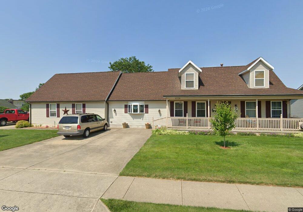
This home is located at 1128 Rockwell Dr, Xenia, OH 45385 and is currently estimated at $291,836, approximately $137 per square foot. 1128 Rockwell Dr is a home located in Greene County with nearby schools including Xenia High School, Summit Academy Community School for Alternative Learners - Xenia, and Legacy Christian Academy.
Ownership History
Date
Name
Owned For
Owner Type
Purchase Details
Closed on
Apr 22, 2009
Sold by
Reynolds Sandra D and Mccaw Sandy D
Bought by
Reynolds Iii Thomas F
Current Estimated Value
Purchase Details
Closed on
May 13, 2005
Sold by
Reynolds Thomas F
Bought by
Reynolds Iii Thomas F
Home Financials for this Owner
Home Financials are based on the most recent Mortgage that was taken out on this home.
Original Mortgage
$77,300
Outstanding Balance
$23,364
Interest Rate
5.87%
Mortgage Type
New Conventional
Estimated Equity
$268,472
Purchase Details
Closed on
Oct 19, 2001
Sold by
Reynolds Thomas F
Bought by
Reynolds Sherry S
Purchase Details
Closed on
Jul 6, 1995
Sold by
Altick & Assoc Inc
Bought by
Reynolds Thomas F and Reynolds S
Home Financials for this Owner
Home Financials are based on the most recent Mortgage that was taken out on this home.
Original Mortgage
$99,250
Interest Rate
7.9%
Mortgage Type
New Conventional
Create a Home Valuation Report for This Property
The Home Valuation Report is an in-depth analysis detailing your home's value as well as a comparison with similar homes in the area
Home Values in the Area
Average Home Value in this Area
Purchase History
| Date | Buyer | Sale Price | Title Company |
|---|---|---|---|
| Reynolds Iii Thomas F | -- | None Available | |
| Reynolds Iii Thomas F | -- | -- | |
| Reynolds Sherry S | -- | -- | |
| Reynolds Thomas F | $112,000 | -- |
Source: Public Records
Mortgage History
| Date | Status | Borrower | Loan Amount |
|---|---|---|---|
| Open | Reynolds Iii Thomas F | $77,300 | |
| Closed | Reynolds Thomas F | $99,250 |
Source: Public Records
Tax History Compared to Growth
Tax History
| Year | Tax Paid | Tax Assessment Tax Assessment Total Assessment is a certain percentage of the fair market value that is determined by local assessors to be the total taxable value of land and additions on the property. | Land | Improvement |
|---|---|---|---|---|
| 2024 | $3,916 | $93,930 | $14,480 | $79,450 |
| 2023 | $3,916 | $93,930 | $14,480 | $79,450 |
| 2022 | $3,192 | $65,260 | $10,340 | $54,920 |
| 2021 | $3,235 | $65,260 | $10,340 | $54,920 |
| 2020 | $3,096 | $65,260 | $10,340 | $54,920 |
| 2019 | $2,648 | $52,540 | $9,310 | $43,230 |
| 2018 | $2,658 | $52,540 | $9,310 | $43,230 |
| 2017 | $2,505 | $52,540 | $9,310 | $43,230 |
| 2016 | $2,505 | $48,620 | $9,310 | $39,310 |
| 2015 | $2,512 | $48,620 | $9,310 | $39,310 |
| 2014 | $2,403 | $48,620 | $9,310 | $39,310 |
Source: Public Records
Map
Nearby Homes
- 1144 Rockwell Dr
- 1342 Kylemore Dr
- 1568 Cheyenne Dr
- 1618 Navajo Dr
- 1208 Bellbrook Ave
- 1272 Bellbrook Ave
- 1391 June Dr
- 1283 June Dr
- 1233 June Dr
- 1223 June Dr
- 1653 Seneca Dr
- 1778 Arapaho Dr
- 1430 Reid Ave
- 121 S Progress Dr
- 1403 Texas Dr
- 1769 Gayhart Dr
- 2758 Wyoming Dr
- 1829 Gayhart Dr
- 161 Montana Dr
- 1866 Roxbury Dr
- 1136 Rockwell Dr
- 1116 Rockwell Dr
- 1152 Rockwell Dr
- 619 Buckskin Trail
- 1160 Rockwell Dr
- 641 Buckskin Trail
- 1168 Rockwell Dr
- 628 Buckskin Trail
- 655 Buckskin Trail
- 1176 Rockwell Dr
- 638 Buckskin Trail
- 667 Buckskin Trail
- 1577 W 2nd St
- 802 Tomahawk Trail
- 1184 Rockwell Dr
- 679 Buckskin Trail
- 814 Tomahawk Trail
- 664 Buckskin Trail
- 1435 W 2nd St
- 693 Buckskin Trail