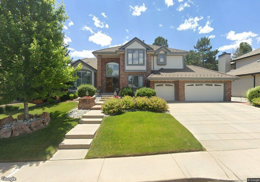
11283 W Asbury Ave Lakewood, CO 80227
Green Mountain NeighborhoodEstimated Value: $1,325,000 - $1,476,000
5
Beds
5
Baths
4,808
Sq Ft
$289/Sq Ft
Est. Value
About This Home
This home is located at 11283 W Asbury Ave, Lakewood, CO 80227 and is currently estimated at $1,390,046, approximately $289 per square foot. 11283 W Asbury Ave is a home located in Jefferson County with nearby schools including Devinny Elementary School, Dunstan Middle School, and Green Mountain High School.
Ownership History
Date
Name
Owned For
Owner Type
Purchase Details
Closed on
Nov 15, 2016
Sold by
Duong Andy and Truong Tammy
Bought by
Morgan James and Metcalfe Jamie
Current Estimated Value
Home Financials for this Owner
Home Financials are based on the most recent Mortgage that was taken out on this home.
Original Mortgage
$83,000
Outstanding Balance
$61,220
Interest Rate
3.42%
Mortgage Type
Credit Line Revolving
Estimated Equity
$1,328,826
Purchase Details
Closed on
Mar 23, 2007
Sold by
The Chih Ted Yang Trust
Bought by
Duong Andy and Truong Tammy
Home Financials for this Owner
Home Financials are based on the most recent Mortgage that was taken out on this home.
Original Mortgage
$385,395
Interest Rate
6.26%
Mortgage Type
Purchase Money Mortgage
Purchase Details
Closed on
Jul 14, 2003
Sold by
Yang Chih Ted and Yang Eveline Liu
Bought by
The Chih Ted Yang Trust
Home Financials for this Owner
Home Financials are based on the most recent Mortgage that was taken out on this home.
Original Mortgage
$150,000
Interest Rate
5.15%
Mortgage Type
Purchase Money Mortgage
Purchase Details
Closed on
Jun 1, 2001
Sold by
Yang Chih Ted and Yang Eveline Liu
Bought by
The Chih Ted Yang Trust
Home Financials for this Owner
Home Financials are based on the most recent Mortgage that was taken out on this home.
Original Mortgage
$150,000
Interest Rate
7.08%
Purchase Details
Closed on
Aug 1, 2000
Sold by
Yang Chih Ted and Yang Eveline Liu
Bought by
The Chih Ted Yang Trust
Purchase Details
Closed on
May 18, 2000
Sold by
Mitchell Peter E Mitchell Wendy L
Bought by
Yang Chih Ted and Yang Eveline Liu
Home Financials for this Owner
Home Financials are based on the most recent Mortgage that was taken out on this home.
Original Mortgage
$150,000
Interest Rate
8.19%
Purchase Details
Closed on
Apr 30, 1999
Sold by
Hopfenbeck James A and Hopfenbeck Sarah M
Bought by
Mitchell Peter E and Mitchell Wendy L
Home Financials for this Owner
Home Financials are based on the most recent Mortgage that was taken out on this home.
Original Mortgage
$388,000
Interest Rate
6.99%
Create a Home Valuation Report for This Property
The Home Valuation Report is an in-depth analysis detailing your home's value as well as a comparison with similar homes in the area
Home Values in the Area
Average Home Value in this Area
Purchase History
| Date | Buyer | Sale Price | Title Company |
|---|---|---|---|
| Morgan James | $700,000 | Heritage Title Co | |
| Duong Andy | $650,000 | Security Title | |
| The Chih Ted Yang Trust | -- | Chicago Title Co | |
| Yang Chih Ted | -- | Chicago Title Co | |
| The Chih Ted Yang Trust | -- | -- | |
| Yang Chih Ted | -- | -- | |
| The Chih Ted Yang Trust | -- | -- | |
| Yang Chih Ted | $500,000 | -- | |
| Mitchell Peter E | $485,000 | Land Title |
Source: Public Records
Mortgage History
| Date | Status | Borrower | Loan Amount |
|---|---|---|---|
| Open | Morgan James | $83,000 | |
| Previous Owner | Duong Andy | $385,395 | |
| Previous Owner | Yang Chih Ted | $150,000 | |
| Previous Owner | Yang Chih Ted | $150,000 | |
| Previous Owner | Yang Chih Ted | $150,000 | |
| Previous Owner | Mitchell Peter E | $388,000 |
Source: Public Records
Tax History Compared to Growth
Tax History
| Year | Tax Paid | Tax Assessment Tax Assessment Total Assessment is a certain percentage of the fair market value that is determined by local assessors to be the total taxable value of land and additions on the property. | Land | Improvement |
|---|---|---|---|---|
| 2024 | $6,787 | $74,379 | $25,295 | $49,084 |
| 2023 | $6,787 | $74,379 | $25,295 | $49,084 |
| 2022 | $5,581 | $59,690 | $21,559 | $38,131 |
| 2021 | $5,659 | $61,407 | $22,179 | $39,228 |
| 2020 | $5,206 | $56,678 | $19,252 | $37,426 |
| 2019 | $5,139 | $56,678 | $19,252 | $37,426 |
| 2018 | $5,156 | $54,929 | $15,735 | $39,194 |
| 2017 | $4,541 | $54,929 | $15,735 | $39,194 |
| 2016 | $4,578 | $51,622 | $11,169 | $40,453 |
| 2015 | $4,763 | $51,622 | $11,169 | $40,453 |
| 2014 | $4,763 | $49,225 | $10,189 | $39,036 |
Source: Public Records
Map
Nearby Homes
- 2064 S Robb Way
- 2252 S Queen St
- 11465 W Atlantic Ave
- 11165 W Asbury Ave
- 2154 S Parfet Dr
- 10890 W Evans Ave Unit 2E
- 10866 W Evans Ave Unit 56
- 1936 S Routt Ct
- 11904 W Auburn Dr
- 1901 S Union Place
- 1865 S Union Blvd
- 1847 S Union Blvd Unit 36
- 1822 S Robb St
- 10390 W Evans Ave
- 10349 W Wesley Dr
- 10490 W Jewell Ave Unit C
- 10490 W Jewell Ave Unit D
- 10430 W Jewell Ave Unit B
- 1799 S Van Gordon Ct
- 10340 W Jewell Ave Unit C
- 11273 W Asbury Ave
- 11293 W Asbury Ave
- 2066 S Robb Way
- 11263 W Asbury Ave
- 2070 S Robb Way
- 11284 W Asbury Ave
- 11274 W Asbury Ave
- 11294 W Asbury Ave
- 11264 W Asbury Ave
- 2062 S Robb Way
- 2234 S Queen St
- 11253 W Asbury Ave
- 2242 S Queen St
- 11416 W Atlantic Ave
- 11254 W Asbury Ave
- 2232 S Queen St
- 2225 S Queen St
- 11426 W Atlantic Ave
- 2244 S Queen St
- 2071 S Robb Way