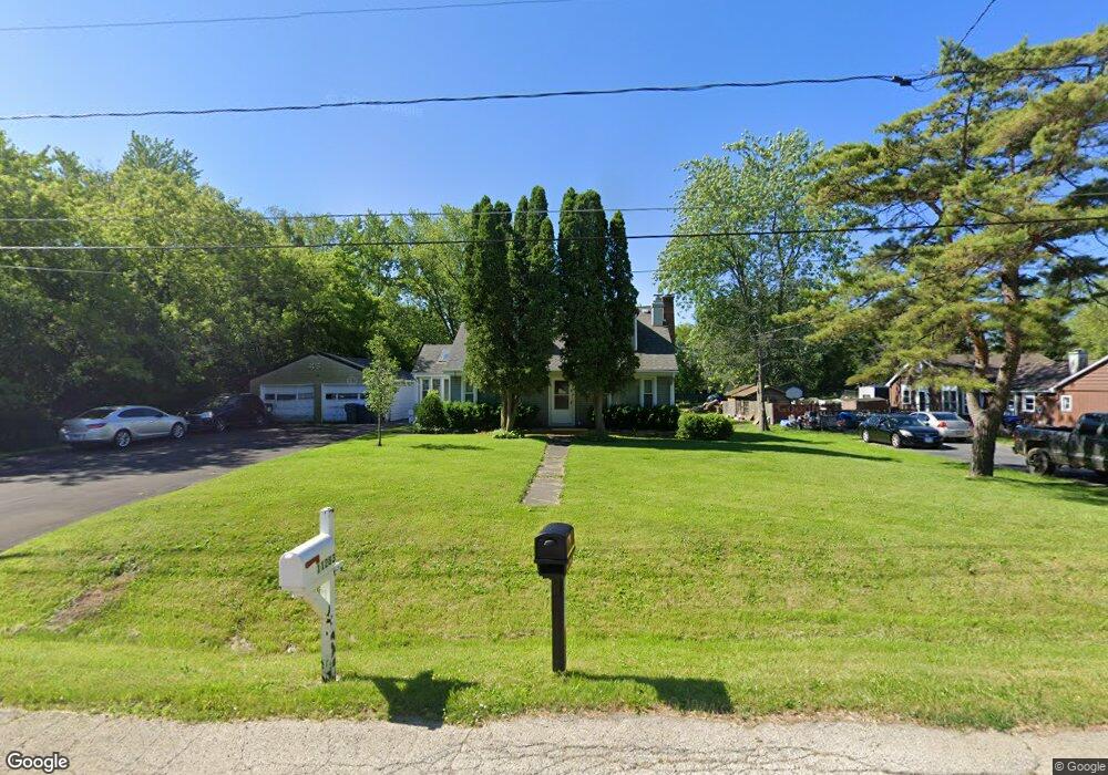
11283 W Carnahan Ave Beach Park, IL 60099
Estimated Value: $267,000 - $296,000
3
Beds
2
Baths
1,474
Sq Ft
$192/Sq Ft
Est. Value
About This Home
This home is located at 11283 W Carnahan Ave, Beach Park, IL 60099 and is currently estimated at $283,687, approximately $192 per square foot. 11283 W Carnahan Ave is a home located in Lake County with nearby schools including Oak Crest School, Beach Park Middle School, and Zion-Benton Township High School.
Ownership History
Date
Name
Owned For
Owner Type
Purchase Details
Closed on
Jan 4, 2000
Sold by
Franco Marcela V
Bought by
Franco Alfonso and Franco Lydia V
Current Estimated Value
Home Financials for this Owner
Home Financials are based on the most recent Mortgage that was taken out on this home.
Original Mortgage
$115,000
Interest Rate
8%
Purchase Details
Closed on
Sep 22, 1999
Sold by
Franco Alfonso V
Bought by
Franco Marcela V and Franco Alfonso
Purchase Details
Closed on
Sep 10, 1997
Sold by
Franco Alfonso V
Bought by
Franco Alfonso V and Franco Marcela V
Purchase Details
Closed on
Aug 7, 1996
Sold by
Rodriguez Irene C
Bought by
Franco Alfonso V
Create a Home Valuation Report for This Property
The Home Valuation Report is an in-depth analysis detailing your home's value as well as a comparison with similar homes in the area
Home Values in the Area
Average Home Value in this Area
Purchase History
| Date | Buyer | Sale Price | Title Company |
|---|---|---|---|
| Franco Alfonso | -- | -- | |
| Franco Marcela V | -- | -- | |
| Franco Alfonso V | -- | -- | |
| Franco Alfonso V | -- | -- |
Source: Public Records
Mortgage History
| Date | Status | Borrower | Loan Amount |
|---|---|---|---|
| Closed | Franco Alfonso | $115,000 |
Source: Public Records
Tax History Compared to Growth
Tax History
| Year | Tax Paid | Tax Assessment Tax Assessment Total Assessment is a certain percentage of the fair market value that is determined by local assessors to be the total taxable value of land and additions on the property. | Land | Improvement |
|---|---|---|---|---|
| 2024 | $7,234 | $76,127 | $12,641 | $63,486 |
| 2023 | $6,968 | $67,850 | $12,203 | $55,647 |
| 2022 | $6,968 | $64,448 | $11,885 | $52,563 |
| 2021 | $6,061 | $52,894 | $11,583 | $41,311 |
| 2020 | $5,964 | $50,477 | $11,054 | $39,423 |
| 2019 | $5,964 | $47,891 | $10,488 | $37,403 |
| 2018 | $6,100 | $47,057 | $12,643 | $34,414 |
| 2017 | $6,068 | $44,268 | $11,894 | $32,374 |
| 2016 | $5,940 | $42,144 | $11,323 | $30,821 |
| 2015 | $5,816 | $38,650 | $10,384 | $28,266 |
| 2014 | $5,139 | $42,669 | $7,957 | $34,712 |
| 2012 | $5,201 | $44,341 | $8,269 | $36,072 |
Source: Public Records
Map
Nearby Homes
- 11345 W Carnahan Ave
- 11382 W Leland Ave
- 11342-11346 W Wadsworth Rd
- 38683 N Lewis Ave
- 1121 Otto Graham Ln
- 38571 N Cedar Ave
- 1730 W Beach Rd
- 3931 Bertrand Ln
- 1667 W Beach Rd Unit 1667
- 1677 W Beach Rd Unit 1677
- 10765 W Liberty Ave
- 2614 33rd St
- 3225 Gilead Ave
- 38176 N De Woody Rd
- 3224 Gilboa Ave
- 3221 Gideon Ave
- 3411 N Lewis Ave
- 38362 N Manor Ave
- 3101 Gilboa Ave
- 37966 N Cornell Rd
- 11303 W Carnahan Ave
- 11284 W Carnahan Ave
- 11292 W Carnahan Ave
- 11327 W Carnahan Ave
- 11256 W Carnahan Ave
- 11320 W Carnahan Ave
- 11236 W Carnahan Ave
- 11239 W Carnahan Ave
- 11338 W Carnahan Ave
- 11220 W Carnahan Ave
- 11363 W Carnahan Ave
- 11221 W Carnahan Ave
- 11328 W Leland Ave
- 11354 W Carnahan Ave
- 11304 W Leland Ave
- 11262 W Leland Ave
- 11346 W Leland Ave
- 11376 W Carnahan Ave
- 11198 W Carnahan Ave
- 11381 W Carnahan Ave