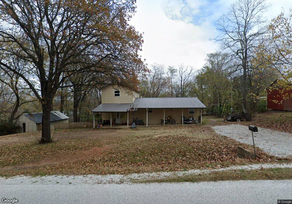
11284 Campbell Rd West Fork, AR 72774
Estimated Value: $165,000 - $412,000
Studio
1
Bath
1,408
Sq Ft
$182/Sq Ft
Est. Value
About This Home
This home is located at 11284 Campbell Rd, West Fork, AR 72774 and is currently estimated at $256,304, approximately $182 per square foot. 11284 Campbell Rd is a home located in Washington County with nearby schools including West Fork Elementary School, West Fork Middle School, and West Fork High School.
Ownership History
Date
Name
Owned For
Owner Type
Purchase Details
Closed on
Jan 27, 2025
Sold by
Watts Bradley A and Channel Tess
Bought by
Simon & Mouse Llc
Current Estimated Value
Home Financials for this Owner
Home Financials are based on the most recent Mortgage that was taken out on this home.
Original Mortgage
$127,500
Outstanding Balance
$87,484
Interest Rate
5.92%
Mortgage Type
Construction
Estimated Equity
$168,820
Purchase Details
Closed on
Jun 16, 2017
Sold by
Henretty Jeff L and Henretty Christina M
Bought by
Watts Bardley A and Watts Channel Tess
Purchase Details
Closed on
Nov 8, 2006
Sold by
Langford Clifford and Langford Sallie
Bought by
Langford Land Co Lllp
Purchase Details
Closed on
Nov 18, 1996
Bought by
Henretty Timothy L
Purchase Details
Closed on
May 9, 1988
Bought by
Henretty Timothy L and Henretty Lisa M
Purchase Details
Closed on
Jan 28, 1988
Bought by
Shackelford Robert R and Shackelford Peggy A
Purchase Details
Closed on
Jan 1, 1985
Bought by
Price Ricky D and Price Ronda L
Create a Home Valuation Report for This Property
The Home Valuation Report is an in-depth analysis detailing your home's value as well as a comparison with similar homes in the area
Home Values in the Area
Average Home Value in this Area
Purchase History
| Date | Buyer | Sale Price | Title Company |
|---|---|---|---|
| Simon & Mouse Llc | $150,000 | None Listed On Document | |
| Watts Bardley A | $126,000 | Waco Title Co | |
| Langford Land Co Lllp | -- | None Available | |
| Henretty Timothy L | -- | -- | |
| Henretty Timothy L | $25,000 | -- | |
| Shackelford Robert R | -- | -- | |
| Price Ricky D | -- | -- |
Source: Public Records
Mortgage History
| Date | Status | Borrower | Loan Amount |
|---|---|---|---|
| Open | Simon & Mouse Llc | $127,500 |
Source: Public Records
Tax History
| Year | Tax Paid | Tax Assessment Tax Assessment Total Assessment is a certain percentage of the fair market value that is determined by local assessors to be the total taxable value of land and additions on the property. | Land | Improvement |
|---|---|---|---|---|
| 2025 | $426 | $31,330 | $6,750 | $24,580 |
| 2024 | $481 | $31,330 | $6,750 | $24,580 |
| 2023 | $516 | $31,330 | $6,750 | $24,580 |
| 2022 | $571 | $20,490 | $3,600 | $16,890 |
| 2021 | $545 | $20,490 | $3,600 | $16,890 |
| 2020 | $519 | $20,490 | $3,600 | $16,890 |
| 2019 | $208 | $11,080 | $3,000 | $8,080 |
| 2018 | $233 | $11,080 | $3,000 | $8,080 |
| 2017 | $166 | $11,080 | $3,000 | $8,080 |
| 2016 | $566 | $11,080 | $3,000 | $8,080 |
| 2015 | $516 | $11,080 | $3,000 | $8,080 |
| 2014 | $595 | $12,770 | $3,000 | $9,770 |
Source: Public Records
Map
Nearby Homes
- 11322 SW Campbell Rd
- 10982 Tony Mountain Rd
- 10845 SW Campbell Rd
- 11498 Tony Mountain Rd
- TBD Butterfield Ave
- 1329 Homestead Ln
- 443 Buckboard Rd
- 1226 N Centennial Ave
- 11487 Tony Mountain Rd
- TBD Mineral Springs Rd
- 657 W Carrol St
- 0 W Carrol St
- 846 James Place
- 815 James Place
- 10092 N Highway 265
- 000 W Circle Dr
- 451 W Horn St
- 10781 Illinois Chapel Rd
- 67 S Red Oak Ave
- 12145 Flowers Rd
- 11284 SE Campbell Rd
- 11274 Campbell Rd
- 11274 SE Campbell Rd
- 11337 Campbell Rd
- 11310 Campbell Rd
- 11214 SE Campbell Rd
- 11369 Campbell Rd
- 11369 SE Campbell Rd
- 11202 Campbell Rd
- 11328 Campbell Rd
- 11202 Campbell Rd
- 11332 Campbell Rd
- 11332 Campbell Rd
- 11399 Campbell Rd
- 11103 SE Campbell Rd
- 0 SE Tbd Campbell
- 11103 Campbell Rd
- 11391 Campbell Rd
- 11391 SE Campbell Rd
- 1129 Campbell Community Rd
Your Personal Tour Guide
Ask me questions while you tour the home.