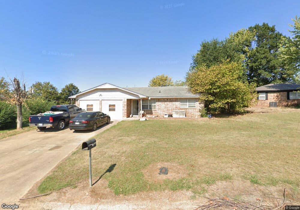
1129 Bob o Link St Sallisaw, OK 74955
Estimated Value: $129,000 - $156,000
3
Beds
2
Baths
1,540
Sq Ft
$95/Sq Ft
Est. Value
About This Home
This home is located at 1129 Bob o Link St, Sallisaw, OK 74955 and is currently estimated at $146,474, approximately $95 per square foot. 1129 Bob o Link St is a home located in Sequoyah County with nearby schools including Liberty Elementary School, Eastside Elementary School, and Sallisaw Middle School.
Ownership History
Date
Name
Owned For
Owner Type
Purchase Details
Closed on
Sep 19, 2006
Sold by
Rogers Randal W and Rogers Shawna A
Bought by
Morgan Tommy Duane and Morgan Sonya Waynette
Current Estimated Value
Home Financials for this Owner
Home Financials are based on the most recent Mortgage that was taken out on this home.
Original Mortgage
$79,170
Outstanding Balance
$47,129
Interest Rate
6.51%
Mortgage Type
FHA
Estimated Equity
$99,345
Purchase Details
Closed on
Aug 24, 2001
Sold by
Goodwin Daryl and Goodwin Paula
Bought by
Parsons David L
Purchase Details
Closed on
Mar 4, 1994
Sold by
Goff James and Goff Shannon
Bought by
Goodwin Paula
Create a Home Valuation Report for This Property
The Home Valuation Report is an in-depth analysis detailing your home's value as well as a comparison with similar homes in the area
Home Values in the Area
Average Home Value in this Area
Purchase History
| Date | Buyer | Sale Price | Title Company |
|---|---|---|---|
| Morgan Tommy Duane | $36,000 | None Available | |
| Parsons David L | $52,000 | -- | |
| Goodwin Paula | $45,000 | -- |
Source: Public Records
Mortgage History
| Date | Status | Borrower | Loan Amount |
|---|---|---|---|
| Open | Morgan Tommy Duane | $79,170 |
Source: Public Records
Tax History Compared to Growth
Tax History
| Year | Tax Paid | Tax Assessment Tax Assessment Total Assessment is a certain percentage of the fair market value that is determined by local assessors to be the total taxable value of land and additions on the property. | Land | Improvement |
|---|---|---|---|---|
| 2024 | $555 | $7,112 | $1,121 | $5,991 |
| 2023 | $555 | $6,905 | $1,120 | $5,785 |
| 2022 | $486 | $6,704 | $1,120 | $5,584 |
| 2021 | $469 | $6,704 | $1,120 | $5,584 |
| 2020 | $461 | $6,320 | $1,044 | $5,276 |
| 2019 | $450 | $6,135 | $1,007 | $5,128 |
| 2018 | $438 | $5,957 | $693 | $5,264 |
| 2017 | $448 | $6,078 | $693 | $5,385 |
| 2016 | $453 | $6,078 | $693 | $5,385 |
| 2015 | $473 | $6,210 | $693 | $5,517 |
| 2014 | $456 | $6,022 | $693 | $5,329 |
Source: Public Records
Map
Nearby Homes
- 1121 N Maple St
- 605 N Maple St
- 403 W Argyle Ave
- 610 N Hickory St
- 401 N Ash St
- 404 N Washington St
- 403 N Maple St
- 310 W Denton Ave
- TBD N Maple St
- 1911 N Maple St
- 204 W Denton Ave
- TBD E 1070 Rd
- 428 N Elm St
- 1705 W Eppler Rd
- 00 U S 59
- 891 W Choctaw Ave
- 469497 E 975th Rd
- 1101 W Taylor Dr
- 0000 N J T Stites St
- 814 W Chickasaw Ave
- 1134 Bob o Link St
- 1125 Bob o Link St
- 1118 Jess Dr
- 1132 Bob o Link St
- 1116 Jess Dr
- 1114 N Boblink
- 1122 Jess Dr
- 1124 Jess Dr
- 1114 Jess Dr
- 1124 Bob o Link St
- 1121 Bob o Link St
- 1114 Bob o Link St
- 1128 Bob o Link St
- 1128 Jess Dr
- 99177 S 4650 Rd
- 1108 Bob o Link St
- 1115 Bob o Link St
- 1209 N Maple St
- 1123 Jess Dr
- 1121 Jess Dr