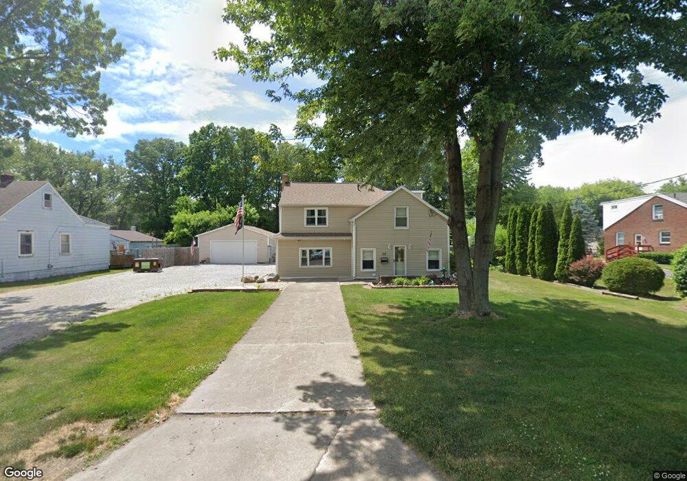
1129 Harrow Rd Toledo, OH 43615
Reynolds Corners NeighborhoodEstimated Value: $126,000 - $219,000
4
Beds
2
Baths
2,270
Sq Ft
$79/Sq Ft
Est. Value
About This Home
This home is located at 1129 Harrow Rd, Toledo, OH 43615 and is currently estimated at $179,131, approximately $78 per square foot. 1129 Harrow Rd is a home located in Lucas County with nearby schools including McTigue Elementary School, Rogers High School, and Horizon Science Academy-Springfield.
Ownership History
Date
Name
Owned For
Owner Type
Purchase Details
Closed on
Jul 25, 2003
Sold by
Sims Rhonda R and Sims Shepherd Rhonda R
Bought by
Shepherd Daniel and Sims Shepherd Rhonda R
Current Estimated Value
Home Financials for this Owner
Home Financials are based on the most recent Mortgage that was taken out on this home.
Original Mortgage
$130,150
Outstanding Balance
$64,502
Interest Rate
7.49%
Mortgage Type
Purchase Money Mortgage
Estimated Equity
$114,629
Purchase Details
Closed on
Jun 24, 1993
Sold by
Sims Manard P and Sims Jackie L
Create a Home Valuation Report for This Property
The Home Valuation Report is an in-depth analysis detailing your home's value as well as a comparison with similar homes in the area
Home Values in the Area
Average Home Value in this Area
Purchase History
| Date | Buyer | Sale Price | Title Company |
|---|---|---|---|
| Shepherd Daniel | -- | Liberty Title Inc | |
| -- | -- | -- |
Source: Public Records
Mortgage History
| Date | Status | Borrower | Loan Amount |
|---|---|---|---|
| Open | Shepherd Daniel | $130,150 |
Source: Public Records
Tax History Compared to Growth
Tax History
| Year | Tax Paid | Tax Assessment Tax Assessment Total Assessment is a certain percentage of the fair market value that is determined by local assessors to be the total taxable value of land and additions on the property. | Land | Improvement |
|---|---|---|---|---|
| 2024 | $1,729 | $54,215 | $8,820 | $45,395 |
| 2023 | $2,812 | $41,370 | $8,225 | $33,145 |
| 2022 | $2,786 | $41,370 | $8,225 | $33,145 |
| 2021 | $2,882 | $41,370 | $8,225 | $33,145 |
| 2020 | $2,734 | $33,950 | $6,755 | $27,195 |
| 2019 | $2,637 | $33,950 | $6,755 | $27,195 |
| 2018 | $2,619 | $33,950 | $6,755 | $27,195 |
| 2017 | $2,536 | $31,360 | $9,275 | $22,085 |
| 2016 | $2,560 | $89,600 | $26,500 | $63,100 |
| 2015 | $2,589 | $89,600 | $26,500 | $63,100 |
| 2014 | $1,973 | $31,370 | $9,280 | $22,090 |
| 2013 | $1,973 | $31,370 | $9,280 | $22,090 |
Source: Public Records
Map
Nearby Homes
- 4860 Airport Hwy
- 1101 Sawyer Rd
- 5665 Camberley Dr
- 1925 Olimphia Rd
- 1916 Birkdale Rd
- 5805 Fryer Ave
- 1930 Birkdale Rd
- 1966 Devinci Dr
- 1709 Acorn Dr
- 428 Deline Dr
- 1911 N Holland Sylvania Rd
- 5331 Fleet Rd
- 5873 Nebraska Ave
- 2113 Broadstone Rd
- 2004 Oakside Rd
- 1715 Brooklynn Park W
- 2015 Oakside Rd
- 2010 Oakside Rd
- 5051 Wissman Rd
- 1985 Oakhaven Rd