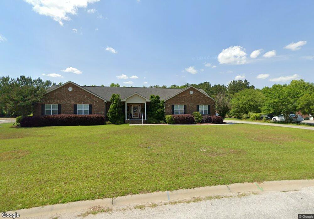
1129 Mckenzie Rd Manning, SC 29102
Estimated Value: $358,872 - $392,000
3
Beds
2
Baths
2,345
Sq Ft
$160/Sq Ft
Est. Value
About This Home
This home is located at 1129 Mckenzie Rd, Manning, SC 29102 and is currently estimated at $376,218, approximately $160 per square foot. 1129 Mckenzie Rd is a home located in Clarendon County with nearby schools including Laurence Manning Academy.
Ownership History
Date
Name
Owned For
Owner Type
Purchase Details
Closed on
Nov 25, 2024
Sold by
Robinson David M and Burtnett-Robinson Patricia
Bought by
Edwards David and Edwards Leona J
Current Estimated Value
Purchase Details
Closed on
Oct 12, 2023
Sold by
Robinson David M
Bought by
Burtnett-Robinson Patricia
Purchase Details
Closed on
Nov 22, 2011
Sold by
Lgb Inc
Bought by
Robinson David M and Robinson Anna P
Create a Home Valuation Report for This Property
The Home Valuation Report is an in-depth analysis detailing your home's value as well as a comparison with similar homes in the area
Purchase History
| Date | Buyer | Sale Price | Title Company |
|---|---|---|---|
| Edwards David | $350,000 | None Listed On Document | |
| Edwards David | $350,000 | None Listed On Document | |
| Burtnett-Robinson Patricia | -- | None Listed On Document | |
| Robinson David M | -- | None Available | |
| Robinson David M | $156,000 | None Available |
Source: Public Records
Tax History
| Year | Tax Paid | Tax Assessment Tax Assessment Total Assessment is a certain percentage of the fair market value that is determined by local assessors to be the total taxable value of land and additions on the property. | Land | Improvement |
|---|---|---|---|---|
| 2025 | $1,895 | $9,348 | $1,800 | $7,548 |
| 2024 | $1,503 | $9,348 | $1,800 | $7,548 |
| 2023 | $1,474 | $9,348 | $1,800 | $7,548 |
| 2022 | $1,456 | $9,348 | $1,800 | $7,548 |
| 2020 | $1,565 | $8,196 | $1,400 | $6,796 |
| 2019 | $1,449 | $8,196 | $1,400 | $6,796 |
| 2018 | $3,938 | $12,294 | $0 | $0 |
| 2017 | $1,030 | $8,196 | $0 | $0 |
| 2016 | $997 | $8,196 | $0 | $0 |
| 2015 | $1,024 | $8,276 | $1,400 | $6,876 |
| 2014 | $1,008 | $8,276 | $1,400 | $6,876 |
| 2013 | -- | $8,276 | $1,400 | $6,876 |
Source: Public Records
Map
Nearby Homes
- 1353 Mckenzie Rd
- 1012 Jonte Dr
- 1038 Jonte Ln
- 4304 Alex Harvin Hwy
- 1036 Allen Rd
- 1146 Oak Grove Church Rd
- 1023 Shortleaf Dr
- 1107 Long Leaf Dr
- 1036 Short Leaf Dr
- 1054 Hickory Ridge Cir
- 1513 Loblolly Dr
- TBD White Oak Dr
- 623 Pickwood Dr
- 617 Pickwood Dr
- 3188 Raccoon Rd
- 950 Berry St
- 610 Gib Dr
- 22 W End St
- 633 Sykes St
- 314 Hopkins St
- 1155 Mckenzie Rd
- 1115 Mckenzie Rd
- 1158 Mckenzie Rd
- 1193 Mckenzie Rd
- 1091 Mckenzie Rd
- 1033 Alayna Dr
- 1172 Mckenzie Rd
- 1072 Mckenzie Rd
- 1073 Alayna Dr
- 1100 Mckenzie Rd
- Lot 2 Mckenzie Rd
- LOT #1 Mckenzie Rd
- LOT #50 Mckenzie Rd
- 0 Mckenzie Rd
- 22 Mckenzie Rd
- 23 Mckenzie Rd
- 50 Mckenzie Rd
- 42 Mckenzie Rd
- 7 Mckenzie Rd
- 8 Mckenzie Rd
Your Personal Tour Guide
Ask me questions while you tour the home.