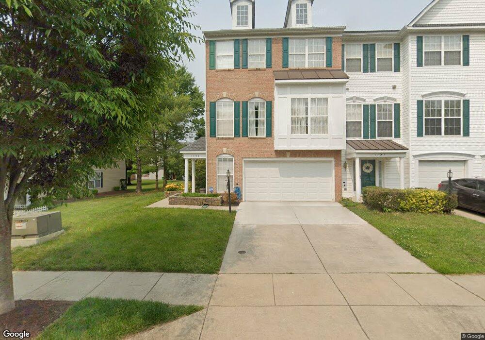
1129 Ring Bill Loop Upper Marlboro, MD 20774
Estimated Value: $477,000 - $518,000
3
Beds
4
Baths
--
Sq Ft
2,614
Sq Ft Lot Lot
About This Home
This home is located at 1129 Ring Bill Loop, Upper Marlboro, MD 20774 and is currently estimated at $503,877. 1129 Ring Bill Loop is a home located in Prince George's County with nearby schools including Perrywood Elementary School, Kettering Middle School, and Largo High School.
Ownership History
Date
Name
Owned For
Owner Type
Purchase Details
Closed on
Mar 28, 2005
Sold by
Hammond John P
Bought by
Hammond John P
Current Estimated Value
Home Financials for this Owner
Home Financials are based on the most recent Mortgage that was taken out on this home.
Original Mortgage
$288,000
Outstanding Balance
$142,513
Interest Rate
5.25%
Mortgage Type
Adjustable Rate Mortgage/ARM
Estimated Equity
$361,364
Purchase Details
Closed on
Nov 6, 2003
Sold by
Washington Homes Of Maryl& I
Bought by
Hammond John P and Hammond Davietta M Carte
Create a Home Valuation Report for This Property
The Home Valuation Report is an in-depth analysis detailing your home's value as well as a comparison with similar homes in the area
Home Values in the Area
Average Home Value in this Area
Purchase History
| Date | Buyer | Sale Price | Title Company |
|---|---|---|---|
| Hammond John P | -- | -- | |
| Hammond John P | $254,963 | -- |
Source: Public Records
Mortgage History
| Date | Status | Borrower | Loan Amount |
|---|---|---|---|
| Open | Hammond John P | $288,000 |
Source: Public Records
Tax History
| Year | Tax Paid | Tax Assessment Tax Assessment Total Assessment is a certain percentage of the fair market value that is determined by local assessors to be the total taxable value of land and additions on the property. | Land | Improvement |
|---|---|---|---|---|
| 2025 | $5,576 | $450,400 | $110,000 | $340,400 |
| 2024 | $5,576 | $422,533 | -- | -- |
| 2023 | $4,389 | $394,667 | $0 | $0 |
| 2022 | $4,079 | $366,800 | $75,000 | $291,800 |
| 2021 | $7,844 | $354,333 | $0 | $0 |
| 2020 | $7,611 | $341,867 | $0 | $0 |
| 2019 | $4,668 | $329,400 | $100,000 | $229,400 |
| 2018 | $4,375 | $303,467 | $0 | $0 |
| 2017 | $7,003 | $277,533 | $0 | $0 |
| 2016 | -- | $251,600 | $0 | $0 |
| 2015 | $4,098 | $251,600 | $0 | $0 |
| 2014 | $4,098 | $251,600 | $0 | $0 |
Source: Public Records
Map
Nearby Homes
- 13506 Perrywood Ct
- 1410 Leeland Forest Rd Unit 25
- 1404 Rd Unit 28
- 711 Bleak Hill Place
- 13600 Oak Grove Rd
- 607 Rexford Way
- 13609 Hebron Ln
- 13603 Hebron Ln
- 14407 Dormansville Blvd
- 13601 Hebron Ln
- 1309 Merganser Ct
- 1512 Leeland Forest Rd
- 14105 Dormansville Blvd
- 1303 Leeland Knoll Pkwy
- 13719 Hebron Ln
- 13811 Hebron Ln
- 1210 Leeland Knoll Pkwy
- 14608 Goldcrest Foxglove Dr Unit LO-22
- 13403 Hillrod Ln
- 1404 Robert Lewis Ave
- 1127 Ring Bill Loop
- 1125 Ring Bill Loop
- 1133 Ring Bill Loop
- 1123 Ring Bill Loop
- 1135 Ring Bill Loop
- 1137 Ring Bill Loop
- 1226 Blue Wing Terrace
- 1224 Blue Wing Terrace
- 1336 Ring Bill Loop
- 1222 Blue Wing Terrace
- 1139 Ring Bill Loop
- 1130 Ring Bill Loop
- 1132 Ring Bill Loop
- 1220 Blue Wing Terrace
- 1134 Ring Bill Loop
- 1334 Ring Bill Loop
- 1136 Ring Bill Loop
- 1332 Ring Bill Loop
- 1117 Ring Bill Loop
- 1230 Blue Wing Terrace
Your Personal Tour Guide
Ask me questions while you tour the home.