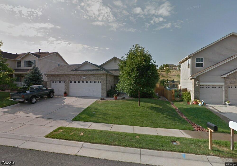
11294 W 54th Ln Arvada, CO 80002
Rainbow Ridge NeighborhoodEstimated Value: $684,952 - $813,000
2
Beds
2
Baths
2,481
Sq Ft
$313/Sq Ft
Est. Value
About This Home
This home is located at 11294 W 54th Ln, Arvada, CO 80002 and is currently estimated at $775,988, approximately $312 per square foot. 11294 W 54th Ln is a home located in Jefferson County with nearby schools including Vanderhoof Elementary School, Drake Junior High School, and Arvada West High School.
Ownership History
Date
Name
Owned For
Owner Type
Purchase Details
Closed on
Apr 1, 2010
Sold by
Chesy Bruce and Rose Chesy Courtney
Bought by
Sullivan John R and Sullivan Carolyn R
Current Estimated Value
Purchase Details
Closed on
Dec 20, 2002
Sold by
Melody Homes Inc
Bought by
Chesy Bruce and Rose Chesy Courtney
Home Financials for this Owner
Home Financials are based on the most recent Mortgage that was taken out on this home.
Original Mortgage
$235,400
Interest Rate
5.89%
Create a Home Valuation Report for This Property
The Home Valuation Report is an in-depth analysis detailing your home's value as well as a comparison with similar homes in the area
Home Values in the Area
Average Home Value in this Area
Purchase History
| Date | Buyer | Sale Price | Title Company |
|---|---|---|---|
| Sullivan John R | $307,000 | Land Title Guarantee Company | |
| Chesy Bruce | $294,264 | Land Title Guarantee Company |
Source: Public Records
Mortgage History
| Date | Status | Borrower | Loan Amount |
|---|---|---|---|
| Previous Owner | Chesy Bruce | $235,400 |
Source: Public Records
Tax History
| Year | Tax Paid | Tax Assessment Tax Assessment Total Assessment is a certain percentage of the fair market value that is determined by local assessors to be the total taxable value of land and additions on the property. | Land | Improvement |
|---|---|---|---|---|
| 2024 | $3,716 | $45,009 | $21,479 | $23,530 |
| 2023 | $3,716 | $45,009 | $21,479 | $23,530 |
| 2022 | $3,074 | $38,340 | $16,636 | $21,704 |
| 2021 | $3,125 | $39,443 | $17,115 | $22,328 |
| 2020 | $3,416 | $35,396 | $14,639 | $20,757 |
| 2019 | $3,370 | $35,396 | $14,639 | $20,757 |
| 2018 | $3,161 | $32,278 | $9,265 | $23,013 |
| 2017 | $2,893 | $32,278 | $9,265 | $23,013 |
| 2016 | $2,737 | $28,765 | $6,994 | $21,771 |
| 2015 | $2,243 | $28,765 | $6,994 | $21,771 |
| 2014 | $2,243 | $22,157 | $7,288 | $14,869 |
Source: Public Records
Map
Nearby Homes
- 11237 W 55th Ln
- 11232 W 53rd Dr
- 5383 Quail St
- 5327 Quail Way
- 5365 Quail St
- 5378 Routt St Unit B
- 5358 Routt St Unit B
- 5240 Routt Ct Unit B
- 5192 Rob Way
- 5218 Routt St Unit A
- 5182 Rob Way
- 5188 Rob Way
- 5537 Lewis Ct Unit 4
- 10336 W 55th Place Unit 204
- 5536 Lewis Ct Unit 101
- 11958 W 57th Place
- 5834 Swadley Ct
- 11890 W 52nd Ave
- 11944 W 57th Dr
- 5779 Taft St
- 11314 W 54th Ln
- 11334 W 54th Ln
- 11254 W 54th Ln
- 11295 W 54th Ln
- 11315 W 54th Ln
- 5529 Quail Ct
- 11354 W 54th Ln
- 11234 W 54th Ln
- 5539 Quail Ct
- 11355 W 54th Ln
- 11214 W 54th Ln
- 5528 Quail Ct
- 5549 Quail Ct
- 11194 W 54th Ln
- 5527 Quail St
- 5548 Quail Ct
- 5559 Quail Ct
- 11174 W 54th Ln
- 11231 W 54th Ave
- 11251 W 54th Ave
Your Personal Tour Guide
Ask me questions while you tour the home.