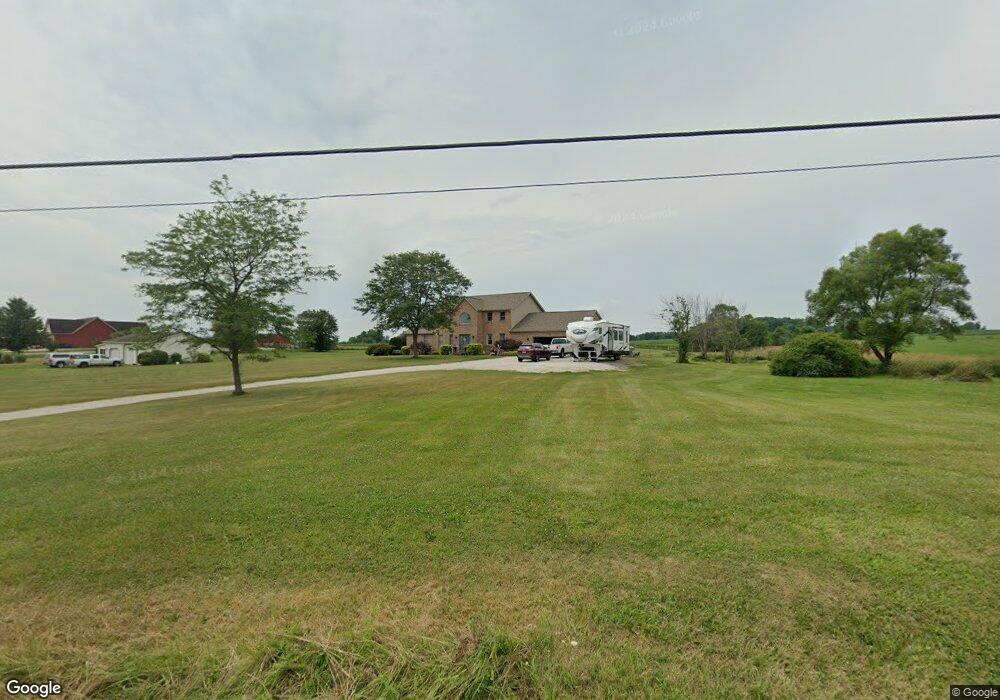
11299 Reeder Ave NE Alliance, OH 44601
Estimated Value: $544,000 - $690,463
4
Beds
3
Baths
3,798
Sq Ft
$157/Sq Ft
Est. Value
About This Home
This home is located at 11299 Reeder Ave NE, Alliance, OH 44601 and is currently estimated at $595,366, approximately $156 per square foot. 11299 Reeder Ave NE is a home located in Stark County with nearby schools including Marlington High School.
Ownership History
Date
Name
Owned For
Owner Type
Purchase Details
Closed on
Sep 22, 2005
Sold by
Eder Michael F and Eder Karrie L
Bought by
Lane Harry S and Lane Michele S
Current Estimated Value
Home Financials for this Owner
Home Financials are based on the most recent Mortgage that was taken out on this home.
Original Mortgage
$177,500
Interest Rate
6.01%
Mortgage Type
Purchase Money Mortgage
Purchase Details
Closed on
Apr 18, 2001
Sold by
George Stevenson and George Lisa A
Bought by
Eder Michael F and Eder Karrie L
Create a Home Valuation Report for This Property
The Home Valuation Report is an in-depth analysis detailing your home's value as well as a comparison with similar homes in the area
Home Values in the Area
Average Home Value in this Area
Purchase History
| Date | Buyer | Sale Price | Title Company |
|---|---|---|---|
| Lane Harry S | $257,500 | First American Title | |
| Eder Michael F | $25,000 | -- |
Source: Public Records
Mortgage History
| Date | Status | Borrower | Loan Amount |
|---|---|---|---|
| Closed | Lane Harry S | $177,500 |
Source: Public Records
Tax History Compared to Growth
Tax History
| Year | Tax Paid | Tax Assessment Tax Assessment Total Assessment is a certain percentage of the fair market value that is determined by local assessors to be the total taxable value of land and additions on the property. | Land | Improvement |
|---|---|---|---|---|
| 2025 | -- | $204,050 | $26,600 | $177,450 |
| 2024 | -- | $243,400 | $29,650 | $213,750 |
| 2023 | $5,912 | $160,370 | $22,330 | $138,040 |
| 2022 | $5,933 | $160,370 | $22,330 | $138,040 |
| 2021 | $5,966 | $160,690 | $22,330 | $138,360 |
| 2020 | $5,251 | $129,680 | $18,760 | $110,920 |
| 2019 | $5,214 | $129,060 | $18,770 | $110,290 |
| 2018 | $4,955 | $129,060 | $18,770 | $110,290 |
| 2017 | $5,045 | $121,650 | $15,200 | $106,450 |
| 2016 | $5,048 | $121,650 | $15,200 | $106,450 |
| 2015 | $5,056 | $121,650 | $15,200 | $106,450 |
| 2014 | $763 | $106,000 | $13,240 | $92,760 |
| 2013 | $2,330 | $106,000 | $13,240 | $92,760 |
Source: Public Records
Map
Nearby Homes
- 0 Reeder Ave NE
- 12355 Edison St NE
- 10666 Wilma Ave NE
- 12252 Snode St NE
- 12415 Snode St NE
- 11960 Freshley Ave NE
- 13109 Edison St NE
- 13334 Cindy St NE
- 0 Meadow St NE
- 11480 Aebi Ave NE
- 1430 Westwood Ave
- 2377 Ansley St Unit 2377
- 0 W Main St Unit 5090123
- 2081 Marwood Cir
- 0 New Milford Rd Unit 5119787
- 2851 Patriots Path Unit 3D
- 2435 Queensbury Rd
- 000 Klinger Ave
- 14920 Mccallum Ave NE
- 14422 Sturbridge Rd NE
- 11267 Reeder Ave NE
- 11241 Reeder Ave NE
- 11292 Reeder Ave NE
- 11224 Reeder Ave NE
- 11184 Reeder Ave NE
- 11480 Reeder Ave NE
- 11481 Reeder Ave NE
- 11119 Reeder Ave NE
- 11225 Reeder Ave NE
- 11049 Reeder Ave NE
- 0 Lair Rd NE Unit 4040793
- 0 Lair Rd NE Unit 3983555
- 0 Lair Rd NE Unit 4420403
- 0 Lair Rd NE Unit 4287412
- 0 Lair Rd NE Unit 4249041
- 0 Lair Rd NE Unit 4209204
- 0 Lair Rd NE Unit 4135732
- 11585 Reeder Ave NE
- 10721 Breit St NE
- 11100 Reeder Ave NE