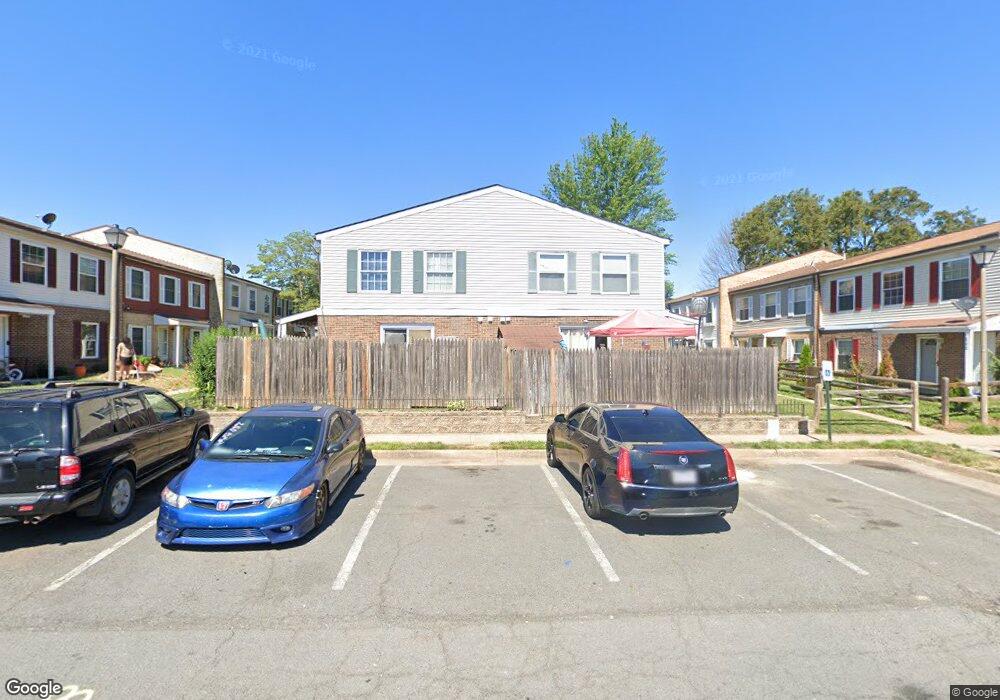
113 Adams Dr NE Unit 35 Leesburg, VA 20176
Estimated Value: $283,000 - $415,000
3
Beds
2
Baths
1,176
Sq Ft
$289/Sq Ft
Est. Value
About This Home
This home is located at 113 Adams Dr NE Unit 35, Leesburg, VA 20176 and is currently estimated at $340,031, approximately $289 per square foot. 113 Adams Dr NE Unit 35 is a home located in Loudoun County with nearby schools including Leesburg Elementary School, Smart's Mill Middle School, and Tuscarora High School.
Ownership History
Date
Name
Owned For
Owner Type
Purchase Details
Closed on
Sep 2, 2022
Sold by
Quaile Limited Liability Company
Bought by
Aveame Community Llc
Current Estimated Value
Purchase Details
Closed on
Nov 17, 2018
Sold by
Pnw Cities Lc
Bought by
Quaile Llc
Purchase Details
Closed on
Apr 7, 2011
Sold by
Sharonview Federal Cu
Bought by
Pnw Cities Llc
Purchase Details
Closed on
Oct 11, 2010
Sold by
Specialized Inc Of Va Sub Tr
Bought by
Sharonview Federal Credit Unio
Purchase Details
Closed on
Nov 5, 2002
Sold by
Farran Johnnie
Bought by
Abuelazan Elias
Home Financials for this Owner
Home Financials are based on the most recent Mortgage that was taken out on this home.
Original Mortgage
$93,000
Interest Rate
6.04%
Mortgage Type
New Conventional
Create a Home Valuation Report for This Property
The Home Valuation Report is an in-depth analysis detailing your home's value as well as a comparison with similar homes in the area
Home Values in the Area
Average Home Value in this Area
Purchase History
| Date | Buyer | Sale Price | Title Company |
|---|---|---|---|
| Aveame Community Llc | $240,000 | -- | |
| Quaile Llc | $173,000 | None Available | |
| Pnw Cities Llc | $108,282 | -- | |
| Sharonview Federal Credit Unio | $88,000 | -- | |
| Abuelazan Elias | $93,000 | -- |
Source: Public Records
Mortgage History
| Date | Status | Borrower | Loan Amount |
|---|---|---|---|
| Previous Owner | Abuelazan Elias | $93,000 |
Source: Public Records
Tax History Compared to Growth
Tax History
| Year | Tax Paid | Tax Assessment Tax Assessment Total Assessment is a certain percentage of the fair market value that is determined by local assessors to be the total taxable value of land and additions on the property. | Land | Improvement |
|---|---|---|---|---|
| 2025 | $2,385 | $296,310 | $100,000 | $196,310 |
| 2024 | $2,349 | $271,520 | $80,000 | $191,520 |
| 2023 | $2,104 | $240,480 | $80,000 | $160,480 |
| 2022 | $2,132 | $239,580 | $55,000 | $184,580 |
| 2021 | $2,043 | $208,480 | $55,000 | $153,480 |
| 2020 | $1,982 | $191,540 | $45,000 | $146,540 |
| 2019 | $1,852 | $177,180 | $45,000 | $132,180 |
| 2018 | $1,876 | $172,870 | $45,000 | $127,870 |
| 2017 | $1,711 | $152,130 | $45,000 | $107,130 |
| 2016 | $1,533 | $133,910 | $0 | $0 |
| 2015 | $319 | $129,550 | $0 | $129,550 |
| 2014 | $272 | $108,580 | $0 | $108,580 |
Source: Public Records
Map
Nearby Homes
- 251 Meadows Ln NE
- 1102 Huntmaster Terrace NE Unit 301
- 710 North St NE
- 1129 Huntmaster Terrace NE Unit 301
- BIRKHALL Plan at Brickyard
- HIGHGROVE Plan at Brickyard
- BALMORAL Plan at Brickyard
- 1148 Keokuk Terrace NE
- 1636 Field Sparrow Terrace NE
- 101 Fort Evans Rd SE Unit F
- 118 Fort Evans Rd SE Unit C
- 514 Covington Terrace NE
- 1504 Shields Terrace NE
- 523 Currant Terrace NE
- 1515 Artillery Terrace NE
- 1204 James Rifle Ct NE
- 216 Wildman St NE
- 1616 Chickasaw Place NE
- 589 Rockbridge Dr SE
- 293 Ariel Dr NE
- 110 Adams Dr NE
- 110 Adams Dr NE Unit 36
- 113 Adams Dr NE
- 111 Adams Dr NE
- 109 Adams Dr NE
- 112 Adams Dr NE
- 114 Adams Dr NE
- 114 Adams Dr NE Unit 37
- 123 Adams Dr NE
- 105 Adams Dr NE
- 106 Adams Dr NE
- 108 Adams Dr NE
- 115 Adams Dr NE Unit 39
- 115 Adams Dr NE
- 104 Adams Dr NE
- 118 Adams Dr NE
- 102 Adams Dr NE Unit 44
- 102 Adams Dr NE
- 107 Adams Dr NE
- 117 Adams Dr NE Unit 30