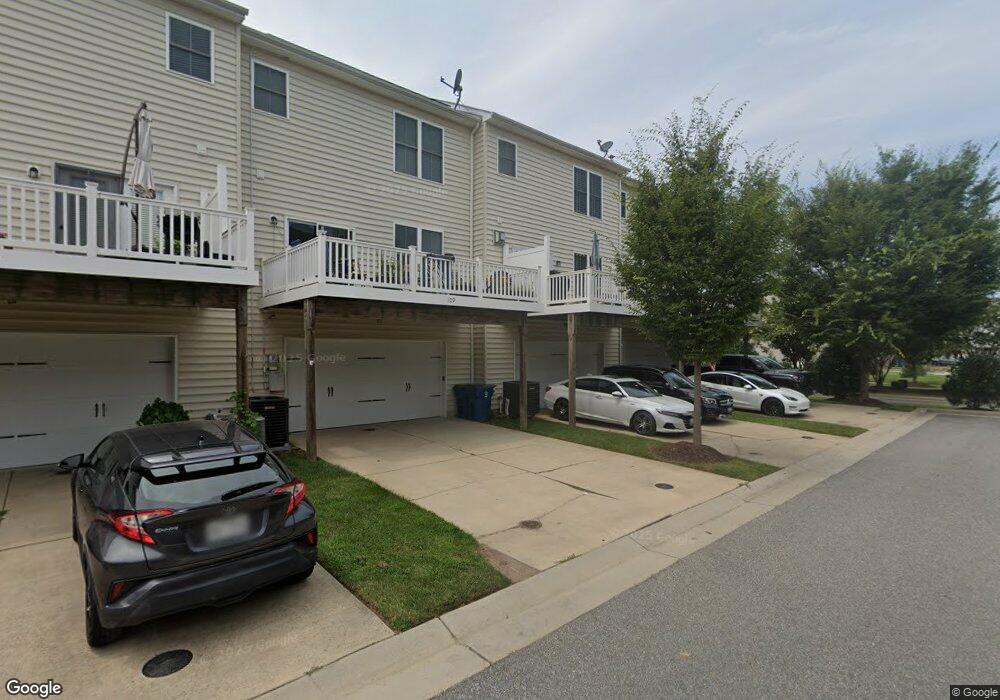
113 Amanda Frances Ln Unit C4 Stevensville, MD 21666
Estimated Value: $469,000 - $526,000
3
Beds
7
Baths
2,304
Sq Ft
$213/Sq Ft
Est. Value
About This Home
This home is located at 113 Amanda Frances Ln Unit C4, Stevensville, MD 21666 and is currently estimated at $490,576, approximately $212 per square foot. 113 Amanda Frances Ln Unit C4 is a home located in Queen Anne's County with nearby schools including Kent Island Elementary School, Bayside Elementary School, and Matapeake Middle School.
Ownership History
Date
Name
Owned For
Owner Type
Purchase Details
Closed on
Jul 31, 2020
Sold by
Woodward Clifford W
Bought by
Booker Ronnie Nathaniel
Current Estimated Value
Home Financials for this Owner
Home Financials are based on the most recent Mortgage that was taken out on this home.
Original Mortgage
$342,424
Outstanding Balance
$304,315
Interest Rate
3.1%
Estimated Equity
$186,261
Purchase Details
Closed on
Apr 24, 2009
Sold by
L H I Ellendale Llc
Bought by
Woodward Clifford W
Create a Home Valuation Report for This Property
The Home Valuation Report is an in-depth analysis detailing your home's value as well as a comparison with similar homes in the area
Home Values in the Area
Average Home Value in this Area
Purchase History
| Date | Buyer | Sale Price | Title Company |
|---|---|---|---|
| Booker Ronnie Nathaniel | $339,000 | Newlyn Ttl Assurance Co Inc | |
| Woodward Clifford W | $348,353 | -- |
Source: Public Records
Mortgage History
| Date | Status | Borrower | Loan Amount |
|---|---|---|---|
| Open | Booker Ronnie Nathaniel | $342,424 |
Source: Public Records
Tax History Compared to Growth
Tax History
| Year | Tax Paid | Tax Assessment Tax Assessment Total Assessment is a certain percentage of the fair market value that is determined by local assessors to be the total taxable value of land and additions on the property. | Land | Improvement |
|---|---|---|---|---|
| 2025 | $3,690 | $391,733 | $0 | $0 |
| 2024 | $3,471 | $368,467 | $0 | $0 |
| 2023 | $3,252 | $345,200 | $125,000 | $220,200 |
| 2022 | $3,203 | $340,000 | $0 | $0 |
| 2021 | $3,211 | $334,800 | $0 | $0 |
| 2020 | $3,161 | $329,600 | $125,000 | $204,600 |
| 2019 | $3,161 | $329,600 | $125,000 | $204,600 |
| 2018 | $3,161 | $329,600 | $125,000 | $204,600 |
| 2017 | $3,052 | $337,000 | $0 | $0 |
| 2016 | -- | $320,767 | $0 | $0 |
| 2015 | $1,523 | $304,533 | $0 | $0 |
| 2014 | $1,523 | $288,300 | $0 | $0 |
Source: Public Records
Map
Nearby Homes
- 105 Amanda Frances Ln
- 119 Keenan Way
- 912 Moorings Cir Unit 8
- 858 Moorings Cir Unit 11
- 103 Liam Thomas Ln
- 821 Moorings Cir Unit 144
- 233 Jessica Lyn Ave
- 127 Topside Dr
- 241 Jessica Lyn Ave
- Townhome Plan at Ellendale Towns
- Townhome - End Unit Plan at Ellendale Towns
- Sanctuary Plan at Ellendale Towns - Ellendale at Kent Island
- 298 Moorings Cir
- 736 Moorings Cir Unit 35
- 349 Topside Dr
- 402 Moorings Cir
- 312 Topside Dr Unit 223
- 440 Moorings Cir Unit 85
- 509 Moorings Cir Unit 249
- 102 Marion Quimby Dr
- 113 Amanda Frances Ln
- 109 Amanda Frances Ln
- 117 Amanda Frances Ln
- 358 Allison Jane Dr
- 101 Amanda Frances Ln
- 114 Amanda Frances Ln
- 110 Amanda Frances Ln
- 118 Amanda Frances Ln
- 106 Amanda Frances Ln
- 106 Amanda Frances Ln Unit C9
- 102 Amanda Frances Ln
- 102 Amanda Frances Ln Unit C-10
- 137 Keenan Way
- 133 Keenan Way
- 125 Keenan Way
- 119 Keenan Way Unit B20
- 250 Liam Thomas Ln Unit D1
- 250 Liam Thomas Ln
- 115 Keenan Way
- 115 Keenan Way Unit B21