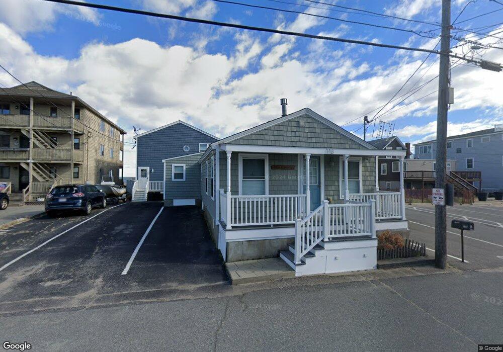
113 Atlantic Ave Salisbury, MA 01952
Estimated Value: $688,000 - $832,000
4
Beds
2
Baths
976
Sq Ft
$777/Sq Ft
Est. Value
About This Home
This home is located at 113 Atlantic Ave, Salisbury, MA 01952 and is currently estimated at $758,305, approximately $776 per square foot. 113 Atlantic Ave is a home located in Essex County with nearby schools including Triton Regional High School.
Ownership History
Date
Name
Owned For
Owner Type
Purchase Details
Closed on
Sep 10, 2010
Sold by
Rand Jill M and Rand Robert S
Bought by
Jill M Rand Ret
Current Estimated Value
Purchase Details
Closed on
May 29, 2009
Sold by
Goterch Margaret and Bellefontaine George
Bought by
Rand Robert S and Rand Jill M
Home Financials for this Owner
Home Financials are based on the most recent Mortgage that was taken out on this home.
Original Mortgage
$295,200
Interest Rate
4.87%
Mortgage Type
Purchase Money Mortgage
Purchase Details
Closed on
Apr 2, 1999
Sold by
Moury Kevin G
Bought by
Bellefontaine George
Home Financials for this Owner
Home Financials are based on the most recent Mortgage that was taken out on this home.
Original Mortgage
$103,200
Interest Rate
6.78%
Mortgage Type
Purchase Money Mortgage
Purchase Details
Closed on
Aug 4, 1998
Sold by
Sapienza Alfred
Bought by
Moury Kevin G
Home Financials for this Owner
Home Financials are based on the most recent Mortgage that was taken out on this home.
Original Mortgage
$90,000
Interest Rate
6.92%
Mortgage Type
Purchase Money Mortgage
Create a Home Valuation Report for This Property
The Home Valuation Report is an in-depth analysis detailing your home's value as well as a comparison with similar homes in the area
Home Values in the Area
Average Home Value in this Area
Purchase History
| Date | Buyer | Sale Price | Title Company |
|---|---|---|---|
| Jill M Rand Ret | -- | -- | |
| Rand Robert S | $369,000 | -- | |
| Bellefontaine George | $129,000 | -- | |
| Moury Kevin G | $118,000 | -- |
Source: Public Records
Mortgage History
| Date | Status | Borrower | Loan Amount |
|---|---|---|---|
| Previous Owner | Rand Robert S | $295,200 | |
| Previous Owner | Bellefontaine George | $103,200 | |
| Previous Owner | Moury Kevin G | $90,000 |
Source: Public Records
Tax History
| Year | Tax Paid | Tax Assessment Tax Assessment Total Assessment is a certain percentage of the fair market value that is determined by local assessors to be the total taxable value of land and additions on the property. | Land | Improvement |
|---|---|---|---|---|
| 2025 | $6,927 | $687,200 | $464,100 | $223,100 |
| 2024 | $7,009 | $670,700 | $464,100 | $206,600 |
| 2023 | $5,301 | $490,800 | $324,900 | $165,900 |
| 2022 | $5,104 | $458,200 | $324,900 | $133,300 |
| 2021 | $5,128 | $455,400 | $324,900 | $130,500 |
| 2020 | $5,188 | $452,700 | $324,900 | $127,800 |
| 2019 | $5,108 | $430,700 | $310,800 | $119,900 |
| 2018 | $5,057 | $429,300 | $310,800 | $118,500 |
| 2017 | $5,002 | $419,600 | $310,800 | $108,800 |
| 2016 | $4,534 | $388,500 | $279,700 | $108,800 |
| 2015 | $4,407 | $375,100 | $279,700 | $95,400 |
Source: Public Records
Map
Nearby Homes
- 114 Railroad Ave
- 103 Railroad Ave
- 20 Cable Ave Unit 5
- 16 N End Blvd Unit 8
- 16 N End Blvd Unit 3
- 16 N End Blvd Unit 7
- 16 N End Blvd Unit 12
- 16 N End Blvd Unit 5
- 16 N End Blvd Unit 9
- 78 N End Blvd Unit 1
- 98 Central Ave
- 170 Beach Rd Unit 52
- 10 Meadowview Ln Unit B
- 2 Old County Rd Unit 13
- 2 Old County Rd Unit 10
- 2 Old County Rd Unit 15
- 127 Beach Rd
- 135 Beach Rd Unit B114
- 34 Dock Ln
- 11 Harbor St
- 109 Atlantic Ave
- 107F Atlantic Ave Unit 1
- 107 Atlantic Ave Unit 3
- 107 Atlantic Ave Unit 2
- 107 Atlantic Ave Unit 1
- 115 Atlantic Ave
- 111 Atlantic Ave Unit 2
- 111 Atlantic Ave Unit 1
- 105 Atlantic Ave Unit 3
- 105 Atlantic Ave Unit 2
- 105 Atlantic Ave Unit 1
- 117 Atlantic Ave
- 108 Atlantic Ave
- 110 Atlantic Ave
- 106 Atlantic Ave
- 112 Atlantic Ave
- 104 Atlantic Ave
- 103 Atlantic Ave
- 114 Atlantic Ave
- 99 Atlantic Ave