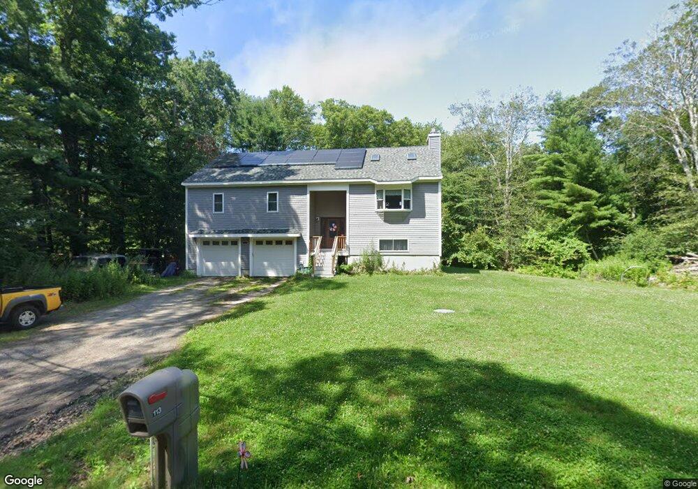
113 Brandt Island Rd Mattapoisett, MA 02739
Estimated Value: $737,384 - $830,000
3
Beds
3
Baths
1,772
Sq Ft
$433/Sq Ft
Est. Value
About This Home
This home is located at 113 Brandt Island Rd, Mattapoisett, MA 02739 and is currently estimated at $766,596, approximately $432 per square foot. 113 Brandt Island Rd is a home with nearby schools including Center School, Old Hammondtown Elementary, and Old Rochester Regional High School.
Ownership History
Date
Name
Owned For
Owner Type
Purchase Details
Closed on
Jul 9, 2020
Sold by
Caton-Gallant Amy
Bought by
Gallant Dennis D and Caton-Gallant Amy
Current Estimated Value
Home Financials for this Owner
Home Financials are based on the most recent Mortgage that was taken out on this home.
Original Mortgage
$100,000
Interest Rate
3.2%
Mortgage Type
New Conventional
Purchase Details
Closed on
May 29, 2020
Sold by
Gallant Dennis D and Caton-Gallant Amy
Bought by
Caton-Gallant Amy and Gallant Amy
Home Financials for this Owner
Home Financials are based on the most recent Mortgage that was taken out on this home.
Original Mortgage
$100,000
Interest Rate
3.2%
Mortgage Type
New Conventional
Purchase Details
Closed on
Aug 27, 2015
Sold by
Lamarre Susan M and Lamarre George E
Bought by
Gallant Dennis D and Caton-Gallant Amy
Create a Home Valuation Report for This Property
The Home Valuation Report is an in-depth analysis detailing your home's value as well as a comparison with similar homes in the area
Home Values in the Area
Average Home Value in this Area
Purchase History
| Date | Buyer | Sale Price | Title Company |
|---|---|---|---|
| Gallant Dennis D | -- | None Available | |
| Gallant Dennis D | -- | None Available | |
| Caton-Gallant Amy | -- | None Available | |
| Caton-Gallant Amy | -- | None Available | |
| Gallant Dennis D | $91,820 | -- | |
| Gallant Dennis D | $91,820 | -- |
Source: Public Records
Mortgage History
| Date | Status | Borrower | Loan Amount |
|---|---|---|---|
| Previous Owner | Caton-Gallant Amy | $100,000 |
Source: Public Records
Tax History Compared to Growth
Tax History
| Year | Tax Paid | Tax Assessment Tax Assessment Total Assessment is a certain percentage of the fair market value that is determined by local assessors to be the total taxable value of land and additions on the property. | Land | Improvement |
|---|---|---|---|---|
| 2025 | $6,847 | $636,300 | $244,300 | $392,000 |
| 2024 | $6,732 | $640,500 | $244,300 | $396,200 |
| 2023 | $6,162 | $547,700 | $208,600 | $339,100 |
| 2022 | $5,294 | $426,900 | $173,900 | $253,000 |
| 2021 | $2,049 | $158,100 | $158,100 | $0 |
| 2020 | $2,032 | $150,600 | $150,600 | $0 |
| 2019 | $1,989 | $150,600 | $150,600 | $0 |
| 2018 | $1,773 | $136,200 | $136,200 | $0 |
| 2017 | $1,958 | $149,800 | $149,800 | $0 |
| 2016 | $1,888 | $143,000 | $143,000 | $0 |
| 2015 | $191 | $14,700 | $14,700 | $0 |
| 2014 | $1,649 | $129,600 | $129,600 | $0 |
Source: Public Records
Map
Nearby Homes
- 0 Brandt Beach Ave
- 2 Marthas Vineyard Dr
- 6 Meadowbrook Ln
- 0 Marina Dr Unit 72497908
- 0 Marina Dr Unit 72497877
- 5 Island View Ave
- 0 Whalers Way
- 2 Port Way
- 41 Starboard Way
- 1 Starboard Way
- 0 Harbor Acres Ln - Lot B
- 86 Fairhaven Rd
- 8 Highland View Ave
- 33 Sylvia St
- 7 Anawan Rd
- 58 Ocean Ave
- 3 Daisy Way
- 35 Seaview Ave
- 43 Grandview Ave
- 406 Nasketucket Way
- 111 Brandt Island Rd
- 109 Brandt Island Rd
- 1 Brandt Beach Ave
- 107 Brandt Island Rd
- 3 Gary Dr
- 119 Brandt Island Rd
- 3 Brandt Beach Ave
- Lot 6 Nantucket Dr
- 108 Brandt Island Rd
- 4 Nantucket Dr
- 4 Nantucket Ln
- 5 Gary Dr
- 105 Brandt Island Rd
- 121 Brandt Island Rd
- 5 Brandt Beach Ave
- 4 Brandt Beach Ave
- 110 Brandt Island Rd
- 2 Nantucket Dr
- Lot 40 Nantucket Dr
- Lot 26 Nantucket Ln