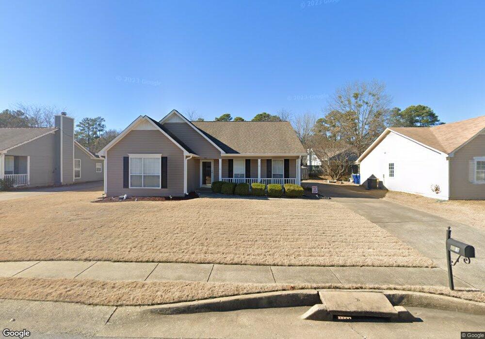
113 Cambridge Pointe Dr Alabaster, AL 35007
Estimated Value: $211,000 - $270,000
--
Bed
1
Bath
1,240
Sq Ft
$185/Sq Ft
Est. Value
About This Home
This home is located at 113 Cambridge Pointe Dr, Alabaster, AL 35007 and is currently estimated at $228,967, approximately $184 per square foot. 113 Cambridge Pointe Dr is a home located in Shelby County with nearby schools including Thompson Intermediate School, Thompson Middle School, and Thompson High School.
Ownership History
Date
Name
Owned For
Owner Type
Purchase Details
Closed on
Nov 26, 2003
Sold by
Dickinson Brian D and Dickinson Bambi H
Bought by
Mckenzie Jeffrey Thomas and Mckenzie Lori Sue
Current Estimated Value
Purchase Details
Closed on
Jul 31, 2003
Sold by
Stephenson Jack C and Stephenson Stephanie
Bought by
Callender Brian
Home Financials for this Owner
Home Financials are based on the most recent Mortgage that was taken out on this home.
Original Mortgage
$90,335
Outstanding Balance
$39,200
Interest Rate
5.42%
Mortgage Type
FHA
Estimated Equity
$189,767
Purchase Details
Closed on
Mar 31, 1999
Sold by
Lawes Carole M
Bought by
Stephenson Jack C
Home Financials for this Owner
Home Financials are based on the most recent Mortgage that was taken out on this home.
Original Mortgage
$93,700
Interest Rate
7.12%
Create a Home Valuation Report for This Property
The Home Valuation Report is an in-depth analysis detailing your home's value as well as a comparison with similar homes in the area
Home Values in the Area
Average Home Value in this Area
Purchase History
| Date | Buyer | Sale Price | Title Company |
|---|---|---|---|
| Mckenzie Jeffrey Thomas | $121,500 | -- | |
| Callender Brian | $101,950 | -- | |
| Stephenson Jack C | $91,000 | Alabama Title Co Inc |
Source: Public Records
Mortgage History
| Date | Status | Borrower | Loan Amount |
|---|---|---|---|
| Open | Callender Brian | $90,335 | |
| Previous Owner | Stephenson Jack C | $93,700 |
Source: Public Records
Tax History Compared to Growth
Tax History
| Year | Tax Paid | Tax Assessment Tax Assessment Total Assessment is a certain percentage of the fair market value that is determined by local assessors to be the total taxable value of land and additions on the property. | Land | Improvement |
|---|---|---|---|---|
| 2024 | $875 | $16,200 | $0 | $0 |
| 2023 | $823 | $16,000 | $0 | $0 |
| 2022 | $733 | $14,340 | $0 | $0 |
| 2021 | $672 | $13,200 | $0 | $0 |
| 2020 | $608 | $12,020 | $0 | $0 |
| 2019 | $609 | $12,040 | $0 | $0 |
| 2017 | $535 | $10,660 | $0 | $0 |
| 2015 | $502 | $10,060 | $0 | $0 |
| 2014 | $499 | $10,000 | $0 | $0 |
Source: Public Records
Map
Nearby Homes
- 201 Shalimar Cir
- 1520 Tropical Cir
- 144 Palm Dr
- 104 Camden Cir
- 117 Kensington Ln
- 240 Jasmine Dr
- 217 Kensington Ln
- 10589 Highway 119
- 104 Kentwood Trail Cir
- 521 13th St SW
- 280 Cedar Grove Pkwy
- 902 6th Ave SW
- 732 4th St SW
- 412 10th St SW
- 0000 Highway 26
- 000 Highway 26
- 3025 Specklebelly Way
- 3001 Specklebelly Way
- 00 Highway 26
- 3020 Specklebelly Way
- 117 Cambridge Pointe Dr
- 109 Cambridge Pointe Dr
- 133 Cambridge Pointe Cir
- 125 Cambridge Pointe Cir
- 105 Cambridge Pointe Dr
- 121 Cambridge Pointe Dr
- 112 Cambridge Pointe Dr
- 121 Cambridge Pointe Cir
- 116 Cambridge Pointe Dr
- 108 Cambridge Pointe Dr
- 125 Cambridge Pointe Dr
- 120 Cambridge Pointe Dr
- 104 Cambridge Pointe Dr
- 137 Cambridge Pointe Cir
- 101 Cambridge Pointe Dr
- 117 Cambridge Pointe Cir
- 124 Cambridge Pointe Dr
- 130 Cambridge Pointe Cir
- 100 Cambridge Pointe Dr
- 134 Cambridge Pointe Cir