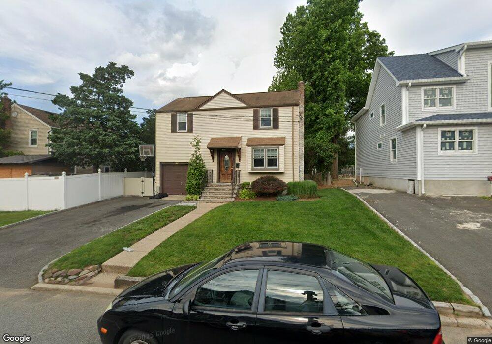
113 Cameron Rd Bergenfield, NJ 07621
Estimated Value: $574,000 - $804,000
3
Beds
2
Baths
1,432
Sq Ft
$474/Sq Ft
Est. Value
About This Home
This home is located at 113 Cameron Rd, Bergenfield, NJ 07621 and is currently estimated at $678,058, approximately $473 per square foot. 113 Cameron Rd is a home located in Bergen County with nearby schools including Bergenfield High School, Hovnanian School, and Grace Lutheran School.
Ownership History
Date
Name
Owned For
Owner Type
Purchase Details
Closed on
Feb 22, 2021
Sold by
Satz Allen and Satz Ava
Bought by
Satz Allen
Current Estimated Value
Home Financials for this Owner
Home Financials are based on the most recent Mortgage that was taken out on this home.
Original Mortgage
$242,500
Interest Rate
3.22%
Mortgage Type
New Conventional
Purchase Details
Closed on
Aug 11, 2011
Sold by
Coughlin Maureen A
Bought by
Satz Allen and Satz Ava
Home Financials for this Owner
Home Financials are based on the most recent Mortgage that was taken out on this home.
Original Mortgage
$242,250
Interest Rate
3.37%
Mortgage Type
Purchase Money Mortgage
Create a Home Valuation Report for This Property
The Home Valuation Report is an in-depth analysis detailing your home's value as well as a comparison with similar homes in the area
Home Values in the Area
Average Home Value in this Area
Purchase History
| Date | Buyer | Sale Price | Title Company |
|---|---|---|---|
| Satz Allen | -- | None Listed On Document | |
| Satz Allen | $285,000 | -- |
Source: Public Records
Mortgage History
| Date | Status | Borrower | Loan Amount |
|---|---|---|---|
| Previous Owner | Satz Allen | $242,500 | |
| Previous Owner | Satz Allen | $242,250 |
Source: Public Records
Tax History Compared to Growth
Tax History
| Year | Tax Paid | Tax Assessment Tax Assessment Total Assessment is a certain percentage of the fair market value that is determined by local assessors to be the total taxable value of land and additions on the property. | Land | Improvement |
|---|---|---|---|---|
| 2025 | $11,283 | $319,900 | $164,900 | $155,000 |
| 2024 | $10,909 | $319,900 | $164,900 | $155,000 |
| 2023 | $10,739 | $319,900 | $164,900 | $155,000 |
| 2022 | $10,739 | $319,900 | $164,900 | $155,000 |
| 2021 | $10,627 | $319,900 | $164,900 | $155,000 |
| 2020 | $10,557 | $319,900 | $164,900 | $155,000 |
| 2019 | $10,435 | $319,900 | $164,900 | $155,000 |
| 2018 | $10,358 | $319,900 | $164,900 | $155,000 |
| 2017 | $10,307 | $319,900 | $164,900 | $155,000 |
| 2016 | $9,900 | $312,200 | $164,900 | $147,300 |
| 2015 | $9,747 | $312,200 | $164,900 | $147,300 |
| 2014 | $9,569 | $312,200 | $164,900 | $147,300 |
Source: Public Records
Map
Nearby Homes
- 466 New Bridge Rd
- 64 Glenwood Dr S
- 98 John Place
- 42 Westview Dr
- 388 S Prospect Ave
- 201 Maiden Ln
- 111 Dudley Dr
- 21 Briarcliffe Rd
- 532 Winthrop Rd
- 591 Warwick Ave
- 352 Birchwood Rd
- 512 Warwick Ave Unit 3A
- 793 Dearborn St
- 10 Judith Place
- 207 Melrose Ave
- 526 Rutland Ave
- 732 Rutland Ave
- 55 Maiden Ln
- 86 Levitt Ave
- 70 Greenwich St
- 117 Cameron Rd
- 182 Baker Ave
- 178 Baker Ave
- 449 New Bridge Rd
- 445 New Bridge Rd
- 174 Baker Ave
- 441 New Bridge Rd
- 118 Cameron Rd
- 170 Baker Ave
- 469 New Bridge Rd
- 437 New Bridge Rd
- 114 Cameron Rd
- 110 Cameron Rd
- 189 Baker Ave
- 106 Cameron Rd
- 185 Baker Ave
- 166 Baker Ave
- 479 New Bridge Rd
- 181 Baker Ave
- 433 New Bridge Rd