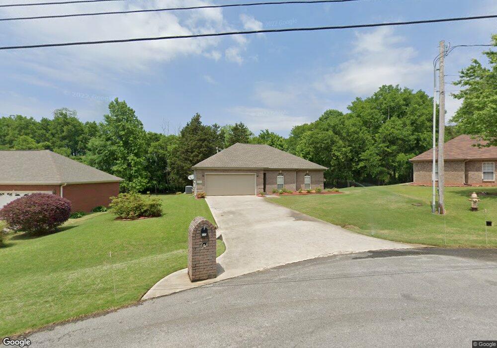
113 Cedar Bluff Ct Harvest, AL 35749
Monrovia NeighborhoodEstimated Value: $229,864 - $310,000
Studio
--
Bath
1,536
Sq Ft
$173/Sq Ft
Est. Value
About This Home
This home is located at 113 Cedar Bluff Ct, Harvest, AL 35749 and is currently estimated at $265,216, approximately $172 per square foot. 113 Cedar Bluff Ct is a home with nearby schools including Legacy Elementary School, Monrovia Middle School, and Sparkman High School.
Ownership History
Date
Name
Owned For
Owner Type
Purchase Details
Closed on
Jul 19, 2006
Sold by
Whitworth Sara
Bought by
Duboise Terry
Current Estimated Value
Home Financials for this Owner
Home Financials are based on the most recent Mortgage that was taken out on this home.
Original Mortgage
$206,000
Interest Rate
6.54%
Mortgage Type
Construction
Purchase Details
Closed on
Apr 14, 2006
Sold by
Duboise Terry L
Bought by
Hartman Edward R
Create a Home Valuation Report for This Property
The Home Valuation Report is an in-depth analysis detailing your home's value as well as a comparison with similar homes in the area
Home Values in the Area
Average Home Value in this Area
Purchase History
| Date | Buyer | Sale Price | Title Company |
|---|---|---|---|
| Duboise Terry | -- | -- | |
| Hartman Edward R | -- | -- |
Source: Public Records
Mortgage History
| Date | Status | Borrower | Loan Amount |
|---|---|---|---|
| Closed | Duboise Terry | $206,000 |
Source: Public Records
Tax History
| Year | Tax Paid | Tax Assessment Tax Assessment Total Assessment is a certain percentage of the fair market value that is determined by local assessors to be the total taxable value of land and additions on the property. | Land | Improvement |
|---|---|---|---|---|
| 2025 | $696 | $20,680 | $3,500 | $17,180 |
| 2024 | $660 | $19,680 | $3,500 | $16,180 |
| 2023 | $612 | $18,360 | $3,500 | $14,860 |
| 2022 | $488 | $14,820 | $1,600 | $13,220 |
| 2021 | $488 | $14,820 | $1,600 | $13,220 |
| 2020 | $436 | $13,390 | $1,600 | $11,790 |
| 2019 | $421 | $12,980 | $1,600 | $11,380 |
| 2018 | $395 | $12,260 | $0 | $0 |
| 2017 | $395 | $12,260 | $0 | $0 |
| 2016 | $395 | $12,260 | $0 | $0 |
| 2015 | $395 | $12,260 | $0 | $0 |
| 2014 | $424 | $13,060 | $0 | $0 |
Source: Public Records
Map
Nearby Homes
- 164 Western Hills Dr
- 125 Gary Allen Blvd
- 114 Poplar Green Ln
- 8059 Wall Triana Hwy
- 349 Lionel Allen Way
- 104 Huntington Ridge Rd
- 112 Silver Poplar Place
- 7424 Wall Triana Hwy
- 212 Wilson Hall Dr
- 146 Forest Ridge Dr
- 123 Forest Ridge Dr
- 102 Dolf Leaf Ln
- 224 Cheswick Dr
- 15776 Mizewell Ln
- 194 Newberry Ct
- 127 Danika Dr NW
- 112 Dexter Cir
- 124 Dexter Cir
- 129 Bridge Crest Dr
- 8246 Wall Triana Hwy
- 111 Cedar Bluff Ct
- 115 Cedar Bluff Ct
- 117 Cedar Bluff Ct
- 109 Cedar Bluff Ct
- 116 Cedar Bluff Ct
- 107 Cedar Bluff Ct
- 110 Cedar Bluff Ct
- 108 Cedar Bluff Ct
- 105 Cedar Bluff Ct
- 106 Cedar Bluff Ct
- 103 Cedar Bluff Ct
- 104 Cedar Bluff Ct
- 116 Silver Cedar Ln
- 102 Cedar Bluff Ct
- 222 Western Hills Dr
- 206 Western Hills Dr
- 118 Silver Cedar Ln
- 100 Cedar Bluff Ct
- 119 Silver Cedar Ln
- 194 Western Hills Dr
Your Personal Tour Guide
Ask me questions while you tour the home.