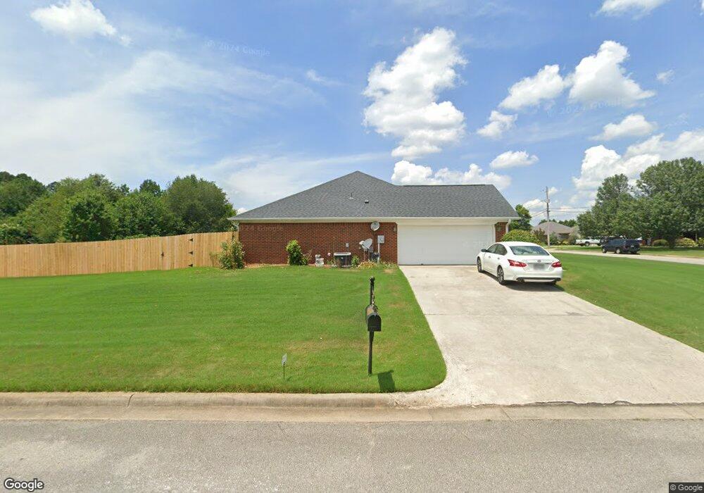
113 Cedar Glen Dr Huntsville, AL 35811
Estimated Value: $283,000 - $361,000
--
Bed
--
Bath
2,111
Sq Ft
$156/Sq Ft
Est. Value
About This Home
This home is located at 113 Cedar Glen Dr, Huntsville, AL 35811 and is currently estimated at $330,032, approximately $156 per square foot. 113 Cedar Glen Dr is a home with nearby schools including Central School and Madison County High School.
Ownership History
Date
Name
Owned For
Owner Type
Purchase Details
Closed on
May 16, 2005
Sold by
Lamb Christopher D and Lamb Jennifer
Bought by
Honeycutt Albert Neil and Honeycutt Robbie T
Current Estimated Value
Home Financials for this Owner
Home Financials are based on the most recent Mortgage that was taken out on this home.
Original Mortgage
$95,000
Outstanding Balance
$49,978
Interest Rate
5.98%
Mortgage Type
New Conventional
Estimated Equity
$280,054
Purchase Details
Closed on
May 12, 2005
Sold by
Lamb Christopher D and Lamb Jennifer
Bought by
Honeycutt Albert Neil and Honeycutt Robbie T
Home Financials for this Owner
Home Financials are based on the most recent Mortgage that was taken out on this home.
Original Mortgage
$95,000
Outstanding Balance
$49,978
Interest Rate
5.98%
Mortgage Type
New Conventional
Estimated Equity
$280,054
Create a Home Valuation Report for This Property
The Home Valuation Report is an in-depth analysis detailing your home's value as well as a comparison with similar homes in the area
Home Values in the Area
Average Home Value in this Area
Purchase History
| Date | Buyer | Sale Price | Title Company |
|---|---|---|---|
| Honeycutt Albert Neil | -- | -- | |
| Honeycutt Albert Neil | -- | -- |
Source: Public Records
Mortgage History
| Date | Status | Borrower | Loan Amount |
|---|---|---|---|
| Open | Honeycutt Albert Neil | $95,000 | |
| Closed | Honeycutt Albert Neil | $95,000 |
Source: Public Records
Tax History Compared to Growth
Tax History
| Year | Tax Paid | Tax Assessment Tax Assessment Total Assessment is a certain percentage of the fair market value that is determined by local assessors to be the total taxable value of land and additions on the property. | Land | Improvement |
|---|---|---|---|---|
| 2024 | $1,017 | $28,860 | $6,000 | $22,860 |
| 2023 | $987 | $28,860 | $6,000 | $22,860 |
| 2022 | $867 | $25,420 | $4,260 | $21,160 |
| 2021 | $776 | $22,920 | $4,260 | $18,660 |
| 2020 | $594 | $17,870 | $3,500 | $14,370 |
| 2019 | $574 | $17,340 | $3,500 | $13,840 |
| 2018 | $553 | $16,760 | $0 | $0 |
| 2017 | $539 | $16,360 | $0 | $0 |
| 2016 | $539 | $16,360 | $0 | $0 |
| 2015 | $539 | $16,360 | $0 | $0 |
| 2014 | $560 | $16,940 | $0 | $0 |
Source: Public Records
Map
Nearby Homes
- 216 Grasslands Rd
- 221 Grasslands Rd
- 235 Grasslands Rd
- 1519 Ryland Pike
- 211 Powell St
- 218 Powell St
- 102 Peyton Cir
- 3608 Maysville Rd NE
- 0 Gilliam Rd
- 309 Gilliam Rd
- 172 Day Dr
- 107 Nolan Dr
- 111 Cool Cir
- 483 Moontown Rd
- 477 Moontown Rd
- 506 Moontown Rd
- 362 Moontown Rd
- 350 Moontown Rd
- 113 Delta Pine Dr
- 123 Delta Pine Dr
- 222 Grasslands Rd
- 224 Grasslands Rd
- 111 Cedar Glen Dr
- 217 Grasslands Rd
- 219 Grasslands Rd
- 112 Cedar Glen Dr
- 215 Grasslands Rd
- 223 Grasslands Rd
- 226 Grasslands Rd
- 110 Cedar Glen Dr
- 109 Cedar Glen Dr
- 213 Grasslands Rd
- 228 Grasslands Rd
- 108 Cedar Glen Dr
- 210 Grasslands Rd
- 107 Cedar Glen Dr
- 204 Grasslands Rd
- 211 Grasslands Rd
- 102 Shallowhill Rd
- 230 Grasslands Rd