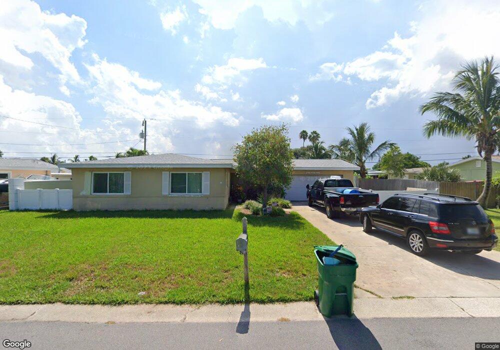
113 Coral Reef Dr Satellite Beach, FL 32937
Estimated Value: $501,000 - $849,000
3
Beds
2
Baths
1,330
Sq Ft
$483/Sq Ft
Est. Value
About This Home
This home is located at 113 Coral Reef Dr, Satellite Beach, FL 32937 and is currently estimated at $642,543, approximately $483 per square foot. 113 Coral Reef Dr is a home located in Brevard County with nearby schools including Spessard L. Holland Elementary School, Satellite Senior High School, and DeLaura Middle School.
Ownership History
Date
Name
Owned For
Owner Type
Purchase Details
Closed on
Jun 26, 2002
Sold by
Swem John E and Swem Joan M
Bought by
Sims Robert N and Sims Mary M
Current Estimated Value
Home Financials for this Owner
Home Financials are based on the most recent Mortgage that was taken out on this home.
Original Mortgage
$159,900
Outstanding Balance
$68,505
Interest Rate
6.86%
Mortgage Type
Purchase Money Mortgage
Estimated Equity
$574,038
Purchase Details
Closed on
May 24, 2002
Sold by
Swem Joan M and Swem John E
Bought by
Swem John E and Swem Joan M
Home Financials for this Owner
Home Financials are based on the most recent Mortgage that was taken out on this home.
Original Mortgage
$159,900
Outstanding Balance
$68,505
Interest Rate
6.86%
Mortgage Type
Purchase Money Mortgage
Estimated Equity
$574,038
Purchase Details
Closed on
May 23, 2002
Sold by
Travis George R and Kennedy Lynn M
Bought by
Travis Margaret D
Home Financials for this Owner
Home Financials are based on the most recent Mortgage that was taken out on this home.
Original Mortgage
$159,900
Outstanding Balance
$68,505
Interest Rate
6.86%
Mortgage Type
Purchase Money Mortgage
Estimated Equity
$574,038
Purchase Details
Closed on
Feb 21, 2001
Sold by
Lund Elsie W
Bought by
Lund Elsie W and Swem Joan M
Create a Home Valuation Report for This Property
The Home Valuation Report is an in-depth analysis detailing your home's value as well as a comparison with similar homes in the area
Home Values in the Area
Average Home Value in this Area
Purchase History
| Date | Buyer | Sale Price | Title Company |
|---|---|---|---|
| Sims Robert N | $246,000 | -- | |
| Swem John E | -- | -- | |
| Travis Margaret D | -- | -- | |
| Lund Elsie W | -- | -- |
Source: Public Records
Mortgage History
| Date | Status | Borrower | Loan Amount |
|---|---|---|---|
| Open | Sims Robert N | $159,900 |
Source: Public Records
Tax History Compared to Growth
Tax History
| Year | Tax Paid | Tax Assessment Tax Assessment Total Assessment is a certain percentage of the fair market value that is determined by local assessors to be the total taxable value of land and additions on the property. | Land | Improvement |
|---|---|---|---|---|
| 2025 | $2,889 | $240,660 | -- | -- |
| 2024 | $2,849 | $233,880 | -- | -- |
| 2023 | $2,849 | $227,070 | $0 | $0 |
| 2022 | $2,654 | $220,460 | $0 | $0 |
| 2021 | $2,759 | $214,040 | $0 | $0 |
| 2020 | $2,729 | $211,090 | $0 | $0 |
| 2019 | $2,681 | $206,350 | $0 | $0 |
| 2018 | $2,689 | $202,510 | $0 | $0 |
| 2017 | $2,719 | $198,350 | $0 | $0 |
| 2016 | $2,766 | $194,280 | $185,000 | $9,280 |
| 2015 | $2,846 | $192,930 | $175,000 | $17,930 |
| 2014 | $2,866 | $191,400 | $160,000 | $31,400 |
Source: Public Records
Map
Nearby Homes
- 429 S Neptune Dr
- 432 N Neptune Dr
- 867 S Patrick Dr
- 11 Barbara Ct
- 935 & 937 S Patrick Dr
- 437 N Neptune Dr
- 336 Jupiter Dr
- 27 Tortuga Trail
- 29 Tortuga Trail
- 31 Tortuga Trail
- 33 Tortuga Trail
- 35 Tortuga Trail
- 37 Tortuga Trail
- 335 Coral Reef Dr
- 53 Emerald Ct
- 313 Polaris Dr
- Pearson End Unit Plan at Tortuga Cay
- Pearson Interior Unit Plan at Tortuga Cay
- 36 Sunset St
- 345 S Point Ct
- 109 Coral Reef Dr
- 402 S Neptune Dr
- 105 Coral Reef Dr
- 915 S Patrick Dr
- 917 South Patrick Dr
- 917 South Patrick Dr
- 925 S Patrick Dr
- 401 Nautilus Dr
- 406 S Neptune Dr
- 921 S Patrick Dr
- 911 S Patrick Dr
- 923 S Patrick Dr
- 925 South Patrick Dr
- 911 South Patrick Dr Unit 911
- 911 South Patrick Dr
- 915917 S Patrick
- 911 N South Patrick Unit 911
- 911913 S Patrick
- 923 South Patrick Dr
- 913 S Patrick Dr