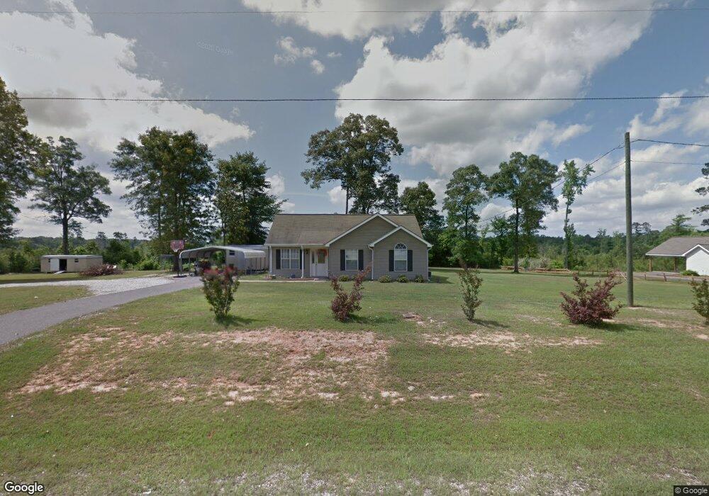
113 Dean Ln Pollock, LA 71467
Estimated Value: $197,000 - $232,505
3
Beds
2
Baths
1,339
Sq Ft
$159/Sq Ft
Est. Value
About This Home
This home is located at 113 Dean Ln, Pollock, LA 71467 and is currently estimated at $212,876, approximately $158 per square foot. 113 Dean Ln is a home located in Grant Parish with nearby schools including Pollock Elementary School, Grant Junior High School, and Grant High School.
Ownership History
Date
Name
Owned For
Owner Type
Purchase Details
Closed on
Nov 24, 2009
Sold by
Moreau Clarence Everette and Moreau Bertha Lousie Clark
Bought by
Keady Robert Leland and Keady Wendy Louanna
Current Estimated Value
Home Financials for this Owner
Home Financials are based on the most recent Mortgage that was taken out on this home.
Original Mortgage
$138,720
Outstanding Balance
$91,221
Interest Rate
5.06%
Estimated Equity
$121,655
Create a Home Valuation Report for This Property
The Home Valuation Report is an in-depth analysis detailing your home's value as well as a comparison with similar homes in the area
Purchase History
| Date | Buyer | Sale Price | Title Company |
|---|---|---|---|
| Keady Robert Leland | $136,000 | -- |
Source: Public Records
Mortgage History
| Date | Status | Borrower | Loan Amount |
|---|---|---|---|
| Open | Keady Robert Leland | $138,720 |
Source: Public Records
Tax History
| Year | Tax Paid | Tax Assessment Tax Assessment Total Assessment is a certain percentage of the fair market value that is determined by local assessors to be the total taxable value of land and additions on the property. | Land | Improvement |
|---|---|---|---|---|
| 2024 | $2,569 | $17,255 | $2,482 | $14,773 |
| 2023 | $2,038 | $13,166 | $1,750 | $11,416 |
| 2022 | $2,036 | $13,166 | $1,750 | $11,416 |
| 2021 | $2,036 | $13,166 | $1,750 | $11,416 |
| 2020 | $2,033 | $13,166 | $1,750 | $11,416 |
| 2019 | $2,037 | $12,763 | $1,750 | $11,013 |
| 2018 | $2,037 | $12,763 | $1,750 | $11,013 |
| 2017 | $1,878 | $12,763 | $1,750 | $11,013 |
| 2015 | $2,042 | $11,688 | $1,750 | $9,938 |
| 2014 | $2,042 | $11,688 | $1,750 | $9,938 |
| 2013 | $2,042 | $11,688 | $1,750 | $9,938 |
Source: Public Records
Map
Nearby Homes
- 6911 Springhill Rd
- 6715 Springhill Rd
- 213 Hamilton Dr
- 120 Hulin
- 200 Irene Dr
- 1720 Birkland Dr
- 1607 Hwy 1204 None
- 6627
- 639 Louisiana 1204
- 6644 Pinebrook Trace
- 112 Oak Run Trail
- 6923 Monroe Hwy
- 6305 Shreveport Hwy
- 0 N 165 Hwy Unit 2516900
- 109 Murrell Ln
- 0 Edmonds Rd
- 6107 Ball Loop
- 5696 Oaklane Rd
- 127 Edwards Dr
- 6531 Dogwood Ct
Your Personal Tour Guide
Ask me questions while you tour the home.