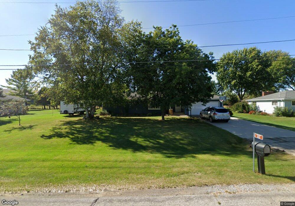
113 Dell Ct Neenah, WI 54956
Estimated Value: $243,514 - $329,000
--
Bed
--
Bath
--
Sq Ft
0.63
Acres
About This Home
This home is located at 113 Dell Ct, Neenah, WI 54956 and is currently estimated at $289,879. 113 Dell Ct is a home located in Winnebago County with nearby schools including Tullar Elementary School, Horace Mann Middle School, and Neenah Middle School.
Ownership History
Date
Name
Owned For
Owner Type
Purchase Details
Closed on
Sep 19, 2013
Sold by
Rigotti Kathleen R and Meyer Sandra K
Bought by
Wells Seven R and Wells Amanda M
Current Estimated Value
Home Financials for this Owner
Home Financials are based on the most recent Mortgage that was taken out on this home.
Original Mortgage
$142,864
Outstanding Balance
$112,033
Interest Rate
5.75%
Mortgage Type
FHA
Estimated Equity
$177,846
Create a Home Valuation Report for This Property
The Home Valuation Report is an in-depth analysis detailing your home's value as well as a comparison with similar homes in the area
Home Values in the Area
Average Home Value in this Area
Purchase History
| Date | Buyer | Sale Price | Title Company |
|---|---|---|---|
| Wells Seven R | $145,500 | None Available |
Source: Public Records
Mortgage History
| Date | Status | Borrower | Loan Amount |
|---|---|---|---|
| Open | Wells Seven R | $142,864 |
Source: Public Records
Tax History Compared to Growth
Tax History
| Year | Tax Paid | Tax Assessment Tax Assessment Total Assessment is a certain percentage of the fair market value that is determined by local assessors to be the total taxable value of land and additions on the property. | Land | Improvement |
|---|---|---|---|---|
| 2024 | $2,603 | $151,000 | $32,300 | $118,700 |
| 2023 | $2,545 | $151,000 | $32,300 | $118,700 |
| 2022 | $2,601 | $151,000 | $32,300 | $118,700 |
| 2021 | $2,521 | $151,000 | $32,300 | $118,700 |
| 2020 | $2,695 | $151,000 | $32,300 | $118,700 |
| 2019 | $2,444 | $125,700 | $21,000 | $104,700 |
| 2018 | $2,378 | $125,700 | $21,000 | $104,700 |
| 2017 | $1,994 | $125,700 | $21,000 | $104,700 |
| 2016 | $2,008 | $125,700 | $21,000 | $104,700 |
| 2015 | $1,849 | $125,700 | $21,000 | $104,700 |
| 2014 | -- | $125,700 | $21,000 | $104,700 |
| 2013 | -- | $125,700 | $21,000 | $104,700 |
Source: Public Records
Map
Nearby Homes
- 0 Vassar Ln
- 1017 Westwind Dr
- 1160 Westwind Dr
- 1516 Kingswood Dr
- 985 Babcock St
- 940 Babcock St Unit 96
- 1562 Lone Oak Dr
- 1372 Baytree Ln
- 970 Manor Dr Unit 72
- 1316 Wedgewood Ln
- 1599 Redwing Dr
- 1112 Oxford Ct
- 1442 Baytree Ln
- 0 Larsen Rd
- 1539 Freedom Meadows Dr
- 1535 Freedom Meadows Dr
- 1721 Freeman Dr
- 1715 Sovereign Way
- 1738 Sovereign Way
- 982 Byrd Ave
- 115 Dell Ct
- 111 Dell Ct
- 1255 Dogwood Trail
- 117 Dell Ct
- 1259 Dogwood Trail
- 1263 Dogwood Trail
- 1247 Dogwood Trail
- 1249 Dogwood Trail
- 1265 Dogwood Trail
- 1251 Dogwood Trail
- 1241 Dogwood Trail
- 1245 Dogwood Trail
- 1241 Dogwood Trail
- 1267 Dogwood Trail
- 119 Dell Ct
- 1239 Dogwood Trail
- 1239 Dogwood Trail
- 1479 County Road Jj
- 1235 Dogwood Trail
- 1231 Dogwood Tr