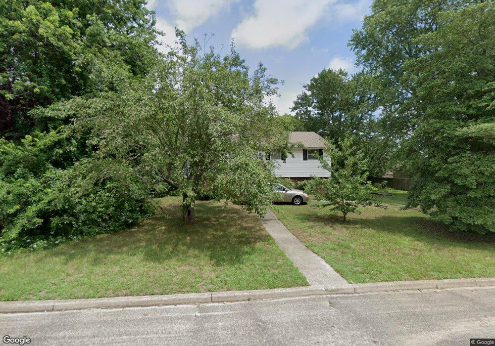
113 Doran Ave Somers Point, NJ 08244
Estimated Value: $309,000 - $462,000
--
Bed
--
Bath
2,042
Sq Ft
$189/Sq Ft
Est. Value
About This Home
This home is located at 113 Doran Ave, Somers Point, NJ 08244 and is currently estimated at $386,612, approximately $189 per square foot. 113 Doran Ave is a home located in Atlantic County with nearby schools including Mainland Regional High School, ChARTer TECH High School for the Performing Arts, and Saint Joseph Regional School.
Ownership History
Date
Name
Owned For
Owner Type
Purchase Details
Closed on
Jul 28, 2017
Sold by
Bakley John F and The Estate Of Joan F Bakley
Bought by
Gager Linda B and Gager David G
Current Estimated Value
Home Financials for this Owner
Home Financials are based on the most recent Mortgage that was taken out on this home.
Original Mortgage
$90,000
Outstanding Balance
$74,935
Interest Rate
3.88%
Mortgage Type
Purchase Money Mortgage
Estimated Equity
$311,677
Purchase Details
Closed on
May 10, 1961
Bought by
Bakley Joan
Create a Home Valuation Report for This Property
The Home Valuation Report is an in-depth analysis detailing your home's value as well as a comparison with similar homes in the area
Home Values in the Area
Average Home Value in this Area
Purchase History
| Date | Buyer | Sale Price | Title Company |
|---|---|---|---|
| Gager Linda B | -- | None Available | |
| Bakley Joan | $600 | -- |
Source: Public Records
Mortgage History
| Date | Status | Borrower | Loan Amount |
|---|---|---|---|
| Open | Gager Linda B | $90,000 |
Source: Public Records
Tax History Compared to Growth
Tax History
| Year | Tax Paid | Tax Assessment Tax Assessment Total Assessment is a certain percentage of the fair market value that is determined by local assessors to be the total taxable value of land and additions on the property. | Land | Improvement |
|---|---|---|---|---|
| 2025 | $5,067 | $141,700 | $68,600 | $73,100 |
| 2024 | $5,067 | $141,700 | $68,600 | $73,100 |
| 2023 | $4,734 | $141,700 | $68,600 | $73,100 |
| 2022 | $4,734 | $141,700 | $68,600 | $73,100 |
| 2021 | $4,663 | $141,700 | $68,600 | $73,100 |
| 2020 | $4,568 | $141,700 | $68,600 | $73,100 |
| 2019 | $4,439 | $141,700 | $68,600 | $73,100 |
| 2018 | $4,505 | $146,900 | $68,600 | $78,300 |
| 2017 | $5,302 | $179,300 | $68,600 | $110,700 |
| 2016 | $5,062 | $179,300 | $68,600 | $110,700 |
| 2015 | $5,010 | $179,300 | $68,600 | $110,700 |
| 2014 | $4,841 | $179,300 | $68,600 | $110,700 |
Source: Public Records
Map
Nearby Homes
- 137 W Johnson Ave
- 1102 Jesse Dr
- 2102 Angelina Ln
- 25 W Pierson Ave
- 33 W Meyran Ave
- 226 Bethel Rd
- 421 Shore Rd
- 29 E Pierson Ave
- 301 Bliss Ave
- 101 E Johnson Ave
- 116 W Ocean Ave
- 112 E Pierson Ave
- 206 Philadelphia Ave
- 114 E Pierson Ave
- 109 E Cedar Ave
- 223 W Wilmont Ave
- 123 E Cedar Ave
- 6 Abbey Rd
- 25 Shore Rd
- 118 E Wilmont Ave
- 107 Doran Ave
- 115 Doran Ave
- 116 W Dawes Ave
- 114 W Dawes Ave
- 105 Doran Ave
- 120 W Dawes Ave
- 108 W Dawes Ave
- 223 Atlantic Ave
- 143 Doran Ave
- 110 Doran Ave
- 138 W Dawes Ave
- 225 Atlantic Ave
- 100 W Dawes Ave
- 121 W Pierson Ave
- 105 W Pierson Ave
- 123 W Pierson Ave
- 112 Doran Ave
- 100 Doran Ave
- 125 W Pierson Ave
- 103 W Pierson Ave