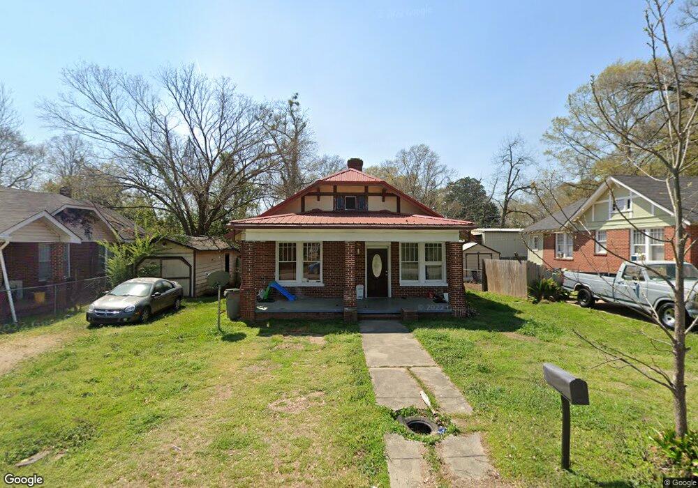
113 Dougherty St Lagrange, GA 30241
Estimated Value: $102,000 - $108,000
2
Beds
1
Bath
1,189
Sq Ft
$88/Sq Ft
Est. Value
About This Home
This home is located at 113 Dougherty St, Lagrange, GA 30241 and is currently estimated at $104,801, approximately $88 per square foot. 113 Dougherty St is a home located in Troup County with nearby schools including Hollis Hand Elementary School, Franklin Forest Elementary School, and Ethel W. Kight Elementary School.
Ownership History
Date
Name
Owned For
Owner Type
Purchase Details
Closed on
Apr 16, 2020
Sold by
Brand Ghami
Bought by
Reyes Rigoberto N
Current Estimated Value
Purchase Details
Closed on
Oct 14, 2015
Sold by
Sec Of Housing & U
Bought by
Brand Ghami
Purchase Details
Closed on
Oct 1, 2013
Sold by
Midfirst Bank
Bought by
Sec Of Housing & Urban
Purchase Details
Closed on
Jul 10, 2000
Sold by
Kenneth Sharp
Bought by
Forshaw Joyce R
Purchase Details
Closed on
Nov 5, 1997
Sold by
Josie B Sharp
Bought by
Kenneth Sharp
Purchase Details
Closed on
Mar 9, 1971
Sold by
Novella S Wagnon
Bought by
Josie B Sharp
Purchase Details
Closed on
Sep 25, 1969
Sold by
Wagnon Tyler S
Bought by
Novella S Wagnon
Create a Home Valuation Report for This Property
The Home Valuation Report is an in-depth analysis detailing your home's value as well as a comparison with similar homes in the area
Purchase History
| Date | Buyer | Sale Price | Title Company |
|---|---|---|---|
| Reyes Rigoberto N | $23,000 | -- | |
| Brand Ghami | $13,100 | -- | |
| Sec Of Housing & Urban | $51,237 | -- | |
| Midfirst Bank | $51,237 | -- | |
| Forshaw Joyce R | $44,900 | -- | |
| Kenneth Sharp | -- | -- | |
| Josie B Sharp | $12,000 | -- | |
| Novella S Wagnon | -- | -- |
Source: Public Records
Tax History
| Year | Tax Paid | Tax Assessment Tax Assessment Total Assessment is a certain percentage of the fair market value that is determined by local assessors to be the total taxable value of land and additions on the property. | Land | Improvement |
|---|---|---|---|---|
| 2025 | $849 | $34,592 | $2,680 | $31,912 |
| 2024 | $849 | $31,112 | $2,680 | $28,432 |
| 2023 | $682 | $24,992 | $2,680 | $22,312 |
| 2022 | $654 | $23,432 | $2,680 | $20,752 |
| 2021 | $277 | $12,840 | $2,680 | $10,160 |
| 2020 | $387 | $12,840 | $2,680 | $10,160 |
| 2019 | $282 | $9,360 | $2,160 | $7,200 |
| 2018 | $282 | $9,360 | $2,160 | $7,200 |
| 2017 | $282 | $9,360 | $2,160 | $7,200 |
| 2016 | $158 | $5,240 | $670 | $4,570 |
| 2015 | $653 | $21,625 | $2,764 | $18,861 |
| 2014 | $624 | $20,632 | $2,764 | $17,868 |
| 2013 | -- | $21,674 | $2,764 | $18,910 |
Source: Public Records
Map
Nearby Homes
- 803 1/2 Hines St
- 600,606,608,616 S Harlem
- 101 McGee St
- 801 Hines St
- 301 E Bacon St
- 131 Foch St
- 121 de Groat St
- 600 S Harlem Cir
- 208 Render St
- 606 S Harlem Cir
- 608 S Harlem Cir
- 228 E Render St
- 616 S Harlem Cir
- 706 N Harlem Cir
- 609 Ridley Ave
- 707 Ridley Ave
- 611 Ridley Ave
- 615 Ridley Ave
- 709 Ridley Ave
- 0 Ridley Ave Unit 10550104
- 105 Doughtery St
- 111 Doughtery St
- 100 Doughtery St
- 110 Doughtery St
- 114 Doughtery St
- 112 Doughtery St
- 212 Hill St
- 118 de Groat St
- 106 Dougherty St Unit 8
- 213 Hill St
- 200 Hill St
- 200 Hill St
- 203 N Dawson St
- 207 N Dawson St
- 201 N Dawson St
- 205 N Dawson St
- 203 Hill St
- 98 Doughtery St
- 109 N Dawson St
- 201 Hill St
Your Personal Tour Guide
Ask me questions while you tour the home.