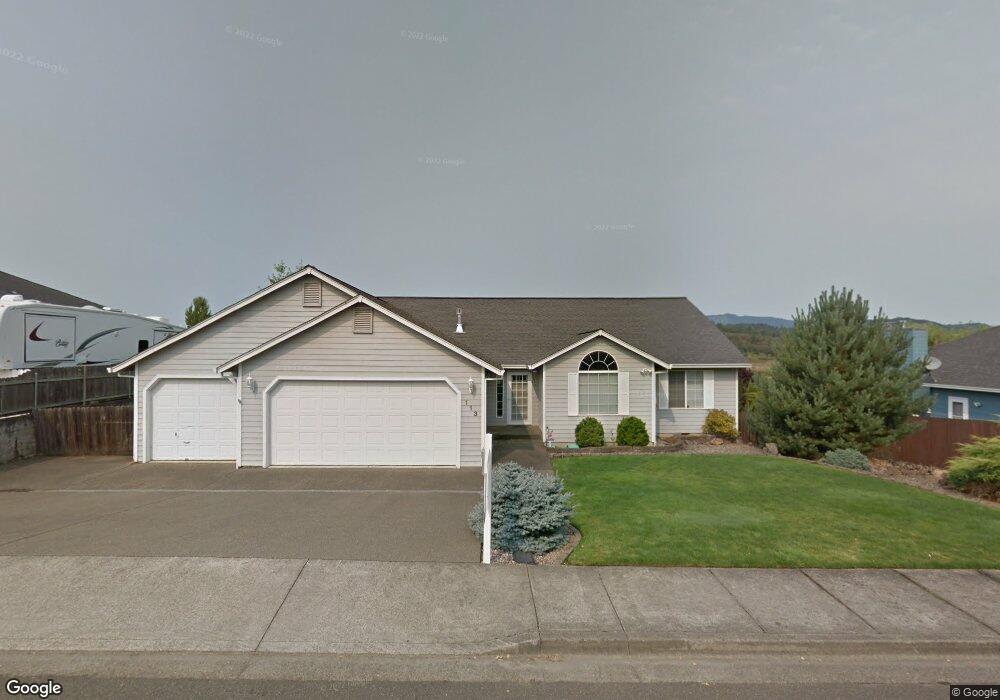
113 Frontier Ct Sutherlin, OR 97479
Estimated Value: $469,000 - $501,000
4
Beds
3
Baths
2,300
Sq Ft
$209/Sq Ft
Est. Value
About This Home
This home is located at 113 Frontier Ct, Sutherlin, OR 97479 and is currently estimated at $480,041, approximately $208 per square foot. 113 Frontier Ct is a home located in Douglas County with nearby schools including East Sutherlin Primary School, West Sutherlin Intermediate School, and Sutherlin Middle School.
Ownership History
Date
Name
Owned For
Owner Type
Purchase Details
Closed on
Nov 27, 2012
Sold by
Weber Nancy Jean and The Jean Carse Revocable Livin
Bought by
Mattes Jan W G and Mattes Karen M
Current Estimated Value
Home Financials for this Owner
Home Financials are based on the most recent Mortgage that was taken out on this home.
Original Mortgage
$221,000
Interest Rate
3.33%
Mortgage Type
VA
Purchase Details
Closed on
Nov 1, 2007
Sold by
Carse Jean
Bought by
Carse Jean and The Jean Carse Revocable Living Trust
Purchase Details
Closed on
Dec 6, 2006
Sold by
Moore David L and Moore Donna R
Bought by
Carse Jean
Create a Home Valuation Report for This Property
The Home Valuation Report is an in-depth analysis detailing your home's value as well as a comparison with similar homes in the area
Home Values in the Area
Average Home Value in this Area
Purchase History
| Date | Buyer | Sale Price | Title Company |
|---|---|---|---|
| Mattes Jan W G | $221,000 | First American Title Ins Co | |
| Carse Jean | -- | First American Title Ins Co | |
| Carse Jean | $328,000 | First American Title Ins Co |
Source: Public Records
Mortgage History
| Date | Status | Borrower | Loan Amount |
|---|---|---|---|
| Previous Owner | Mattes Jan W G | $221,000 |
Source: Public Records
Tax History Compared to Growth
Tax History
| Year | Tax Paid | Tax Assessment Tax Assessment Total Assessment is a certain percentage of the fair market value that is determined by local assessors to be the total taxable value of land and additions on the property. | Land | Improvement |
|---|---|---|---|---|
| 2024 | $3,140 | $262,520 | -- | -- |
| 2023 | $3,050 | $254,875 | $0 | $0 |
| 2022 | $2,963 | $247,448 | $0 | $0 |
| 2021 | $2,878 | $240,240 | $0 | $0 |
| 2020 | $2,793 | $233,246 | $0 | $0 |
| 2019 | $2,712 | $226,450 | $0 | $0 |
| 2018 | $2,633 | $219,855 | $0 | $0 |
| 2017 | $2,698 | $213,454 | $0 | $0 |
| 2016 | $2,620 | $207,242 | $0 | $0 |
| 2015 | $2,462 | $195,758 | $0 | $0 |
| 2014 | $2,546 | $201,882 | $0 | $0 |
| 2013 | -- | $192,310 | $0 | $0 |
Source: Public Records
Map
Nearby Homes
- 101 Frontier Ct
- 122 Lilly Ct
- 307 Cambridge Dr
- 178 Dovetail Ln
- 2730 Golfview Ave
- 910 Swallow Ave
- 2076 Sawgrass Ct
- 149 Coles Valley St
- 126 Coles Valley St
- 154 Coles Valley St
- 135 Elkton St
- 832 Sand Pines Ave
- 702 Divot Loop
- 881 Medina Ave
- 890 Durham Ave
- 336 Schudeiske Rd
- 420 Backwater Loop
- 1716 Scardi Blvd Unit 174
- 1688 W Central Ave
- 181 SW Hutchins St
- 117 Frontier Ct
- 109 Frontier Ct
- 105 Frontier Ct
- 114 Frontier Ct
- 110 Frontier Ct
- 118 Frontier Ct
- 108 Frontier Ct
- 104 Frontier Ct
- 129 Lilly Ct
- 133 Lilly Ct
- 125 Lilly Ct
- 2701 Westlake Ave
- 100 Frontier Ct
- 119 Lilly Ct
- 201 Greyfox Dr
- 201 Grey Fox Dr
- 385 Church Rd
- 205 Greyfox Dr
- 100 Church Rd
- 130 Lilly Ct