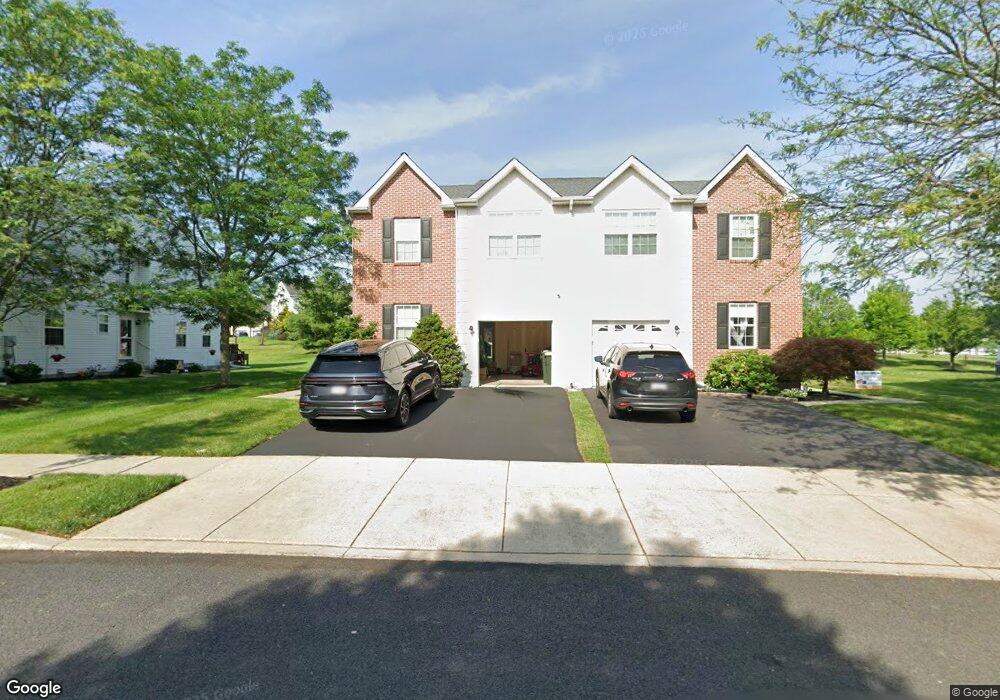
113 Glenwood Dr Sellersville, PA 18960
Estimated Value: $444,000 - $478,829
3
Beds
3
Baths
2,084
Sq Ft
$223/Sq Ft
Est. Value
About This Home
This home is located at 113 Glenwood Dr, Sellersville, PA 18960 and is currently estimated at $464,457, approximately $222 per square foot. 113 Glenwood Dr is a home located in Bucks County with nearby schools including Pennridge High School, Souderton Charter School Collaborative, and Grace Christian School.
Ownership History
Date
Name
Owned For
Owner Type
Purchase Details
Closed on
Jul 13, 2005
Sold by
Smale Michael T and Smale Jill
Bought by
Smale Andrew R
Current Estimated Value
Home Financials for this Owner
Home Financials are based on the most recent Mortgage that was taken out on this home.
Original Mortgage
$212,800
Outstanding Balance
$111,156
Interest Rate
5.67%
Mortgage Type
Fannie Mae Freddie Mac
Estimated Equity
$353,301
Create a Home Valuation Report for This Property
The Home Valuation Report is an in-depth analysis detailing your home's value as well as a comparison with similar homes in the area
Home Values in the Area
Average Home Value in this Area
Purchase History
| Date | Buyer | Sale Price | Title Company |
|---|---|---|---|
| Smale Andrew R | $266,000 | -- |
Source: Public Records
Mortgage History
| Date | Status | Borrower | Loan Amount |
|---|---|---|---|
| Open | Smale Andrew R | $212,800 |
Source: Public Records
Tax History Compared to Growth
Tax History
| Year | Tax Paid | Tax Assessment Tax Assessment Total Assessment is a certain percentage of the fair market value that is determined by local assessors to be the total taxable value of land and additions on the property. | Land | Improvement |
|---|---|---|---|---|
| 2025 | $4,350 | $25,370 | $4,880 | $20,490 |
| 2024 | $4,350 | $25,370 | $4,880 | $20,490 |
| 2023 | $4,299 | $25,370 | $4,880 | $20,490 |
| 2022 | $4,299 | $25,370 | $4,880 | $20,490 |
| 2021 | $4,299 | $25,370 | $4,880 | $20,490 |
| 2020 | $4,299 | $25,370 | $4,880 | $20,490 |
| 2019 | $4,274 | $25,370 | $4,880 | $20,490 |
| 2018 | $4,274 | $25,370 | $4,880 | $20,490 |
| 2017 | $4,242 | $25,370 | $4,880 | $20,490 |
| 2016 | $4,242 | $25,370 | $4,880 | $20,490 |
| 2015 | -- | $25,370 | $4,880 | $20,490 |
| 2014 | -- | $25,370 | $4,880 | $20,490 |
Source: Public Records
Map
Nearby Homes
- 213 Hampshire Dr
- 203 Hampshire Dr
- 420 Longleaf Dr
- 69 Maple Leaf Dr
- 114 Orchard Rd
- 92 Robin Ln
- 76 Waterford Ln Unit T 76
- 170 W Main St
- 964 Route Unit 113
- 0007 Baldwin Way
- 0001 Baldwin Way
- 1 Baldwin Way
- 0008 Baldwin Way
- 0009 Baldwin Way
- 0010 Baldwin Way
- 121 Arbor Blvd
- 124 S Main St
- 508 Telegraph Rd
- 42 Independence Ct
- 129 N Main St
- 115 Glenwood Dr
- 111 Glenwood Dr
- 117 Glenwood Dr
- 109 Glenwood Dr
- 400 Ridgeview Ct
- 500 Ridgeview Ct
- 107 Glenwood Dr
- 119 Glenwood Dr
- 403 Ridgeview Ct
- 509 Ridgeview Ct
- 235 Hampshire Dr
- 233 Hampshire Dr
- 105 Glenwood Dr
- 121 Glenwood Dr
- 231 Hampshire Dr
- 801 Ridgeview Ct
- 816 Ridgeview Ct
- 803 Ridgeview Ct
- 812 Ridgeview Ct
- 407 Ridgeview Ct