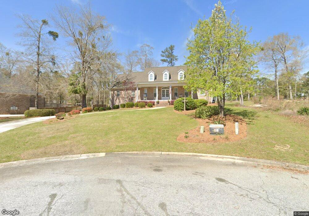
113 Hampton Point Warner Robins, GA 31088
Estimated Value: $481,000 - $601,000
4
Beds
5
Baths
3,504
Sq Ft
$151/Sq Ft
Est. Value
About This Home
This home is located at 113 Hampton Point, Warner Robins, GA 31088 and is currently estimated at $530,603, approximately $151 per square foot. 113 Hampton Point is a home located in Houston County with nearby schools including Bonaire Elementary School, Huntington Middle School, and Warner Robins High School.
Ownership History
Date
Name
Owned For
Owner Type
Purchase Details
Closed on
Dec 26, 2008
Sold by
Flesher Michael J
Bought by
Flesher Cynthia Burns
Current Estimated Value
Home Financials for this Owner
Home Financials are based on the most recent Mortgage that was taken out on this home.
Original Mortgage
$360,000
Outstanding Balance
$236,740
Interest Rate
5.95%
Mortgage Type
Stand Alone Refi Refinance Of Original Loan
Estimated Equity
$293,863
Purchase Details
Closed on
Oct 9, 2003
Sold by
Stathams Landing Co
Bought by
Flesher Michael J and Flesher Cynthia L
Create a Home Valuation Report for This Property
The Home Valuation Report is an in-depth analysis detailing your home's value as well as a comparison with similar homes in the area
Home Values in the Area
Average Home Value in this Area
Purchase History
| Date | Buyer | Sale Price | Title Company |
|---|---|---|---|
| Flesher Cynthia Burns | -- | None Available | |
| Flesher Michael J | $48,500 | -- |
Source: Public Records
Mortgage History
| Date | Status | Borrower | Loan Amount |
|---|---|---|---|
| Open | Flesher Cynthia Burns | $360,000 |
Source: Public Records
Tax History
| Year | Tax Paid | Tax Assessment Tax Assessment Total Assessment is a certain percentage of the fair market value that is determined by local assessors to be the total taxable value of land and additions on the property. | Land | Improvement |
|---|---|---|---|---|
| 2024 | $4,290 | $181,320 | $24,000 | $157,320 |
| 2023 | $4,072 | $170,480 | $24,000 | $146,480 |
| 2022 | $3,694 | $154,840 | $24,000 | $130,840 |
| 2021 | $3,313 | $138,360 | $24,000 | $114,360 |
| 2020 | $3,309 | $137,560 | $24,000 | $113,560 |
| 2019 | $3,309 | $137,560 | $24,000 | $113,560 |
| 2018 | $3,309 | $137,560 | $24,000 | $113,560 |
| 2017 | $3,312 | $137,560 | $24,000 | $113,560 |
| 2016 | $3,317 | $137,560 | $24,000 | $113,560 |
| 2015 | $3,257 | $134,840 | $24,000 | $110,840 |
| 2014 | -- | $140,600 | $24,000 | $116,600 |
| 2013 | -- | $140,600 | $24,000 | $116,600 |
Source: Public Records
Map
Nearby Homes
- 114 Hampton Pointe
- 212 Falcon Crest
- 125 Bunkers Trail
- 216 Stathams Way
- 104 Bunkers Trail
- 108 Falcon Crest
- 215 Falcon Crest
- 256 Falcon Crest Unit STATHAMS LANDING
- 215 Falcon Crest Unit Stathams Landing
- 256 Falcon Crest
- 102 Twelfth Fairway
- 107 Deerwood Dr
- 226 Landings Pointe Ln
- 601 Charlestown Way
- 2016 Pin Oak Terrace
- 255 Waterford Dr
- 104 Hampton Meadows Dr
- 210 Lydia Dr
- 228 Flat Shoal Dr
- 226 Flat Shoal Dr
- 111 Hampton Point
- 109 Hampton Point
- 116 Hampton Pointe
- 116 Hampton Point
- 107 Hampton Point
- 112 Hampton Point
- 112 Hampton Point
- 406 Stathams Way
- 408 Stathams Way
- 107 Hampton Point
- 408 Stasthams Way
- 410 Stathams Way
- 110 Hampton Point
- 404 Stathams Way
- 105 Hampton Point
- 261 Falcon Crest
- 105 Hampton Point
- 402 Stathams Way
- 108 Hampton Point
- 108 Hampton Pointe
Your Personal Tour Guide
Ask me questions while you tour the home.