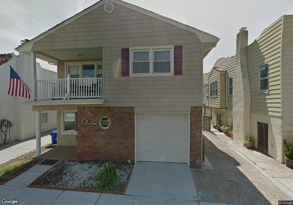
113 Harding Ave Unit Upper Long Beach, NY 11561
Estimated Value: $899,510 - $1,011,000
3
Beds
2
Baths
2,208
Sq Ft
$433/Sq Ft
Est. Value
About This Home
This home is located at 113 Harding Ave Unit Upper, Long Beach, NY 11561 and is currently estimated at $955,255, approximately $432 per square foot. 113 Harding Ave Unit Upper is a home located in Nassau County with nearby schools including Lido Elementary School, East Elementary School, and Lindell Elementary School.
Ownership History
Date
Name
Owned For
Owner Type
Purchase Details
Closed on
Jan 11, 2017
Sold by
Faske Steven and Last Will And Testament Of Phy
Bought by
Paul Bryan and Paul Stefanie
Current Estimated Value
Home Financials for this Owner
Home Financials are based on the most recent Mortgage that was taken out on this home.
Original Mortgage
$543,192
Outstanding Balance
$451,174
Interest Rate
4.4%
Mortgage Type
FHA
Estimated Equity
$504,081
Create a Home Valuation Report for This Property
The Home Valuation Report is an in-depth analysis detailing your home's value as well as a comparison with similar homes in the area
Home Values in the Area
Average Home Value in this Area
Purchase History
| Date | Buyer | Sale Price | Title Company |
|---|---|---|---|
| Paul Bryan | $565,000 | Abstracts Incorporated |
Source: Public Records
Mortgage History
| Date | Status | Borrower | Loan Amount |
|---|---|---|---|
| Open | Paul Bryan | $543,192 |
Source: Public Records
Tax History
| Year | Tax Paid | Tax Assessment Tax Assessment Total Assessment is a certain percentage of the fair market value that is determined by local assessors to be the total taxable value of land and additions on the property. | Land | Improvement |
|---|---|---|---|---|
| 2025 | $8,423 | $585 | $189 | $396 |
| 2024 | $1,072 | $604 | $196 | $408 |
Source: Public Records
Map
Nearby Homes
- 855 E Broadway Unit ph-a
- 855 E Broadway Unit 4G
- 855 E Broadway Unit 3F
- 855 E Broadway Unit Ld
- 855 E Broadway Unit 2D1
- 128 Belmont Ave
- 127 Maple Blvd
- 129 Belmont Ave
- 107 Pacific Blvd
- 140 Mitchell Ave
- 830 Shore Rd Unit 1G
- 124 Coolidge Ave
- 134 Coolidge Ave
- 2 Richmond Rd Unit 6U&6V
- 2 Richmond Rd Unit 3B
- 2 Richmond Rd Unit PH 6U
- 2 Richmond Rd Unit 4th Floor
- 2 Richmond Rd Unit 3a
- 2 Richmond Rd Unit 4A
- 2 Richmond Rd Unit 4-O
- 113 Harding Ave Unit Lower
- 113 Harding Ave
- 115 Harding Ave
- 115 Harding Ave Unit Main
- 111 Harding Ave
- 112 Mitchell Ave
- 110 Mitchell Ave
- 110 Mitchell Ave Unit 1st Fl
- 114 Mitchell Ave
- 112 Harding Ave
- 116 Mitchell Ave
- 108 Mitchell Ave
- 108 Mitchell Ave Unit HOUSE
- 119 Harding Ave
- 110 Harding Ave
- 116 Harding Ave
- 108 Harding Ave
- 118 Mitchell Ave
- 106 Mitchell Ave
- 107 Harding Ave
Your Personal Tour Guide
Ask me questions while you tour the home.