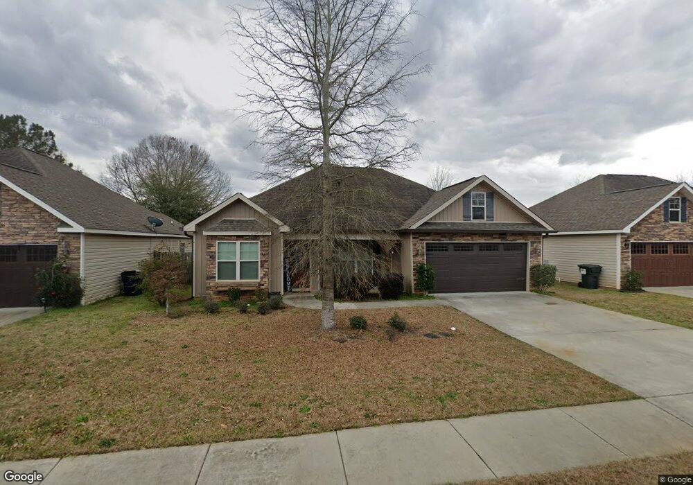
113 Highland Point Dr Kathleen, GA 31047
Estimated Value: $259,000 - $271,000
3
Beds
2
Baths
1,510
Sq Ft
$174/Sq Ft
Est. Value
About This Home
This home is located at 113 Highland Point Dr, Kathleen, GA 31047 and is currently estimated at $263,359, approximately $174 per square foot. 113 Highland Point Dr is a home located in Houston County with nearby schools including Langston Road Elementary School, Mossy Creek Middle School, and Perry High School.
Ownership History
Date
Name
Owned For
Owner Type
Purchase Details
Closed on
Oct 18, 2019
Sold by
Mcdaniel Rodney P
Bought by
Mcdaniel Rodney P and Mcdaniel Naomi M
Current Estimated Value
Home Financials for this Owner
Home Financials are based on the most recent Mortgage that was taken out on this home.
Original Mortgage
$137,600
Outstanding Balance
$120,545
Interest Rate
3.5%
Mortgage Type
New Conventional
Estimated Equity
$142,814
Purchase Details
Closed on
May 20, 2015
Sold by
Southern Properties Of Geo
Bought by
Morgan Michael A
Home Financials for this Owner
Home Financials are based on the most recent Mortgage that was taken out on this home.
Original Mortgage
$147,155
Interest Rate
3.77%
Mortgage Type
New Conventional
Create a Home Valuation Report for This Property
The Home Valuation Report is an in-depth analysis detailing your home's value as well as a comparison with similar homes in the area
Home Values in the Area
Average Home Value in this Area
Purchase History
| Date | Buyer | Sale Price | Title Company |
|---|---|---|---|
| Mcdaniel Rodney P | -- | None Available | |
| Mcdaniel Rodney P | $172,000 | None Available | |
| Morgan Michael A | $154,900 | -- |
Source: Public Records
Mortgage History
| Date | Status | Borrower | Loan Amount |
|---|---|---|---|
| Open | Mcdaniel Rodney P | $137,600 | |
| Previous Owner | Morgan Michael A | $147,155 |
Source: Public Records
Tax History Compared to Growth
Tax History
| Year | Tax Paid | Tax Assessment Tax Assessment Total Assessment is a certain percentage of the fair market value that is determined by local assessors to be the total taxable value of land and additions on the property. | Land | Improvement |
|---|---|---|---|---|
| 2024 | $3,594 | $97,800 | $14,000 | $83,800 |
| 2023 | $3,020 | $81,640 | $14,000 | $67,640 |
| 2022 | $1,667 | $72,480 | $10,800 | $61,680 |
| 2021 | $1,421 | $61,480 | $10,800 | $50,680 |
| 2020 | $1,428 | $61,480 | $10,800 | $50,680 |
| 2019 | $1,269 | $56,640 | $10,800 | $45,840 |
| 2018 | $1,269 | $56,640 | $10,800 | $45,840 |
| 2017 | $1,271 | $56,640 | $10,800 | $45,840 |
| 2016 | $1,273 | $56,640 | $10,800 | $45,840 |
| 2015 | $397 | $17,000 | $10,800 | $6,200 |
Source: Public Records
Map
Nearby Homes
- 313 Ruger Place
- 201 Boulder Creek Rd
- 205 Canvass Back Trail
- 436 Courtney Ln
- 304 N Lake Dr
- 109 Village Blvd
- 312 Cambrian Dr
- 431 Sawtooth Ct
- 162 Addington Dr
- 203 Saraland Trail
- 224 Otters Ridge Dr
- 115 Woody Dr
- 0 Hunt Rd Unit 253426
- 0 Hunt Rd Unit 10529566
- 124 Audrey Way
- 102 Token Ct
- 107 Waldorf Dr
- 102 Hunts Landing Dr
- 411 Colt Ct
- 103 Hunts Landing Dr
- 113 Highland Point Dr
- 111 Highland Point Dr
- 115 Highland Point Dr
- 109 Highland Point Dr
- 117 Highland Point Dr
- 204 Weatherwood Rd
- 202 Weatherwood Rd
- 206 Weatherwood Rd
- 110 Highland Point Dr Unit 7
- 110 Highland Point Dr
- 112 Highland Point Dr
- 200 Weatherwood Rd
- 107 Highland Point Dr
- 208 Weatherwood Rd
- 119 Highland Point Dr Unit 38H
- 119 Highland Point Dr
- 116 Highland Point Dr
- 108 Highland Point Dr
- 104 Weatherwood Rd
- 300 Weatherwood Rd