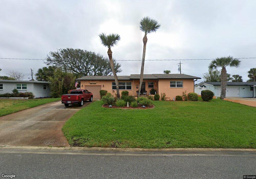
113 Jamestown Dr Ormond Beach, FL 32176
Estimated Value: $317,000 - $337,000
3
Beds
2
Baths
1,372
Sq Ft
$237/Sq Ft
Est. Value
About This Home
This home is located at 113 Jamestown Dr, Ormond Beach, FL 32176 and is currently estimated at $324,930, approximately $236 per square foot. 113 Jamestown Dr is a home located in Volusia County with nearby schools including Ormond Beach Middle School, Seabreeze High School, and Lourdes Academy.
Ownership History
Date
Name
Owned For
Owner Type
Purchase Details
Closed on
Jan 30, 2008
Sold by
Smith Randall
Bought by
Bruno Michael P and Dobies Christine C
Current Estimated Value
Home Financials for this Owner
Home Financials are based on the most recent Mortgage that was taken out on this home.
Original Mortgage
$159,900
Outstanding Balance
$99,804
Interest Rate
6.12%
Mortgage Type
Purchase Money Mortgage
Estimated Equity
$225,126
Purchase Details
Closed on
Apr 12, 2006
Sold by
Burton Barbara L
Bought by
Smith Randall
Purchase Details
Closed on
Apr 22, 1999
Sold by
Lenz Henrietta W
Bought by
Burton Barbara L
Purchase Details
Closed on
Nov 22, 1996
Sold by
Lenz Henrietta W
Bought by
Lenz Henrietta W
Purchase Details
Closed on
Dec 15, 1974
Bought by
Bruno Michael P
Create a Home Valuation Report for This Property
The Home Valuation Report is an in-depth analysis detailing your home's value as well as a comparison with similar homes in the area
Home Values in the Area
Average Home Value in this Area
Purchase History
| Date | Buyer | Sale Price | Title Company |
|---|---|---|---|
| Bruno Michael P | $179,900 | Waterside Title Co | |
| Smith Randall | $240,000 | Southern Title Hldg Co Llc | |
| Burton Barbara L | -- | -- | |
| Lenz Henrietta W | -- | -- | |
| Bruno Michael P | $35,000 | -- |
Source: Public Records
Mortgage History
| Date | Status | Borrower | Loan Amount |
|---|---|---|---|
| Open | Bruno Michael P | $159,900 |
Source: Public Records
Tax History
| Year | Tax Paid | Tax Assessment Tax Assessment Total Assessment is a certain percentage of the fair market value that is determined by local assessors to be the total taxable value of land and additions on the property. | Land | Improvement |
|---|---|---|---|---|
| 2026 | $1,350 | $128,305 | -- | -- |
| 2025 | $1,350 | $124,932 | -- | -- |
| 2024 | $1,244 | $121,412 | -- | -- |
| 2023 | $1,244 | $117,876 | $0 | $0 |
| 2022 | $1,193 | $114,443 | $0 | $0 |
| 2021 | $1,220 | $111,110 | $0 | $0 |
| 2020 | $1,196 | $109,576 | $0 | $0 |
| 2019 | $1,166 | $107,112 | $0 | $0 |
| 2018 | $1,162 | $105,115 | $0 | $0 |
| 2017 | $1,173 | $102,953 | $0 | $0 |
| 2016 | $1,177 | $100,835 | $0 | $0 |
| 2015 | $1,212 | $100,134 | $0 | $0 |
| 2014 | $1,202 | $99,339 | $0 | $0 |
Source: Public Records
Map
Nearby Homes
- 792 Marvin Rd
- 159 Ponce de Leon Dr
- 45 Loyola Dr
- 3041 N Oleander Ave
- 150 Benjamin Dr
- 46 Marvin Rd
- 246 Ponce de Leon Dr
- 901 S Atlantic Ave Unit 102
- 901 S Atlantic Ave Unit PH2
- 901 S Atlantic Ave Unit 3
- 3000 N Atlantic Ave Unit 180
- 331 Fordham Dr
- 106 Cardinal Dr Unit B
- 2900 N Atlantic Ave Unit 2001
- 2900 N Atlantic Ave Unit 1503
- 2900 N Atlantic Ave Unit 2002
- 2900 N Atlantic Ave Unit 305
- 2900 N Atlantic Ave Unit 2003
- 3013 N Halifax Ave Unit 3
- 3009 N Halifax Ave Unit 7
Your Personal Tour Guide
Ask me questions while you tour the home.