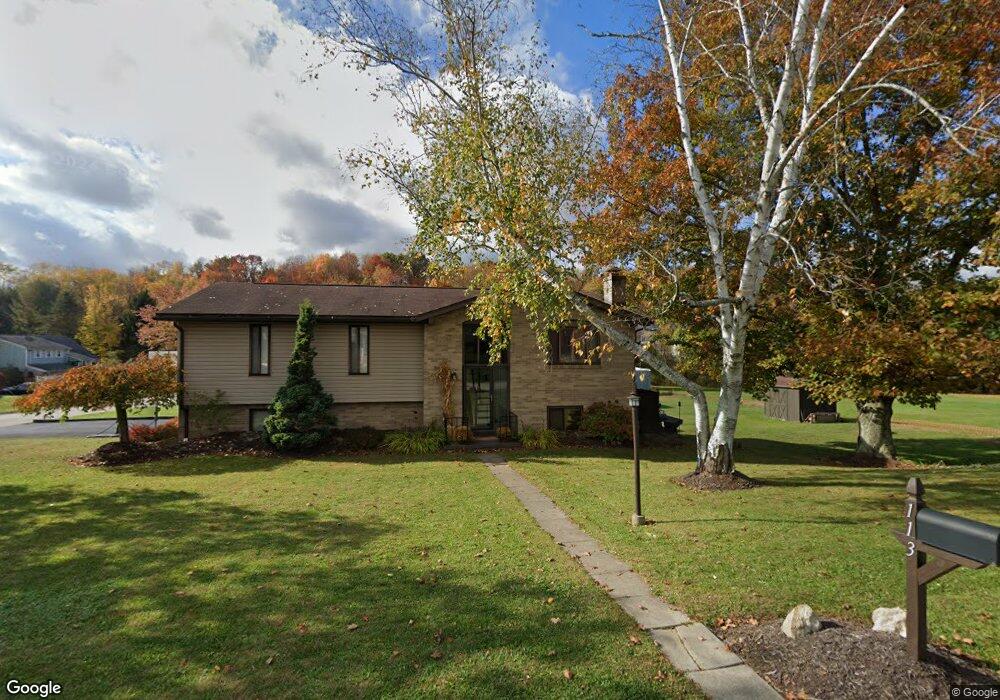
113 Kathy Dr Hunker, PA 15639
Hempfield Township NeighborhoodEstimated Value: $111,395 - $291,000
3
Beds
2
Baths
--
Sq Ft
9,191
Sq Ft Lot
About This Home
This home is located at 113 Kathy Dr, Hunker, PA 15639 and is currently estimated at $233,849. 113 Kathy Dr is a home located in Westmoreland County with nearby schools including Stanwood Elementary School, West Hempfield Middle School, and Hempfield Area Senior High School.
Ownership History
Date
Name
Owned For
Owner Type
Purchase Details
Closed on
Jun 30, 2009
Sold by
Calderone Brad A and Calderone Kelly J
Bought by
Cervola Paul J and Cervola Pamela Christine
Current Estimated Value
Home Financials for this Owner
Home Financials are based on the most recent Mortgage that was taken out on this home.
Original Mortgage
$146,772
Outstanding Balance
$93,926
Interest Rate
4.93%
Mortgage Type
FHA
Estimated Equity
$139,923
Purchase Details
Closed on
Jul 11, 2002
Sold by
Birbal Bassant and Birbal Suroojapatie
Bought by
Calderone Brad A and Calderone Kelly J
Home Financials for this Owner
Home Financials are based on the most recent Mortgage that was taken out on this home.
Original Mortgage
$80,000
Interest Rate
6.64%
Create a Home Valuation Report for This Property
The Home Valuation Report is an in-depth analysis detailing your home's value as well as a comparison with similar homes in the area
Home Values in the Area
Average Home Value in this Area
Purchase History
| Date | Buyer | Sale Price | Title Company |
|---|---|---|---|
| Cervola Paul J | $149,480 | None Available | |
| Calderone Brad A | $108,000 | -- |
Source: Public Records
Mortgage History
| Date | Status | Borrower | Loan Amount |
|---|---|---|---|
| Open | Cervola Paul J | $146,772 | |
| Previous Owner | Calderone Brad A | $80,000 |
Source: Public Records
Tax History Compared to Growth
Tax History
| Year | Tax Paid | Tax Assessment Tax Assessment Total Assessment is a certain percentage of the fair market value that is determined by local assessors to be the total taxable value of land and additions on the property. | Land | Improvement |
|---|---|---|---|---|
| 2025 | $4,013 | $32,830 | $5,180 | $27,650 |
| 2024 | $3,849 | $32,830 | $5,180 | $27,650 |
| 2023 | $3,544 | $32,830 | $5,180 | $27,650 |
| 2022 | $3,544 | $32,830 | $5,180 | $27,650 |
| 2021 | $3,544 | $32,830 | $5,180 | $27,650 |
| 2020 | $3,544 | $32,830 | $5,180 | $27,650 |
| 2019 | $3,528 | $32,830 | $5,180 | $27,650 |
| 2018 | $3,487 | $32,830 | $5,180 | $27,650 |
| 2017 | $3,405 | $32,830 | $5,180 | $27,650 |
| 2016 | $3,237 | $32,830 | $5,180 | $27,650 |
| 2015 | $3,237 | $32,830 | $5,180 | $27,650 |
| 2014 | $3,188 | $32,830 | $5,180 | $27,650 |
Source: Public Records
Map
Nearby Homes
- 103 Ruth Dr
- 0 Sunny Ln
- 234 Swartz Rd
- 408 Frank St
- 274 Ruffsdale Rd
- 135 Preacher Rd
- T666 Lot#4 & Walnut Right of Way
- 303 Pine Dr
- 237 Melrose Dr
- 107 Edgewood Dr
- 105 Brinker Rd
- 0 Thermo Village Rd
- 154 Fire Dept Rd
- 776 Pennsylvania 31
- 440 N Center Ave
- 0 Mays Ln Unit 22454665
- 0 Broadview Rd
- 416 Curtis Ct
- 414 Curtis Ct
- 412 Curtis Ct